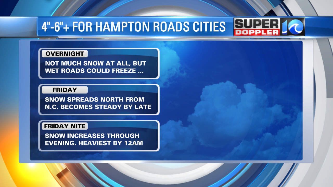
(WAVY) — The snow of Thursday evening came and went, with a few areas over the Peninsula and especially the Williamsburg area where enough snow fell to create a little slush on sidewalks and in the streets. Of course, these could re-freeze and create some travel problems Friday morning.
But of course, the main reason for this post is a quick update as to the upcoming bigger storm for Friday evening into Saturday early morning. Here’s a rough timeline for Friday into Friday night and early on Saturday morning:
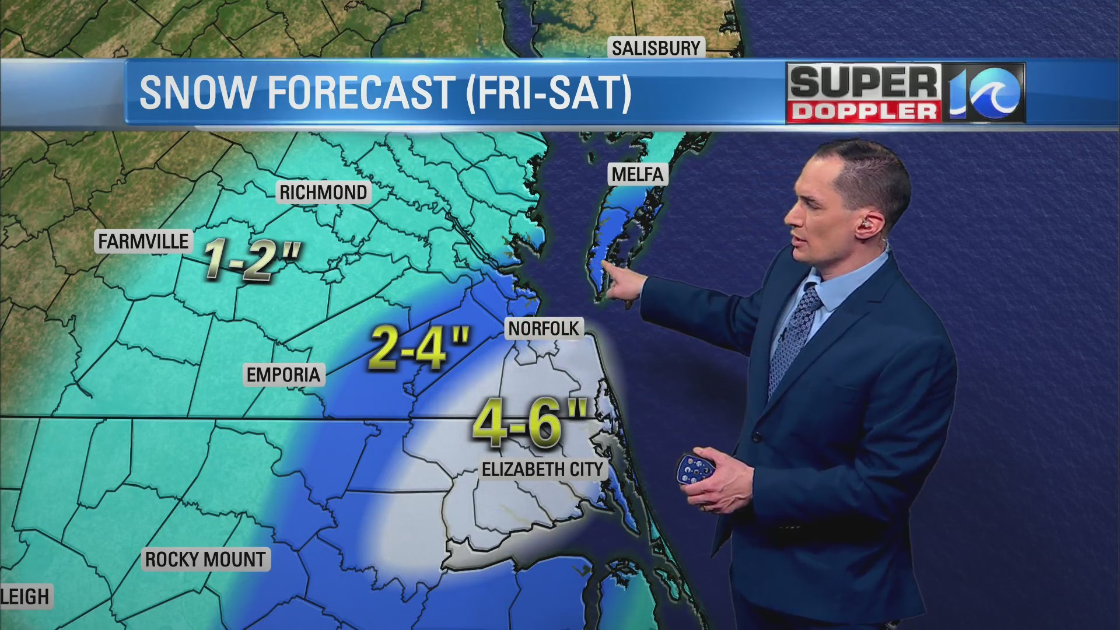
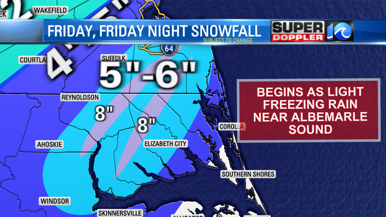
Unlike many storms of the past, this storm will produce heaviest snow in the southern portions of our area…from the south side cities and into eastern North Carolina. 5″ to 6″ snowfall totals are possible in these areas.
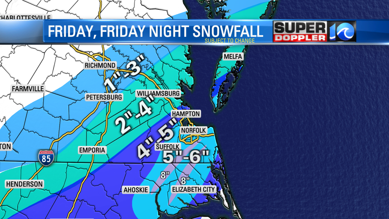
There could even be a few areas that see “bursts” of heavier amounts as highs as 8″.
As we go farther northward on the map, there will likely be a sharp cutoff in snowfall amounts due to dry air to the north…and the storm itself remaining off to the south. For the Peninsula, we’ll likely see enough snow (4″-5″) to create big problems on the roads. But as we move closer to Williamsburg, the snowfall amounts will likely be much, much less.
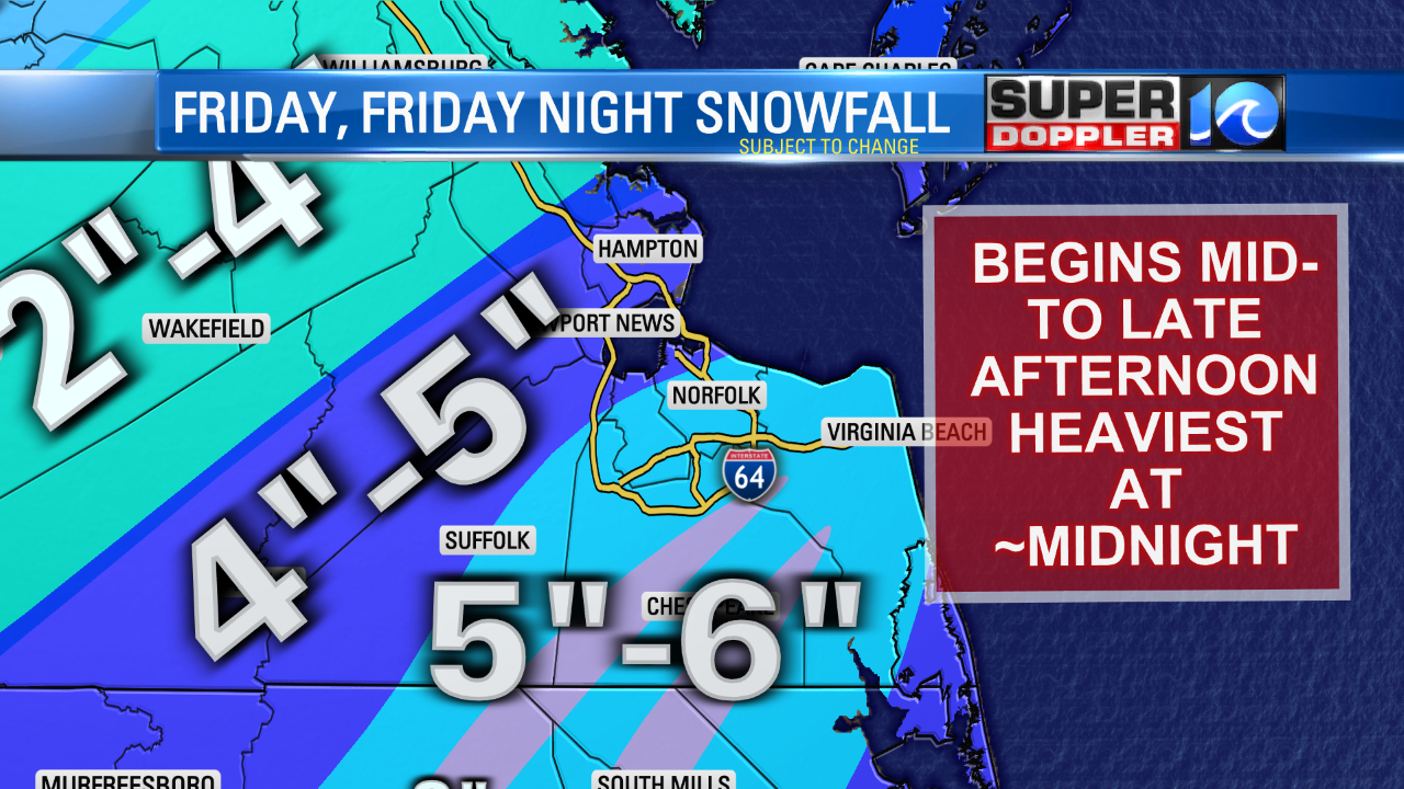
You will note that there’s some small, yellow lettering that says, “subject to change.” And that truly is the case!
Jeremy Wheeler has latest updates Friday morning. Jeremy’s latest update has a slightly different accumulation map than Don’s.