When it comes to forecasting snow… there’s one question that everyone wants answered.
How much snow!???
A simple question. Should be a simple answer, right? Well, that depends.
We can discuss the plethora of factors that come into play when forecast snow but primarily for this forum, we’ll discuss the snow ratio.
Snow Ratio is the amount of water content in a column of snow – a ratio used to understand the liquid equivalent of snow. The general rule of thumb is that every 10 inches of snow is the equivalent of one inch of rain – a simple 10-1 ratio.
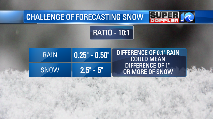
So a quarter of an inch to half an inch of rainfall is the difference between two to five inches of snow!
A dusting or an inch of snow won’t cause any big issues around here… but five inches would.
The smallest change in liquid content translates to big changes in snowfall content. So when you’re local meteorologists’ forecast is off by a half inch of snow… remember that’s the equivalent of 0.05″ of rain, barely enough to wet the roadways.
Our forecast moving forward features a few opportunities for snow, some of which better than others. A cold front arrives Thursday and with comes the unsettled, cold weather.
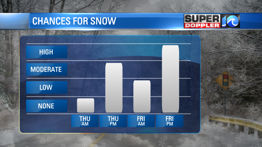
We’ll start Thursday in the 40s as rain showers move in by late morning. Once the cold air from the north pushes in behind the front, rain should flip over to snow by the afternoon and evening. Minor accumulations are expected, primarily on grassy surfaces. This same front will stall out on Friday, keeping the cold air around and keeping the precipitation chances elevated.
Snow may then move back into the region Friday and Friday night – where more accumulations are possible, if not likely. Into the weekend, it’ll remain unsettled and cold. Rain and snow chances stay alive Saturday before most of this moisture moves out. Another round of rain could be possible Sunday as well. Stay tuned for updates as this is a fluid situation, so expect changes in the forecast.
Meteorologist Steve Fundaro

