(WAVY) — Hampton Roads’ second weekend in a row with winter weather is here! While we are not expecting as much snow as last time, we are still expecting impacts as we go through the first part of the weekend.
WHAT: Snow, gusty winds and frigid temperatures
TIMING: Snow develops Friday night, scattered at first around 9-10pm, becoming more widespread across much of the Hampton Roads area after midnight. Tapers off Saturday morning from west to east.
WHAT HAS CHANGED: No major changes from Friday morning’s forecast. The Winter Storm Warning has been expanded into Newport News.
Winter Storm Warnings, Winter Weather Advisories and Blizzard Warnings are in effect across our area. The Winter Storm Warning is for areas near the coast. The advisories are for areas inland, where snow totals will be lower. Finally, the Blizzard Warning is in effect for Northampton and Accomack Counties on the Eastern Shore.
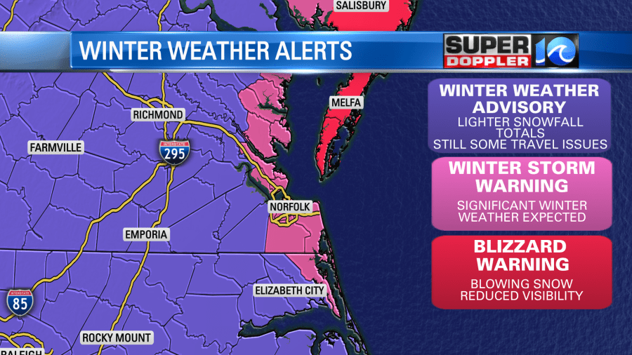
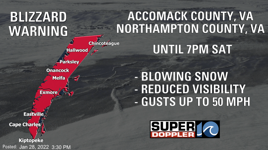
Why is there a Blizzard Warning for the Eastern Shore? That’s where winds will be the highest, visibility will be the lowest and snow totals will be highest.
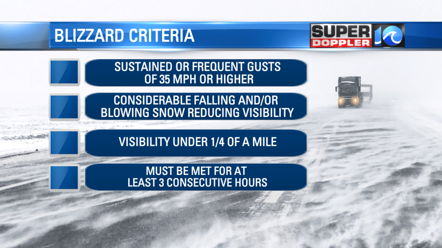
Snow began across the area late Friday evening into the overnight. Some of the heaviest amounts of snow were overnight. By Saturday morning, the snow was expected to slowly taper off from west to east. However, with this being a drier snow, there will still be some blowing and drifting of the snow through Saturday. In addition, if you’re driving across any of the bridge/tunnels, there could be some sea spray.
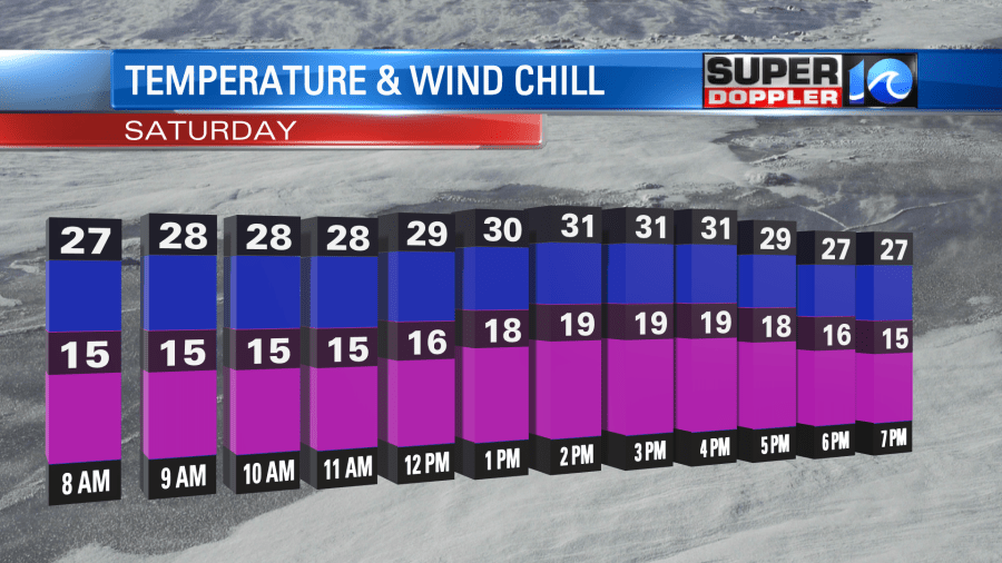
Winds will be a BIG factor with this system. Through the day Saturday, gusts will be in the 30-45 mph range – with slightly higher gusts of 50 possible on the Eastern Shore. This could cause some scattered power outages and lead to blowing and drifting of the snow. With the wind, the feels like temperature (aka wind chill) will be lower too – with those values in the teens to single digits in spots through Saturday.
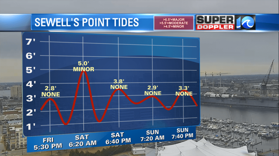
Tidal flooding is expected to be in the minor flood stage at most locations. There could be a few spots towards the Lynnhaven Inlet and the western side of the Eastern Shore that see higher impacts but the flooding is not expected to be significant.
Here is the latest thinking in terms of amounts. Most of the metro area from eastern Suffolk through Chesapeake and VA Beach is expected to see 2-4″. There may be a zone of higher totals in northern parts of VA Beach, closer to the water.
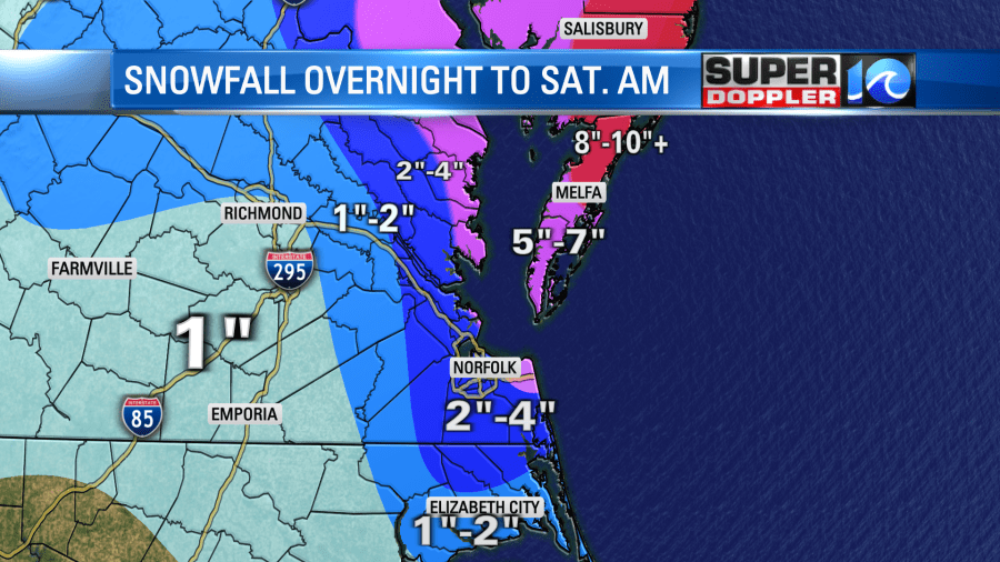
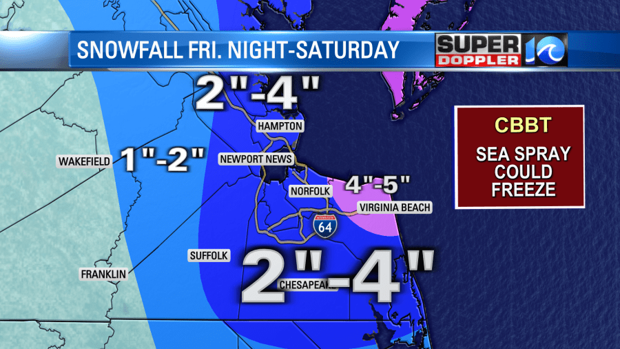
Overall, this will be LESS snow than last time for much of the area. Areas inland — due to the snow falling as temps are a little warmer and the blowing nature of the snow — it may be hard to tell it snowed that much.

