PORTSMOUTH, Va. (WAVY) — Severe storms Friday in the Hampton Roads region brought heavy rain and high wind gusts, up to egg-sized hail and a reported tornado to the Isle of Wight County area.
At the peak of the storm, Dominion Energy reported more than 15,000 power outages, mostly in Norfolk, Isle of Wight and Hampton. As of about 2 a.m. Saturday, there were 2,817 Dominion customers in southeastern Virginia still without power, including 1,269 in Virginia Beach, 298 in Newport News and 187 in Norfolk. There are still scattered outages in other parts of Hampton Roads, also.
The reported Isle of Wight tornado was confirmed by the National Weather Service on Saturday. They said it was an EF-0 with peak winds of 70-75 mph.
Meteorologist Don Slater said the tornado formed in the Smithfield area around 4:40 p.m. based on radar. NWS confirmed this information Saturday.
Several WAVY viewers shared damage reports afterward, including Jenny Voros, who had downed trees and debris.

Bob Hill who lives off the James River in Carrollton watched the storm from his front porch. Hill told us his home was struck by lightning last year so he automatically assumes the worst when the alerts pop up.
“We have a lot of severe weather because there’s five miles of the James River right behind us. Whatever we hear as the wind speed when Don Slater says it, we double it,” Hill said.
The damage across Smithfield and Carrollton was minimal. The worst, a dented sedan and a large downed tree that neighbors quickly chopped up in Waterford Oaks.
“We drove around and relatively speaking everybody did pretty well,” Hill stated.
The storms that went through Isle of Wight were part of a second blast of storms that hit the region Friday. They continued southeast into the Southside area (with a tornado warning through 5:30 p.m.). Once the tornado warning was lifted, a flash flood warning for Southside Hampton Roads took its place. That warning was through 8:30 p.m. Friday. A severe thunderstorm watch for the Hampton Roads region was allowed to expire at 9 p.m.
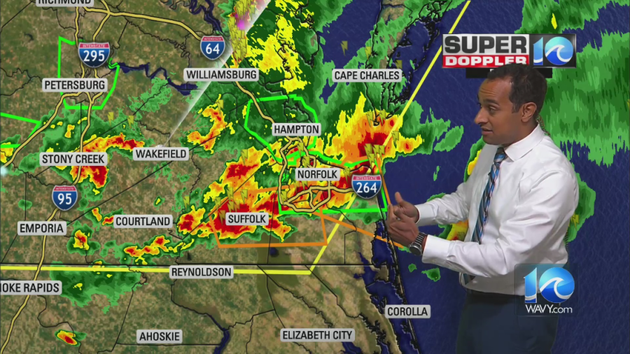
Meanwhile there was also a mass of storms that went across the Peninsula. Those brought heavy winds, but they didn’t appear to be tornadic, Meteorologist Don Slater said.
The storms Friday also brought hail across the region, with egg-sized hail reported in Surry County. Hail was also reported in the Harbour View area of Suffolk, the Churchland area of Portsmouth and on Colley Avenue/Ghent and Robin Hood Road in Norfolk.
You can view our interactive radar here and follow our WAVY Weather team on social media for the latest updates.