Potential record high temperature today is possible with a high close to 95° before a cold blast at the end of the week brings the chance for snow!
….. April fools!
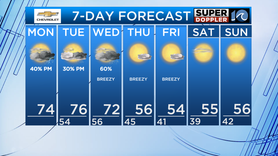
Now our actual forecast isn’t that wacky… it’s still weird! At least over the next few days we’ve got an interesting spread in our temperatures and a few chances for rain. It’s all going to depend on where the wiggly, wiry stationary front sets up.
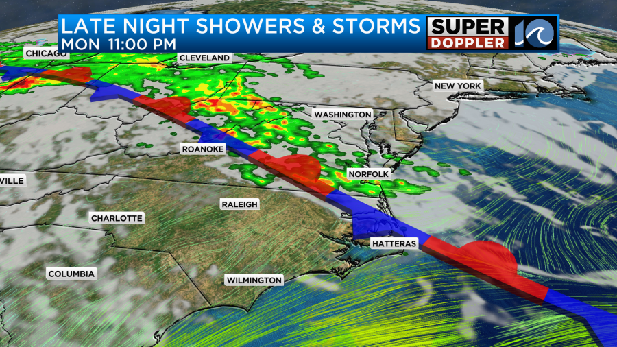
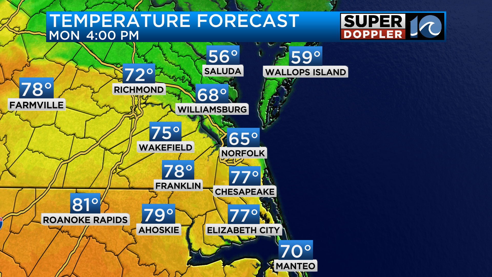
Expect a mix of sun and clouds today with 70s this afternoon for most… but not for all. The Peninsulas may be stuck in the 60s this afternoon. As the front wiggles south, we have to bring in some downpours and even a few thunderstorms later tonight. Rain chances should arrive well after sunset. Keep an eye on radar, as some of those storms could be strong!
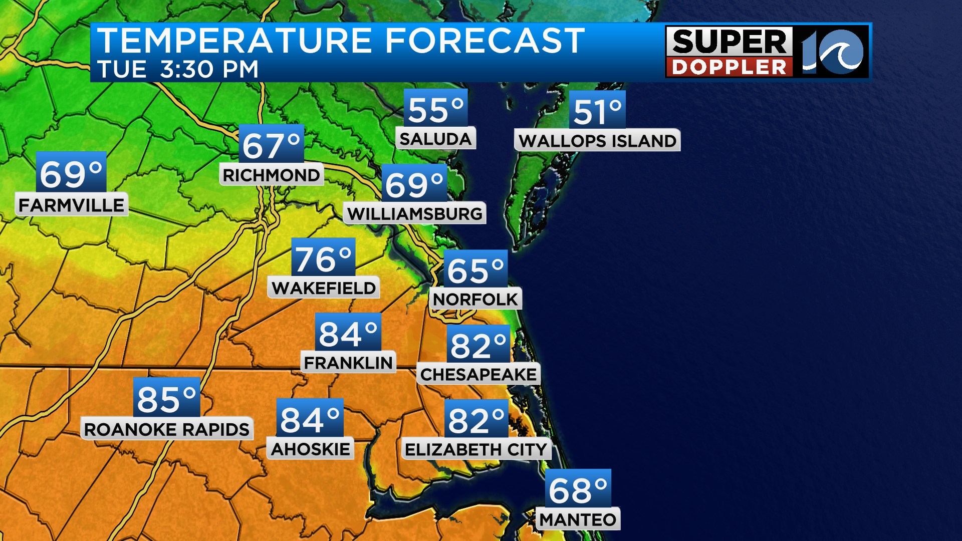
Tuesday poses to be quite similar, just a bit warmer, as some locations across town will reach 80°, if not into the low 80s. Rain chances look pretty slim, so we’ll only call for an isolated shower or two by the evening hours.
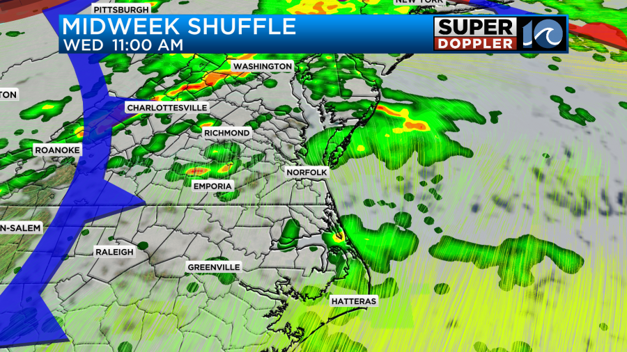
By midweek we will increase our rain chances as an approaching cold front arrives to settle the score. Expect scattered showers with a warm breeze Wednesday, highs should be in the 70s. By the evening there could be a round of a few thunderstorms, some of which could feature damaging wind gusts.
Behind the front cooler and drier air crashes into Hampton Roads – temperatures will drop big time for the end of the week. Expect lows in the 30s & 40s and afternoon temperatures in the 50s!
While chillier, our afternoons from Thursday into the weekend will feature plenty of sunshine.
While the roller coaster ride of temperatures may seem like an April Fool’s joke… we know the wacky spring weather is a staple of Hampton Roads.
-Steve