
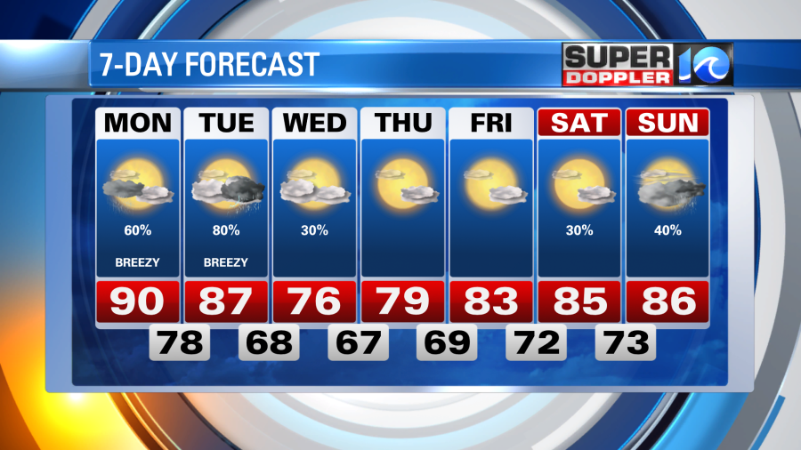
The next few days remain unsettled as we’ll be dealing with the unorganized tropical system Claudette Monday and then an approaching cold front Tuesday.
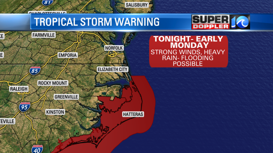
Claudette is expected to strengthen a bit as it races to the northeast tonight and makes it’s way into North Carolina. So tonight, we can expect increasing clouds and a few showers or thunderstorms for our NE North Carolina communities. A Tropical Storm Warning is in effect for Dare County, NC, from 12am to 12pm Monday.
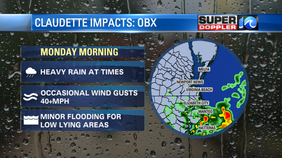
Expect cloudier skies waking up Monday with muggy & humid conditions, temperatures around dawn should hold in the mid to upper 70s. Pockets of heavy rain move into NE North Carolina around this time, too. As Claudette rides up the coastline, some wind gusts to 40mph are also possible, as well as minor flooding in low lying areas. Watch the high tide around 4:30am Monday.
For the Hampton Roads area, we should fair with a few showers around for the Monday morning commute, some may be heavy at times. However, this system will be (and already is) pretty fast moving, so by the time lunch rolls around it should be moving offshore. Taking most of the precipitation with it, we’ll get some clearing into Monday afternoon. This will allow our high temperatures to then reach 90°! A few isolated showers could pop up by the end of the day.
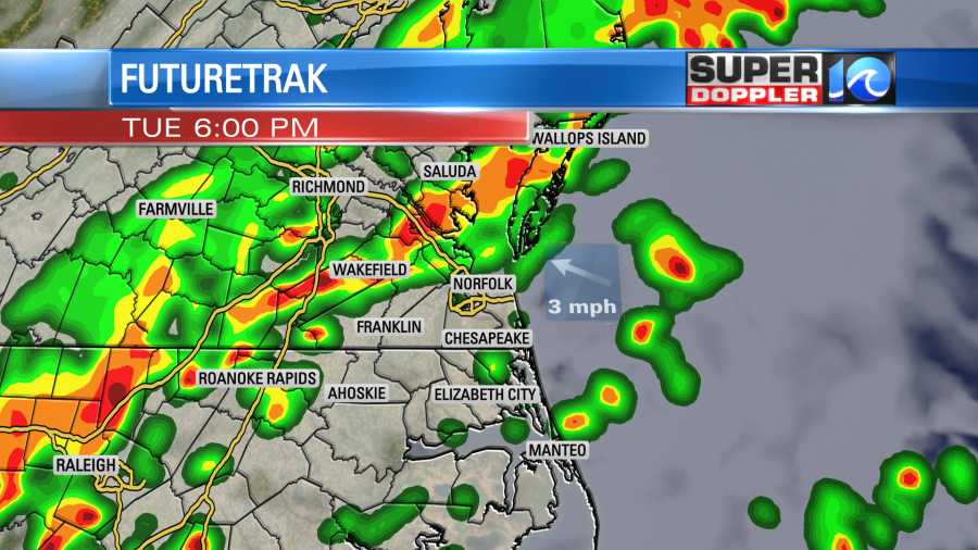
Now onto Tuesday, it’s our next shot of rain and is one that should include the majority of our region. We should get a nice sunrise with temperatures starting in the mid to upper 70s. It’ll be a humid day with a solid warm breeze out of the southwest. Clouds will then thicken as the day progresses and the approaching cold front inches closer. Towards the second half of the day we can expect showers and thunderstorms, some of which could be strong so stay weather aware.
As of now, drier conditions should prevail by Wednesday, with a refreshing breeze out of the north. Highs should hold in the 70s Wednesday afternoon with lows that night in the 60s. Temperatures and humidity should moderate back to our summer standards as the rest of the week unfolds.
Meteorologist Steve Fundaro


