Afternoon a fantastic Sunday weather-wise, we’ll need to turn our attention to the approaching round of showers & thunderstorms Monday afternoon. Some of which will be strong to severe, so it’ll be a day to stay weather aware!

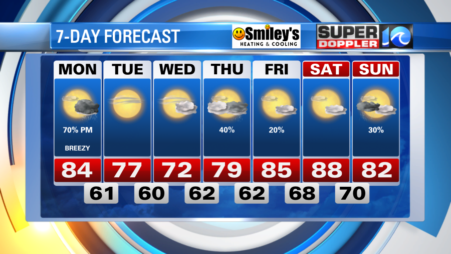
Clouds stick around tonight with a stray shower or two as lows hold in the low to mid 60s. We’ll get some sun through the morning hours Monday as the first half of the day is pretty nice! Expect warm & muggy conditions with highs in the low to mid 80s. By the early afternoon, though, those puffy cumulus clouds thicken up and we’ll see showers & thunderstorms develop.
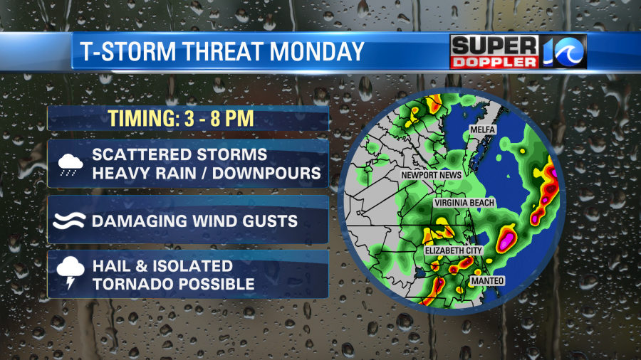
A cool front sliding into the region Monday afternoon will trigger a broken line of scattered showers and thunderstorms. Again, some of which will be strong to severe – damaging wind gusts, hail and even an isolated tornado (while the tornadic threat is very low, it’s still none-zero) are all possibilities.
Expect the scattered showers to develop after 1 p.m., then taking us through sunset before the leftover rain tapers off. Skies clear out pretty quickly overnight into Tuesday, and with plenty of sunshine on the way and low humidity values, Tuesday will arguably be the nicest day this week.
Will it rain from start to finish Monday? No – but that’s more of a reason to pay attention to the weather as what storms do develop will do so quickly.
Meteorologist Steve Fundaro