Not going to lie, our job in the weather center this week should be pretty easy… summer sunshine takes over all week long!
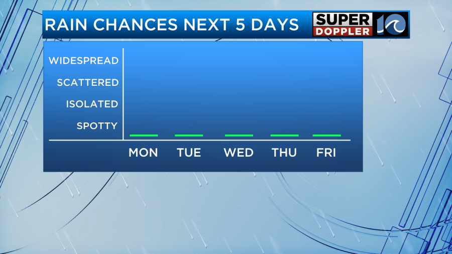

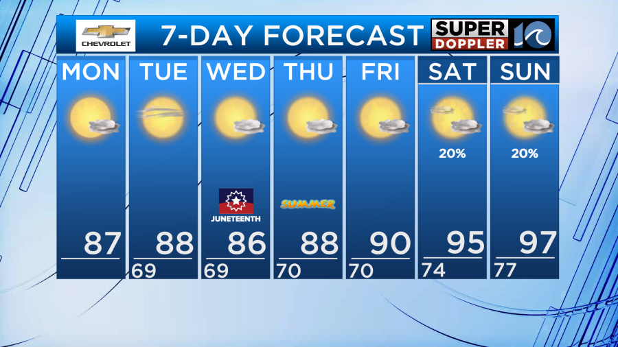
Rain chances are slim to none for at least the next four to five days, so expect bright summer sun each afternoon with just a few passing clouds. Highs should hold in the mid and upper 80s through Wednesday, then some bigger summer heat builds by the end of the week and weekend.
Humidity remains relatively comfortable, muggy, but not the worst we’ve dealt with. By the end of the week the humidity climbs a bit with the rise in our afternoon temperatures. Things really get sizzling by the weekend. High temperatures on Saturday and Sunday of the upcoming weekend could easily be in the low to mid 90s, with heat index values in the 100° to 110° range. Dangerous heat is possible by the weekend, be prepared.
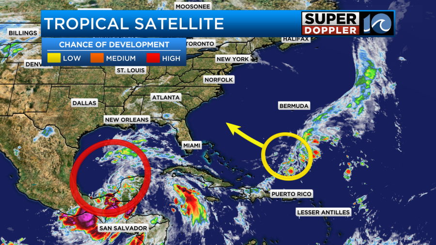
Tropically, we’re keeping an eye of two areas of potential development, fortunately neither will pose any issues for us locally. In the Gulf of Mexico a broad tropical depression or tropical storm is possible by midweek, potentially bringing heavy rain for the Gulf coast of Texas. Off the SE US coast, there’s a low chance of tropical development in a weak disturbance, by the end of the week there could be a few showers for SE US coast.
Otherwise, there’s nothing but sunshine all week long… grab those sunglasses!
-Steve