
The brief little round of showers and thunderstorms this afternoon was just the appetizer – the main course comes later tonight with the passage of the cold front.
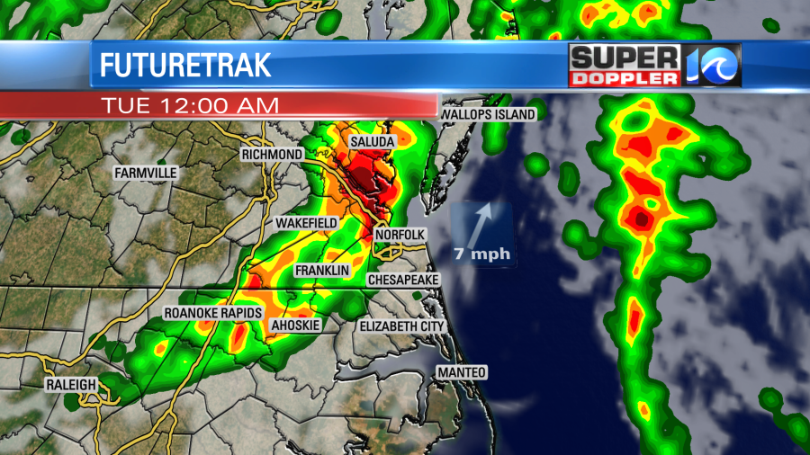
Some breaks in the clouds and a lull in the rain has allowed the atmosphere to recharge for a bit. Temperatures have rebounded into the low 70s over dew points in the mid/upper 60s – a set up that does not feel like October. That humidity will help the next round of showers and thunderstorms stay alive.
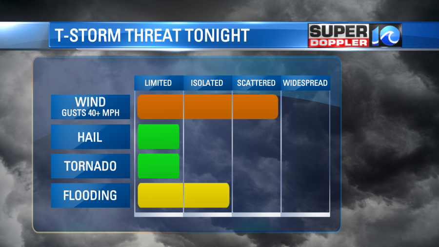
Expect a broken line of showers and thunderstorms to blow through well after dark. The timing still looks to be after 9 pm and into the early overnight. Most of us should see the storms move in around midnight. Damaging wind will be the primary concern with this front, but small hail and a brief tornado cannot be rule out. There will be some pockets of heavy rain as well so minor street flooding is also possible.
By tomorrow morning, all of this will be blown offshore as a cool October breeze decreases our cloud coverage. Look for a mix of sun & clouds through the day, a lingering shower or two, and highs holding in the 60s.
Be sure to have a way to get weather alerts late tonight and stay safe!
Meteorologist Steve Fundaro


