After a stellar weekend of weather we’ll start our workweek in similar fashion. Take advantage as cooler weather will step in around midweek and could stick around for quite awhile.
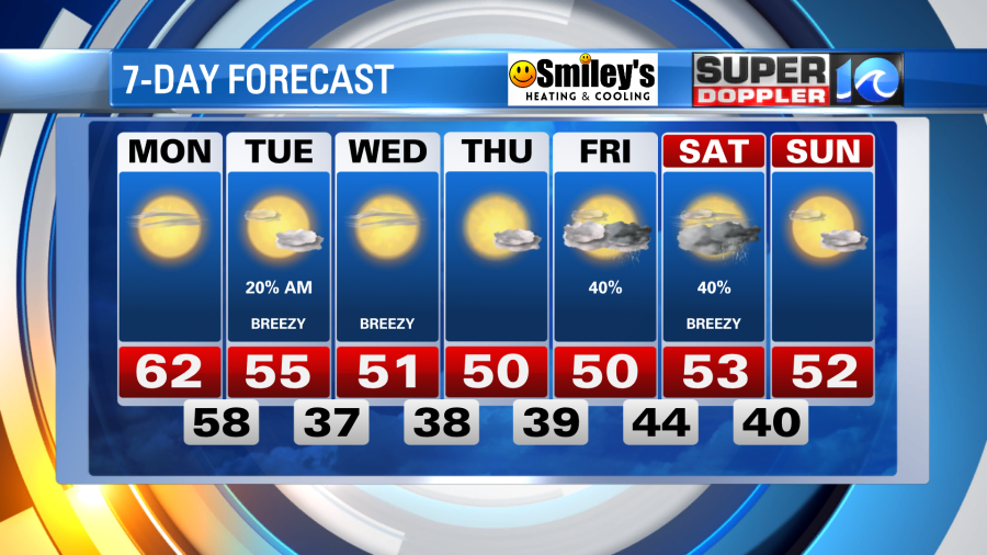
A touch on the chilly side early Monday morning but with high pressure in control for one more day we’ll keep the sunshine and highs in the 60s. A few inland locations could even push 70°!
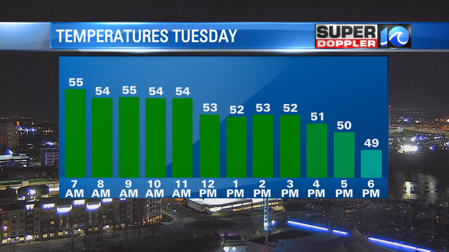
Overnight into Tuesday a weakening system will slide by to our north – it’ll throw a spotty shower or two our way (particularly for the Peninsulas and the Eastern Shore before dawn), but more notably it’ll pull down some cooler air. Temperatures will be in the mid to upper 50s through sunrise Tuesday as the cool breeze blows in. Gusting to 25+mph, temperatures should steadily drop throughout the day under partly cloudy skies.
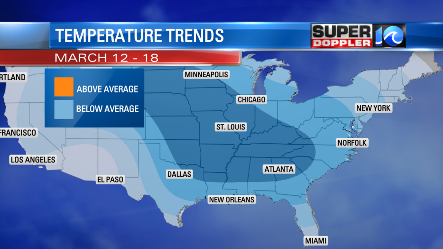
This will then set up a stretch of cooler weather for the back half of the workweek – highs from Wednesday through Friday will likely be on either side of 50°. Some indications are pointing towards the cooler weather sticking around for the following week as well (in the 8 to 14 day window). So a good chunk of March could very well be more lion-like, and cooler, after a warm February.

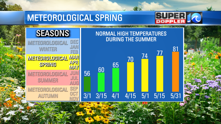
A warm February does not directly translate into a warm March, or even a warm spring. The spring season is more of a transitional period between winter and summer – so the broad range of the average high temperatures between March, April, and May, allow for wide ranges in our day-to-day and week-to-week weather.

Fortunately, we won’t have any significant rainfall to worry about for the majority of the week. By weeks end we’ll look for our next chance of rain, potentially Friday night and Saturday.

Meteorologist Steve Fundaro


