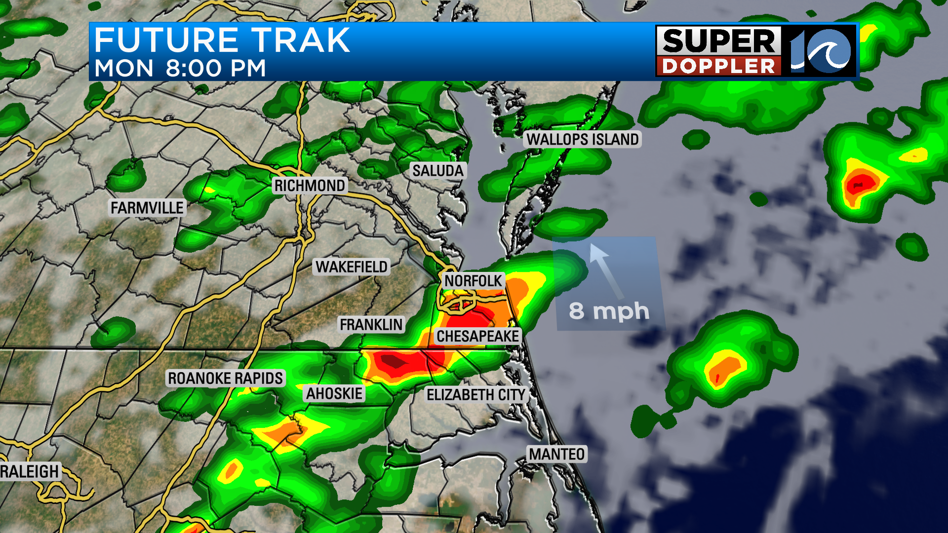
The stationary front has draped itself across the region and will provide scattered showers and potentially heavy rain for our Monday. The front won’t move much over the next couple of days either, so it’ll keep things unsettled through at least Wednesday.

Tonight we’ll see increasing clouds and a stray shower here or there. Expect mostly cloudy conditions to guide us through most of our Monday with most of the scattered showers developing for the afternoon and evening.
Showers and thunderstorms will be slow moving and slow burners, so the potential for flooding in a few spots is there. Something to keep in mind on the afternoon/evening commute. Rainfall amounts could be over 1″ depending on where the showers develop.
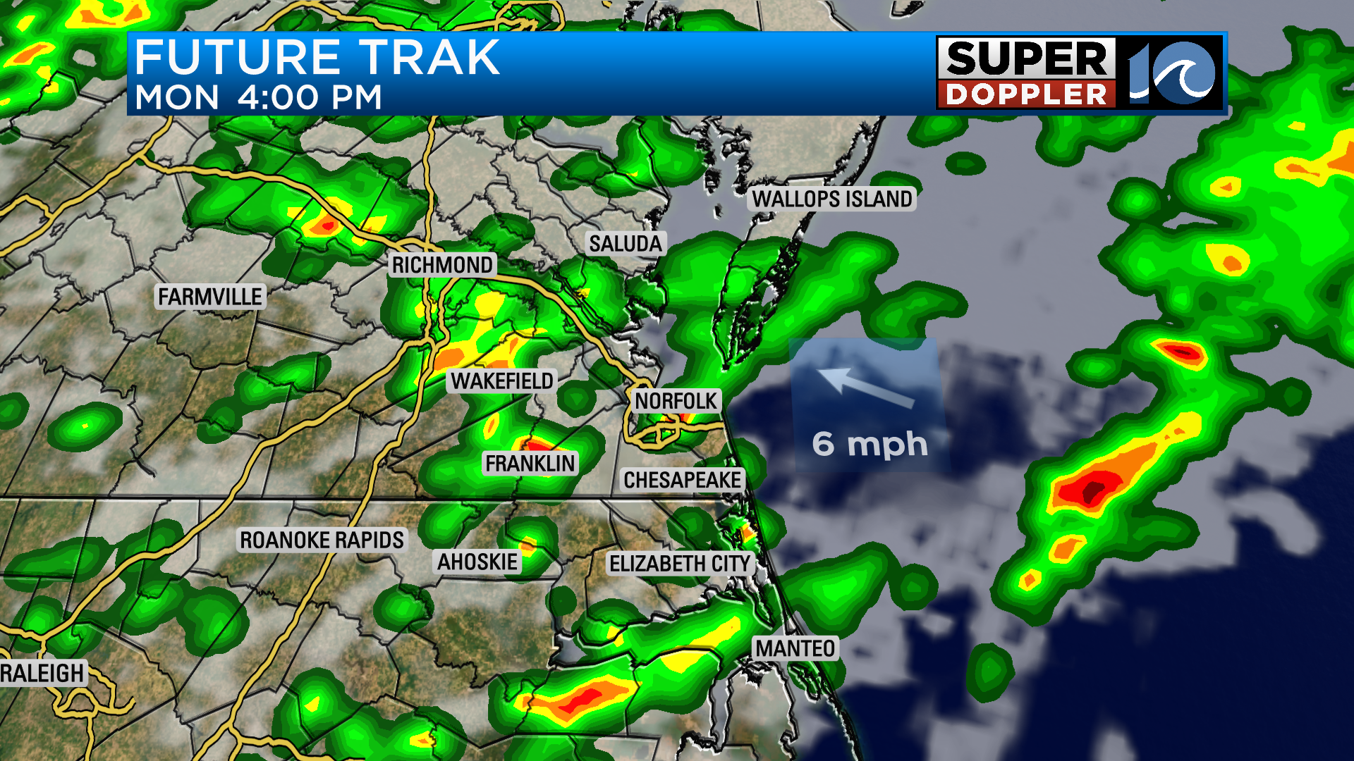
The northeast wind tomorrow will keep temperatures down in the low 80s, but it’ll still feel very muggy.
The stationary front won’t move much over the next 36 to 48 hours, so it keeps our local forecast unsettled. As of now, it does look likely we’ll get some more sun on Tuesday and Wednesday with isolated showers around the region.

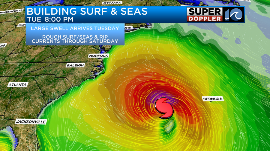
In the tropics, we continue to closely monitor Franklin and Idalia. With full confidence, Franklin will pass by Hampton Roads on Tuesday and Wednesday by over 300 miles. The storm will eventually become a major hurricane by midweek, sending a large swell to the east coast. Waves form the system arrive to our area beaches on Tuesday, filling in on Wednesday. Expect large surf and strong rip currents. Surf and seas will remain elevated through the end of the week as an onshore wind develops.
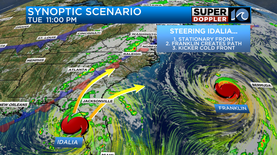
Idalia will slowly move into the Gulf of Mexico early this week, making an approach to the Big Bend area of Florida overnight Tuesday into Wednesday. The system could quickly strengthen into a strong hurricane upon landfall somewhere between Cedar Key and Apalachicola.
The storm system will likely race up the coastline of the Carolinas on Wednesday/Thursday before heading out to sea on Friday.
There’s still too much uncertain as for what exactly will unfold in the extended forecast, it’ll all be dependent on the strength and track of the storm system. Right now, we’ve got late week rain chances (primarily for NE NC) with a solid ocean breeze. If the storm takes the southerly track, we could be left with cooler conditions, lower rain chances and a fresh ocean breeze. If it takes a northerly track, we could be dealt more showers and heavy rainfall. This is all still up in the air, so please be sure to check back for updates this week as conditions warrant.
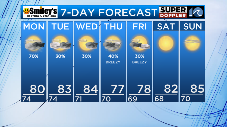
One this is for certain, though, and that is the forecast for Saturday and Sunday should prove stunning.
Meteorologist Steve Fundaro