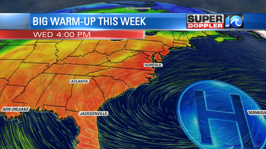
I’ll be honest, I was hoping for a little more sunshine today to finish the weekend, moving forward though we’ll have nothing but it all week long. Once the big area of high pressure slides into place this week temperatures will soar into the 80s. Grab those sunglasses!
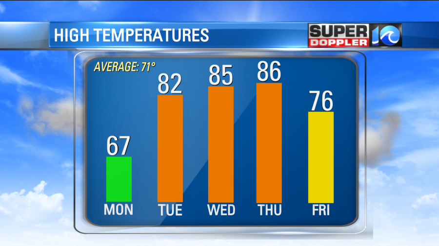
The northwest breeze through the night will help clear things out as temperatures drop down to the upper 40s and low 50s Monday morning. Expect a bright sunrise to start a bright, sunshine filled spring day. The north wind tomorrow will hold highs temperatures near 70°, but once the big ridge of high pressure slides to the east the rest is history.

By Tuesday the breeze flips out of the southwest and with plenty of sunshine temperatures will quickly soar into the upper 70s and low 80s. We’ll do a wash, rinse and repeat for Wednesday and Thursday, just a tad warmer. We can go for highs in the mid 80s(!). Dew points should remain around 60°, if not below that, so the warmth shouldn’t feel too humid.

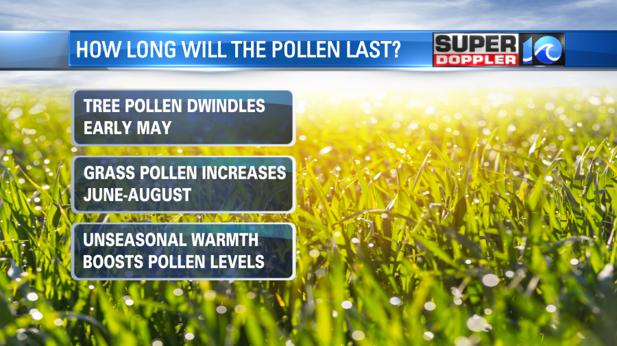
The only downside with this stretch of beautiful weather: pollen levels remain high. Especially with the warm breeze by midweek, tree and grass pollen will remain elevated all week.

The rain last night helped suppress the pollen briefly today, but there isn’t much relief by the way of more rain this week. The next shot at rain may be late week, Friday, as showers/rain will try to break down this unseasonal spring warmth. As of now, it doesn’t look too impressive, but we’ll keep you posted. Until then, enjoy this weeks weather!
Stay stoked! – Meteorologist Steve Fundaro


