Today may have very well been the warmest day over the next seven or so – an approaching cold front will not only bring us much needed rainfall, but a blast of winter as we go into the holiday workweek.
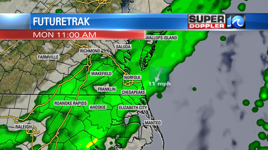
Clouds thicken up through the night as the front marches towards Hampton Roads. Most of the overnight will be dry outside of one or two brief rain showers. Temperatures should hold in the low 50s. The rain will move into the region right around sunrise, just in time for the Monday morning commute! Rain showers will then take us through late morning and into early afternoon. Things will eventual taper on off by the evening, we’ll also notice the breeze pick up out of the northwest.
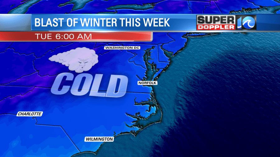
By then, the cold and dry air will come sinking into the area. So much so, that the warmest part of Monday will be in the morning hours, when temperatures are in the upper 50s. Throughout the day temperatures will steadily drop, before then plummeting overnight into Tuesday. The coldest air of the season so far crashes in and sets up a morning with 20s and 30s Tuesday.
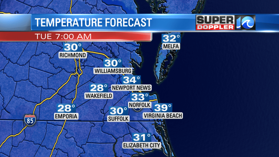
Highs will only hold in the 40s on Tuesday! This cold air is dry, so it does come with a lot of sunshine, and helps set up a really nice pattern into Thanksgiving. By then temperatures should rebound close to 60°. There may be another shot at rain on Black Friday, but there’s still some uncertainty there, check back this week for more details.
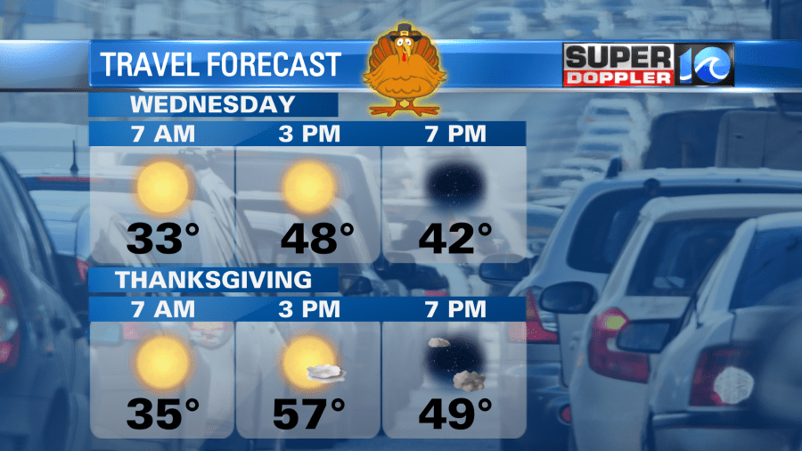
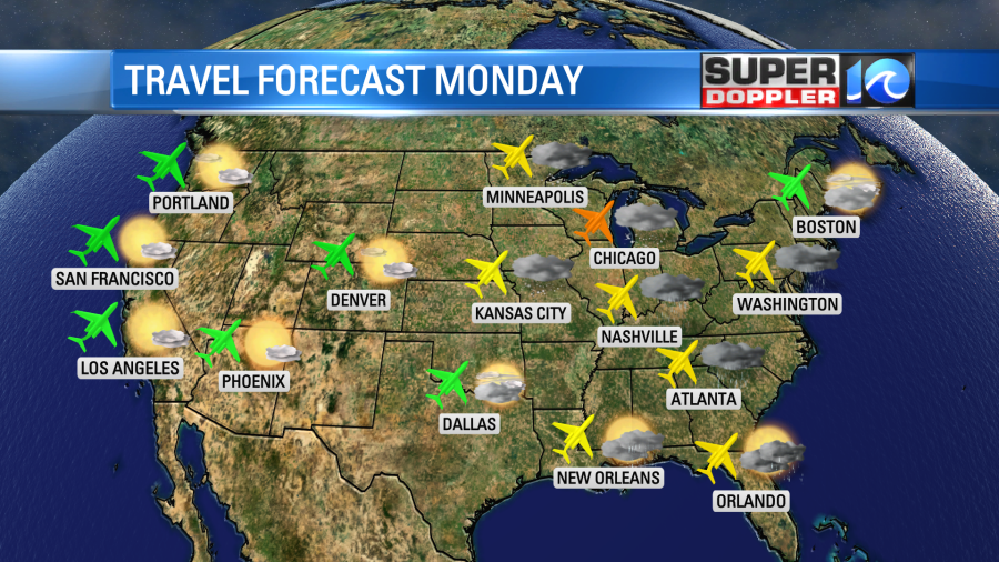
Thanksgiving travel! The only day I see this week that could cause some issues would be Monday as the front sweeps across the east. Even then, I don’t see major delays or major issues. Rain likely for the I-95 corridor for most of Monday before a nice pattern sets up into Thanksgiving.
So grab the umbrellas tomorrow and the coats Tuesday!

Meteorologist Steve Fundaro


