After an absolute gorgeous Mother’s Day across the region, an approaching cold front arrives on Monday to switch things up. The rest of our Sunday will be dry, though, just expect clouds to continue to thicken through the evening. We’ll hold onto the southwest breeze so it’ll remain pretty warm through sunset, temperatures should hold near 70° after dark.
Only downside with this evenings cloud coverage is it may get in the way of the NASA Wallops launch slated for tonight. After getting scrubbed yesterday due to winds, it may get scrubbed due to visibility tonight. We’ll see! Launch window opens at 8:03pm.
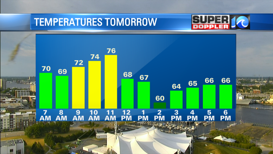
Upper 60s with mostly cloudy skies by dawn on Monday, as most of the morning should be dry, especially the morning commute. By late morning or so scattered showers begin to develop across the region and take us into the afternoon. A thunderstorm or two is possible as well.
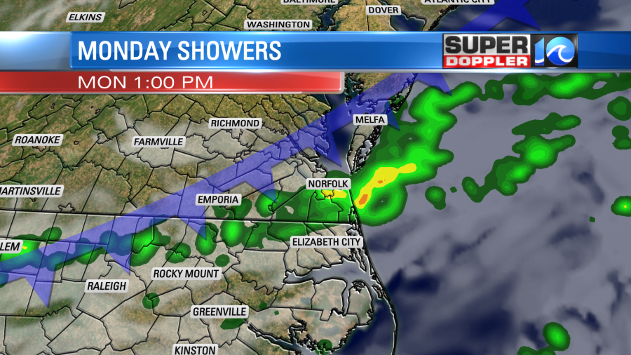
High temperatures will be in the mid to upper 70s before the noon hour or so, then as the cold front and scattered showers work through the area temperatures will fall off into the 60s for rest of the afternoon. The north wind behind the front will then eventually clear things out by the evening.
Plenty more sunshine returns to the area on Tuesday but the northerly flow will hold temperatures in the mid to upper 60s, in fact, that’ll likely be the case for the majority of the wee (at least through Thursday).
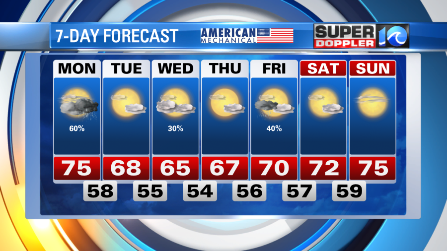
So a cooler stretch of weather is on the way behind our impending cold front. Here’s to hoping the rain Monday and cooler conditions suppress those reluctant pollen levels.
Stay stoked! – Meteorologist Steve Fundaro


