We are setting up the coldest Christmas since 2013 with big time wind chill factors for most of the holiday weekend – bundle up! It may not look like a winter wonderland, but it most certainly will feel like one – or feel more like the Grinch’s attitude for that matter.
Christmas morning temperatures are in the low 20s across the region, and it feels like it’s in the mid-teens. Temperatures are expected to rise into the upper 30s, with lows in the low 20s overnight into Monday morning.
As the westerly wind gusts to 25+mph through the day wind chills values will be on either side of 0° through late morning, with temperatures feeling like the teens for most of the afternoon. Expect bright, polar blue skies and sunshine, just downright cold!
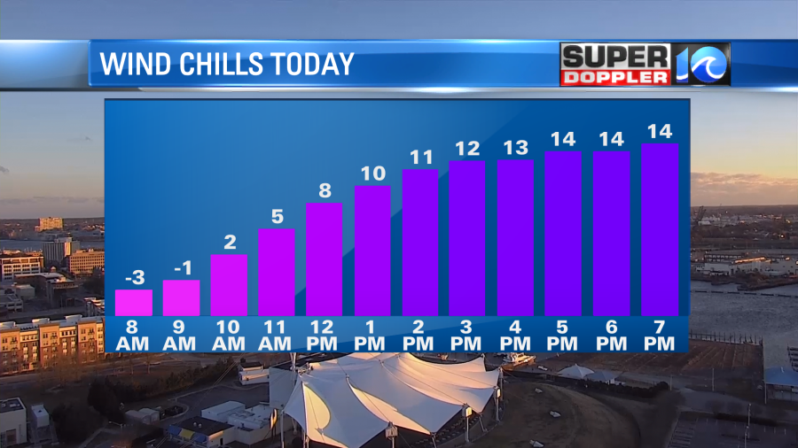
Actually highs today will reach the mid to upper 20s as this arctic air settles into place. The wind will slowly back off by tonight, when temperatures drop to either side of 20° for Christmas morning. A gentle breeze will create wind chill values in the teens through Christmas morning with afternoon temperatures reach the low to mid 30s.
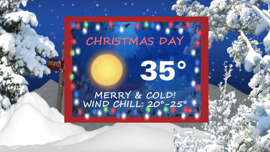
Hard to believe, but this will not be the coldest Christmas on record for the Norfolk Airport when you look at the climate data. That was in 1983 when we saw a high temperature of 16°F. We’ve seen a high of only 32°F several times, most recently in 1999 and 1989. In 2013, we saw a high of 35°F.
We’ll be under the influence of this arctic air for the next few days, so that means cold mornings are in store for us through at least Wednesday. However, high pressure will be slowly moving in to help thaw things out. High temperatures are set to reach the 40s by Tuesday & Wednesday, with 50s and even low 60s possible by weeks end.

Merry Christmas and Happy Holidays from the Super Doppler 10 Weather Team.
Meteorologist Steve Fundaro


