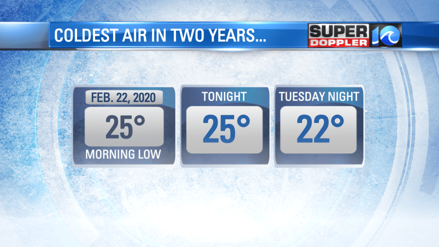
If today’s brisk breeze had you feeling chilly, just wait until dawn tomorrow. Mother Nature will wake us up in a rude, bitter mood, dropping temperatures to readings we haven’t seen in the past two years.
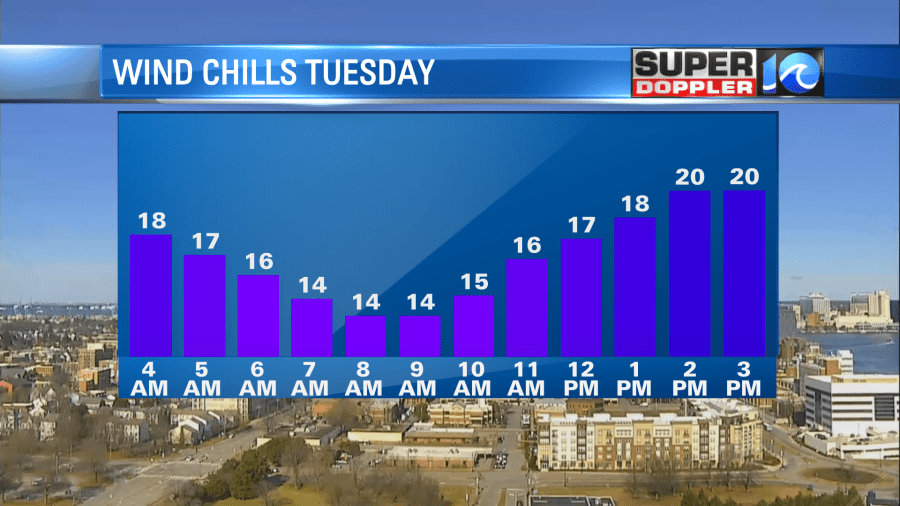
A pool of arctic air to our north squeezes in tonight to reinforce the cold, and with it, comes another northerly breeze. It should hold steady between 12-18 mph later tonight and through tomorrow morning. And with lows dropping into the 20s, wind chill factors will feel like the teens, even single digits at times.
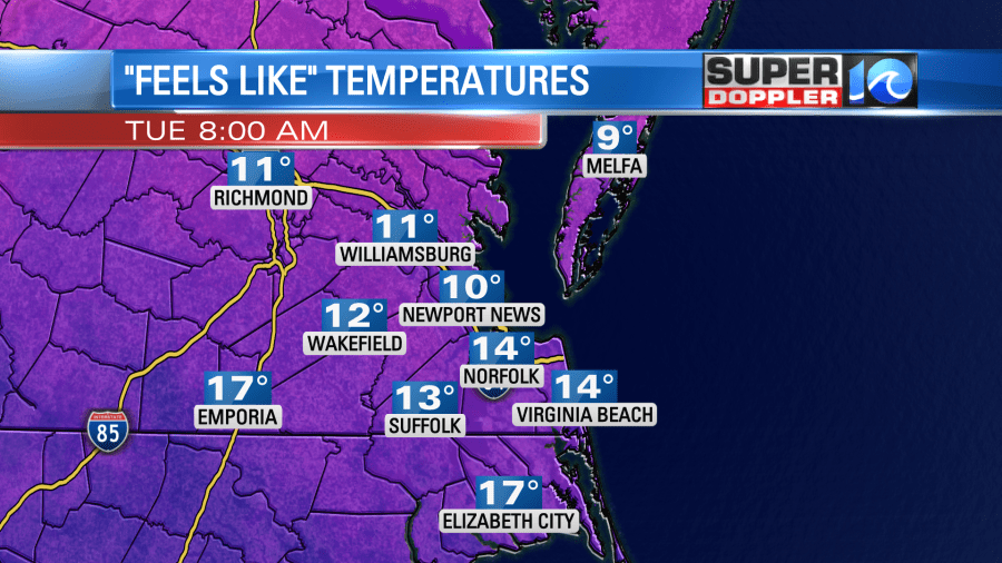
Wind chill factors should be with us through at least late morning / midday, so expect temperatures to feel closer to 20° for the first half of the day. Afternoon highs should only be in the low to mid 30s, despite the abundant sunshine.
Moving into tomorrow night, temperatures will crash even further. Lows will likely read in the low 20s, however, we don’t see any significant wind chill factor. So temperatures should feel true to their reading, before rebounding back into the 40s. It’ll remain chilly through the end of the week when we await our next chance of rain, sometime between Saturday and Sunday, and with the cold air likely to stick around, it’ll be an interesting system to watch.
Until then, bundle up, stay warm and enjoy this cold, cold, sunshine!
Meteorologist Steve Fundaro