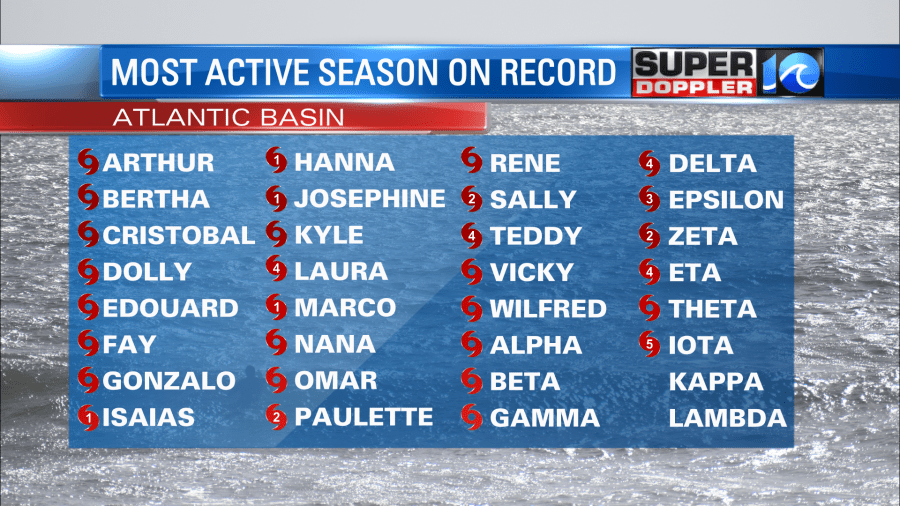
2020 has been a year, I don’t think anyone will dispute that, and it seems fitting that the most active hurricane season on record is during the year 2020. But today I’m not here to blame that on 2020, we’ve done enough of that this year for countless other things. Instead, let’s reflect on why the National Hurricane Center has called this year “extremely active”.
Waking up this morning, it was heart wrenching to see the rapidly intensifying Hurricane Iota bear down on essentially the same location Hurricane Eta devastated just two weeks ago. Nicaragua and Central America are dealing with a major Category 5 hurricane 14 days after being impacted by a major Category 4 hurricane.
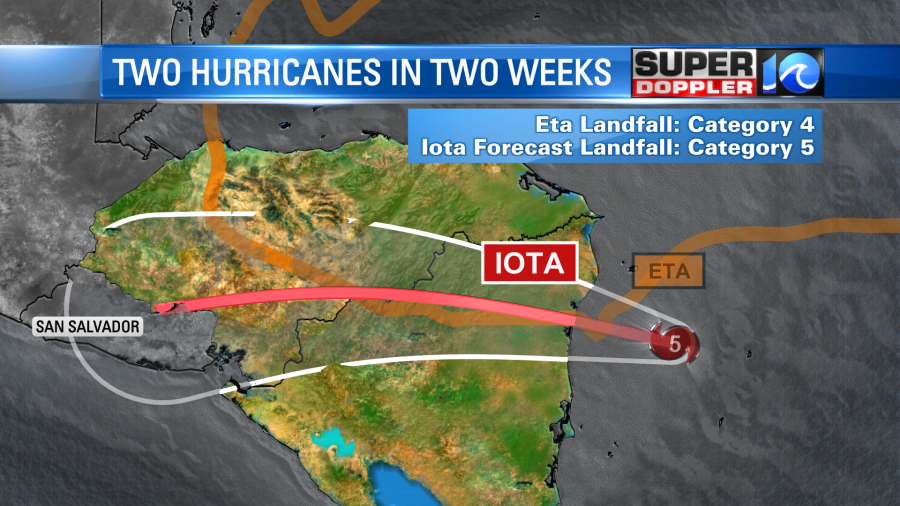
It’s impressive in itself to see a system that’s this strong (the strongest of the year) this late in the game. Let alone it following up the previously strongest storm of the season (Eta), on virtually the same path.
Hurricane Iota is the first Greek alphabet named storm to reach Category 5 status. This is also the first time there’s ever been two major hurricanes in the month of November. However, just like a lot of other things in life, it’s hard to use one system to portray that something bigger is happening, we need more evidence. For that, let’s look back at the year so far.
30 named storms, 13 hurricanes, 6 major hurricanes. 12 landfalling systems on the mainland United States, 6 of those were hurricanes. 5 landfalls on Louisiana’s coastline. It’s the 5th year in a row with at least one Category 5 hurricane. And in my opinion, the strongest tidbit of them all this year, is that there has been 10 tropical cyclones that underwent rapid intensification.
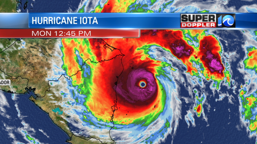
Rapid intensification is when a tropical cyclone increases it’s wind speed by 35 mph or more in a 24 hour window (Hurricane Iota went double time, increased 70 mph in that 24 hour window). Something that used to only happen a few times a year is happening more frequently, and closer to land. Why? There is more energy in the atmosphere.
A changing, warming climate simply means there’s more heat in both the atmosphere and in the oceans. Heat is just a measure of energy, so more heat equals more energy. More energy simply means more extremes.
Locally, sure we escaped a “direct hit”, but that may be besides the point. Instead, lets look at how the area was impacted weather wise this hurricane season. For starters, there was the severe weather and 10+ confirmed tornadoes in early August associated with Isaias. Shortly after the 10 or so inches of rain in 12 hours from what soon later become Kyle. The rains from Sally in September, the wind from Zeta in October, and the swells from Paulette, Teddy and Epsilon. Which Meteorologist Jeff Edmondson claims were some of the best waves in quite some time. It was also really hot this summer, wasn’t it.
Or just recall how warm it’s been for the first portions of November, just last week I paddled out without a wetsuit! In November! Or even last week, how a cold front dumped 5 – 6 inches of rain and flooded our roadways. All things we can handle, but things that are happening more frequently, because the atmosphere is containing more heat, and therefore more energy.
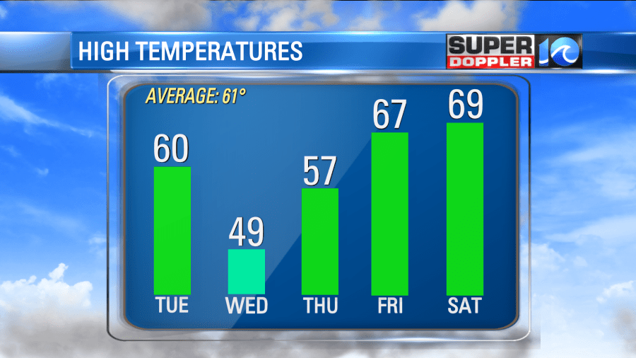
That’s not to say it’ll storm every week, no, because just like life the atmosphere needs balance. And we got some balance this week. Finally some normalcy in our high temperatures, roughly near 60° for the majority of the next 5 days.
Post-cold front weather Monday is an absolute delight, proving it’s some of the best weather around. Sunshine, low dew points, a light breeze, goes perfect with that warm cup of coffee. Now there is a secondary cold front nearby, it’ll approach the area from the north by the end of the day Tuesday. What’s cool though, is that it won’t bring any rain, or really any clouds either (maybe a handful). But what it’ll do is reinforce the cooler, some may say colder, air.
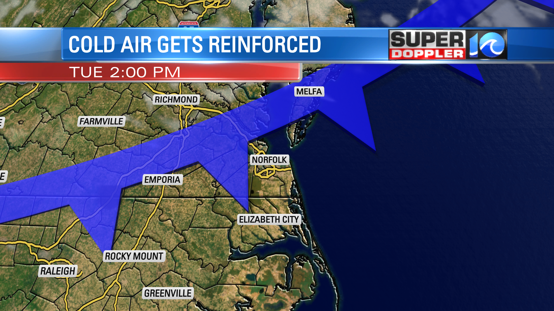
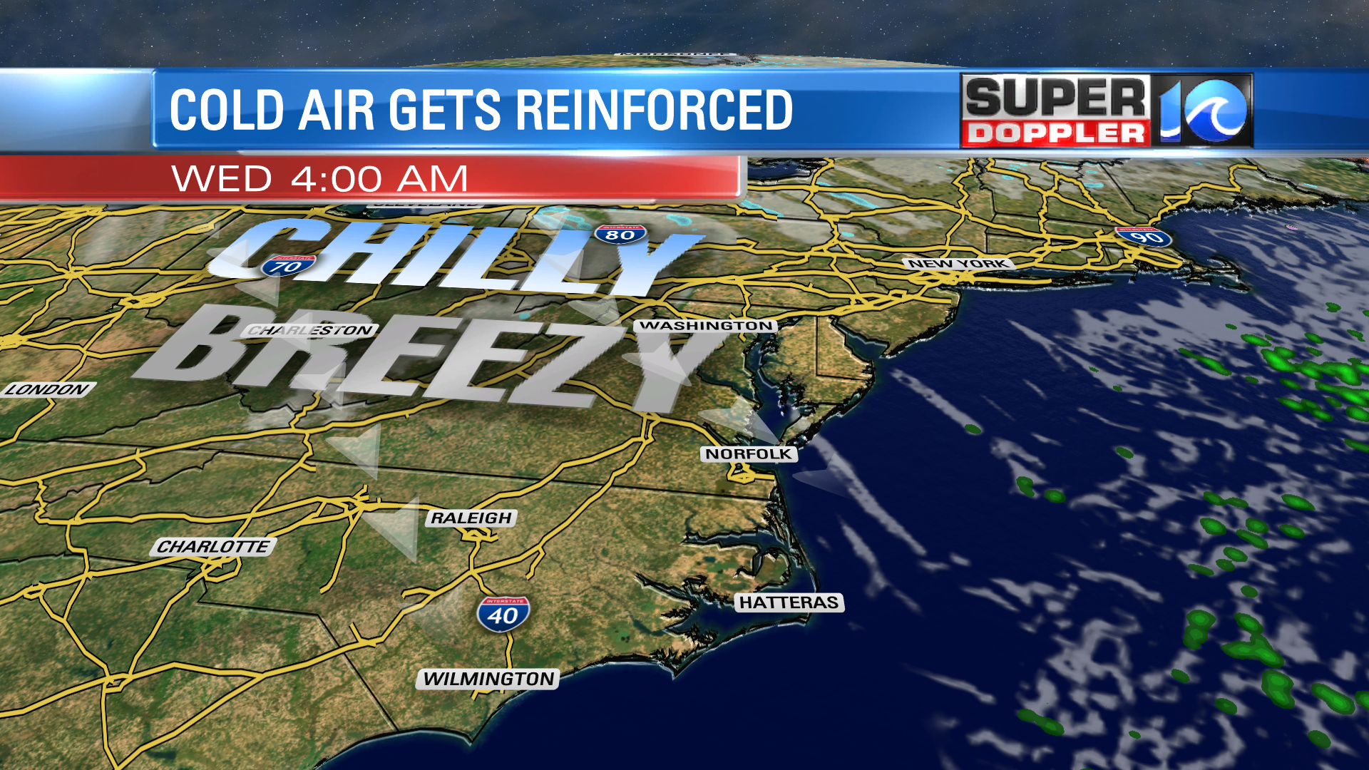
The breeze picks up by Tuesday afternoon out of the west-northwest. This is the door opening and the colder air pushing in. Lows by Wednesday morning will be in the mid to upper 30s for most of us. A blustery day too, especially in the morning. Depending on how strong the breeze is, it could hold our highs Wednesday in the 40s! Now that’s some sweater weather. A little preview that winter is right around the corner, and we can soon say good riddance to the 2020 Hurricane Season.
Stay stoked. – Meteorologist Steve Fundaro


