We started off this morning with chilly, foggy and drizzly weather.
There has been a lot of moisture pushing up into a cooler pocket of air in the Mid-Atlantic and Northeast states.
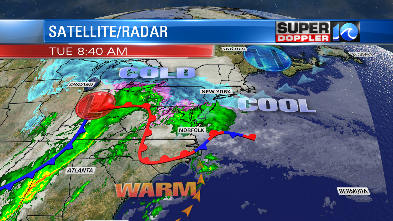
For us it just made for some chilly showers. However, this is going to create some snow from New York up into Maine today. A slow moving warm front will eventually move into Hampton Roads. We’ve had a northeast wind this morning, but winds will gradually turn to out of the south. We’ll warm up late in the day to the upper 50s north and mid 60s south.
A lot of Hampton Roads will be in the low 60s, but these temps may not arrive until the late afternoon into the evening. We’ll have mostly cloudy skies this afternoon. The rain showers and drizzle from this morning should become much more isolated.
By tonight, a cool front will swipe in from the west. There will be a line of showers and isolated thunderstorms out ahead of it.
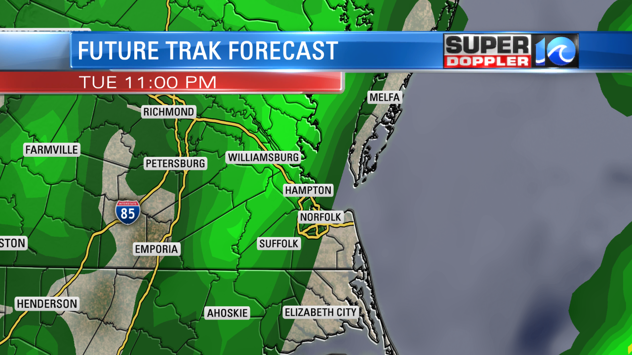
Winds will pick up out of the south ahead of the boundary. Then they will turn northwesterly behind it. We’ll dry out by tomorrow morning. Then we’ll have some nice weather through Wednesday. We’ll dry out with highs in the upper 50s. Thursday gets even better for Valentine’s Day. We’ll be partly cloudy with highs near 60.
We’ll be in the 60s again on Friday, but there will be a few rain showers in the region.
Then there’s the weekend….
I won’t lie…the weekend forecast is tough. One trough will quickly move through while another bigger trough developing form the western states will quickly moving east. The models aren’t handling this very well. They also have a front coming in and either stalling out or moving back north as a warm front. For now I’ll just say that you should hold off on solidifying any outdoor weekend plans, but also don’t cancel them. Hopefully, that part of the forecast will become easier by tomorrow. Stay tuned!
In national news…a major storm just rolled over the state of Hawaii with hurricane force winds over the mountains and some snow to a fairly low elevation. When I first saw the stories about snow, it looked like it was down to sea level. However, after reading some more it looks like it made it down to one of the state parks that sits about about 6,000ft in elevation. The same storm system caused wind gusts to about 190mph on top of one of Mouna Kea…crazy. Here is the article with more information: Hawaii storm with snow.
Meteorologist: Jeremy Wheeler


