OUTER BANKS, N.C. (WAVY) — Outer Banks communities saw significant impacts from a coastal storm Tuesday, with more than 15 inches of rain falling in Corolla and other areas getting more than six inches as flash floods reigned in areas of Dare, Currituck and Camden counties.

Both lanes of NC 12 by the Sanderling Inn in Duck were open and passable by just after 10 p.m. Tuesday after being impassible earlier in the day due to high water. Police had redirected traffic through the parking lot of Kimball’s Kitchen until the water receded.
The town of Duck advised, however, that those needing to drive through Duck via Southern Shores be careful of areas of standing water remaining on the road.
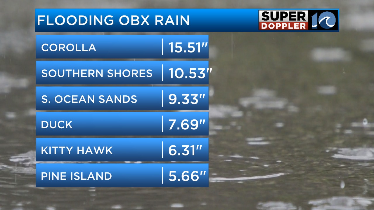
Most areas of the Outer Banks received at least a half foot of rain, as the storm brought significant flooding and the possibility of more Rodanthe homes collapsing into the Atlantic Ocean, though there were no immediate reports of that happening Tuesday.
Super Doppler 10 Chief Meteorologist Jeff Edmondson said travel was not advisable in the northern Outer Banks Tuesday evening.
NC 12 traffic cameras showed flooding on roads in Duck, Southern Shores and Kill Devil Hills, as travel in some areas was difficult to impossible. In some areas of Duck, water depths were more than a foot deep.


There was flash flood warnings for northeastern Dare County, including Duck and Southern Shores, as local law enforcement reported thunderstorms producing heavy rain over multiple roadways along NC 12, making travel difficult or impossible.
In Currituck County, there was “extensive” and life-threatening flash flooding, with more than an inch to 1.5 inches per hour of rain falling at some points Tuesday afternoon and evening.
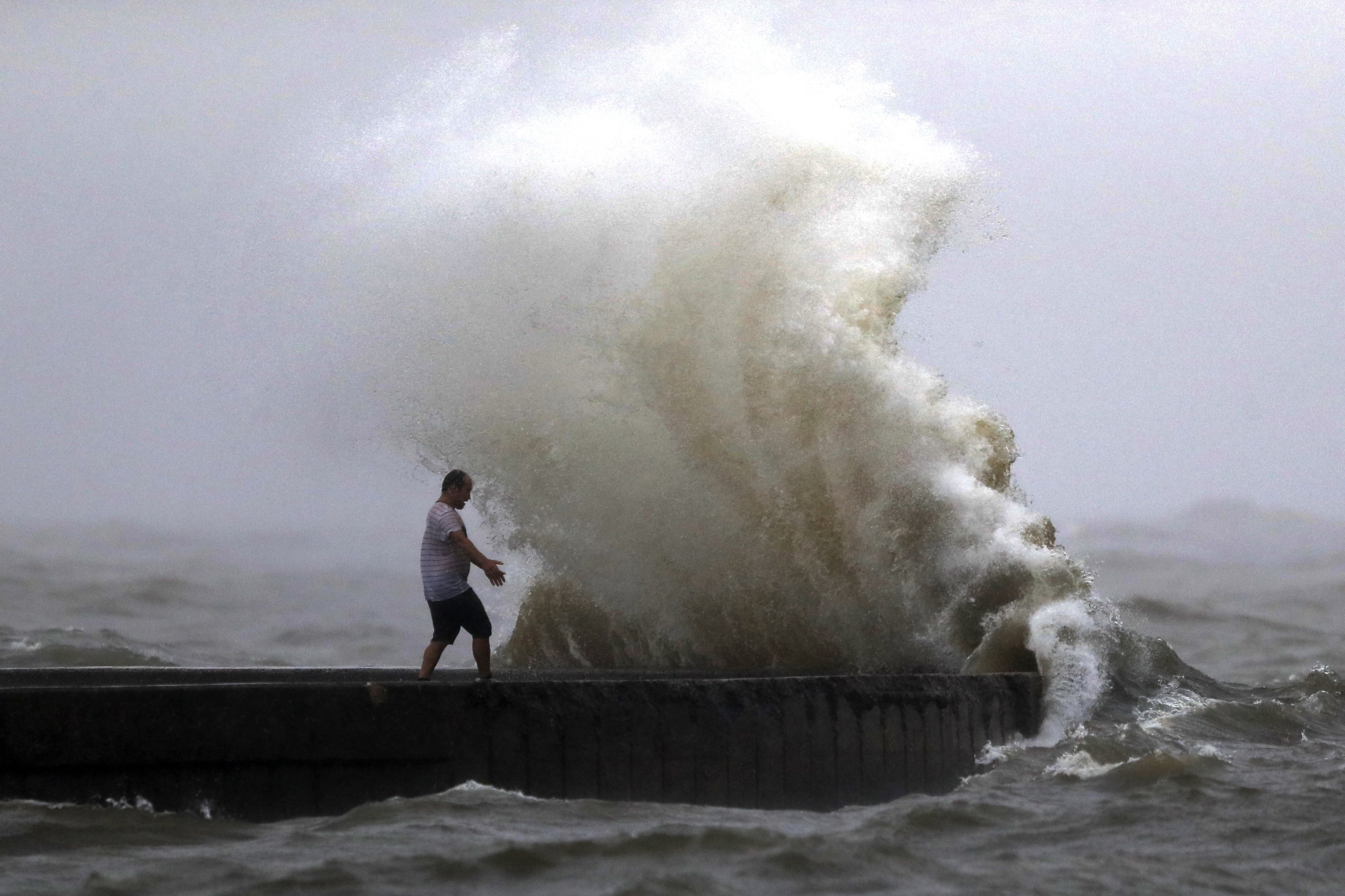
Double red flags were posted on all beaches from Duck south to Ocracoke and other Tuesday, as ocean conditions were ripe for powerful rip/longshore currents. No ocean swimming was allowed.
There had been a tropical storm warning in effect along the North Carolina coast for areas south of Ocracoke Inlet, with the strongest wind gusts of 40 mph to 50 mph expected within the warning area from potential tropical cyclone eight, according to the North Carolina Department of Emergency Management. There were also small craft advisories along the Outer Banks, and an increased tornado threat for far eastern North Carolina.
Everyone braced for a low-pressure system to the south along with King Tides, which are higher than usual because the full moon is closer to the Earth.
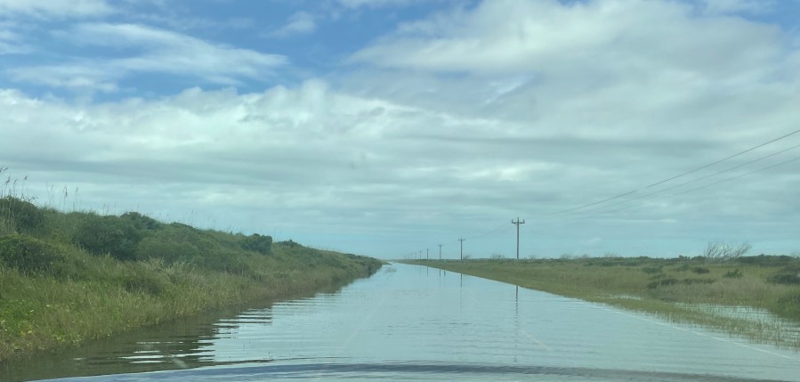
On Tuesday, the Cape Hatteras National Seashore announced that they would not be reopening NC 12 on the north end of Ocracoke due to continued heavy rains and ocean overwash.
In other areas, NC 12 remained open and passable. Tuesday morning, there was a small area of standing water and sand around Pea Island, while there was some water on the road in Buxton. In Hatteras, there was some ponded water and a thin layer of sand on the road.
There was a two-hour delay for Cape Hatteras Elementary and Secondary schools Tuesday due to potential coastal flooding in low-lying areas.
Secondary roads in Rodanthe were “inundated” with ocean overwash, and the North Carolina Department of Transportation said it would clear roads as the water recedes.
NCDOT had closed NC 12 on Ocracoke Monday night from the ferry terminal to the pony pens “until further notice,” and the road stayed closed in that area Tuesday, with water “extremely deep ad conditions unsafe for driving.” It said its crews would continue to clear the road and reevaluate conditions after Wednesday morning’s high tide.
NCDOT said Wednesday ferry schedule would be:
- Cedar Island to Ocracoke: 7:30 a.m. and 4:30 p.m.
- Ocracoke to Cedar Island: 1 p.m. and 4:30 p.m.
- Swan Quarter to Ocracoke: 10 a.m. and 1:30 p.m.
- Ocracoke to Swan Quarter: 7 a.m. and 10 a.m.
The Avon Fishing Pier remained closed through much of the day Monday, but reopened Tuesday.
While the storm had a significant impact in parts of the Outer Banks, other areas of southeastern North Carolina saw more than 18 inches in a day in some locations, as Gov. Roy Cooper declared a state of emergency for impacted areas, making assistance available.
The waves stirred up in Rodanthe Monday and Tuesday, where there are still a number of homes at danger of being lost to the ocean.
The Atlantic Ocean claimed a Rodanthe home last month after swells from Hurricane Ernesto churned hundreds of miles offshore near Bermuda, and there have been seven homes in the past four years swallowed up by the Atlantic.
The superintendent of Cape Hatteras National Seashore told WAVY he was keeping a close eye on what happens over the next few days in Rodanthe.
“We’ve got some concern that they may collapse, or one of them may collapse, in which case there could be a large debris field and the beach could experience a lesser quality itself,” said Cape Hatteras National Seashore Superintendent Dave Hallac. “Even at low tide, those homes are standing in the water, and their pilings are being battered by the waves every time those waves pass by the houses and come onto shore.”
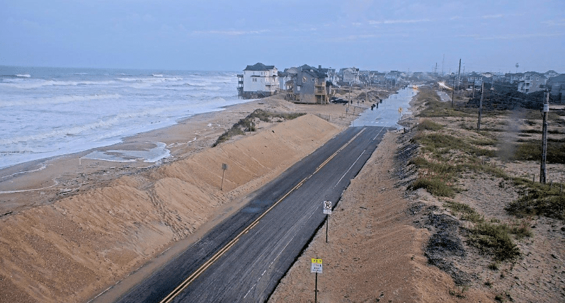
10 On Your Side’s Andy Fox reported Monday afternoon that there are five homes in which the stairs have been washed away due to higher than usual tides rolling in.
“The architecture is amazing, but Mother Nature is coming to take it back,” said Glenn Maurer of Pennsylvania. “It’s the way the world works.”
Julie Wilkerson of Chesapeake, who has been coming to Rodanthe for years, said she has seen the changes take place, and not for the better.
“We’ve been coming here for all of our lives,” Wilkerson said. “I remember when the dunes used to be three of four stories high, and now, look at them, it’s kind of wasting away. It’s really sad.”
There was uncertainty in the rainfall forecast as of Monday afternoon, though a flood watch remained in effect for much of central and eastern North Carolina through Tuesday afternoon. The amount of rain depended on the eventual track and strength of the storm, but the heaviest rain was expected Monday into Tuesday.
NC 12 Monday morning was open and passable, though the road had standing water and blown sand on it in several areas, including near the Pea Island Visitor Center, north of Buxton, north of Hatteras and on Ocracoke. NCDOT called for people to slow down and give them room to work.
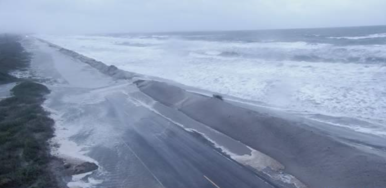

“We want people to remember to slow down,” said NCDOT spokesperson Tim Haas, “because there will be sand on the road, there will be water on the road, and we’ll have crews on the road working, so the best advice I have is to slow down.”
“This is amazing,” said Pennsylvania resident Amanda Vazquez, who is visiting the Rodanthe area. “I’m just speechless. It’s cool to see, [but] I feel bad for [the homeowners].”

