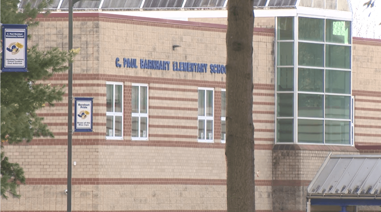
PORTSMOUTH, Va. (WAVY) — Tropical Storm Michael brought high winds and heavy rain to the region overnight, leaving a mess of downed trees, power outages and road closures as the sun rose on Friday.
Hurricane Ready Guide | WAVY.com Livestream
The National Weather Service said in its 5 a.m. update Michael had become a post-tropical cyclone with maximum sustained winds of 65 mph.
The storm was tracking to the east-northeast at 29 mph. Wind speeds across Hampton Roads are forecast to decrease as Michael moves further away from the coast.
At least five people were killed in Virginia during the storm. Officials with the Virginia Department of Emergency Management told 10 On Your Side four of the deaths were in the western portion of the state, while the fifth was in Central Virginia.
IMPACTS ACROSS THE REGION
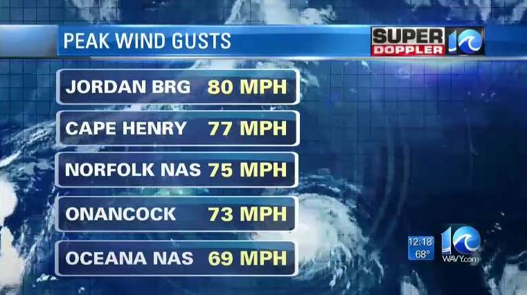
Michael swept across Virginia Thursday evening, bringing wind gusts as high as 65 mph in some parts of the viewing area. An official in James City County confirmed a tornado touched down Thursday, damaging 14 homes in the process.
PHOTOS: Damage from Tropical Storm Michael
The National Weather Service tells 10 On Your Side they will be confirming that a tornado formed in Gloucester during Tropical Storm Michael. A city planner reportedly watched the twister in Gloucester come off the water and onto the shore near Cuba Road.
Power was heavily impacted across the region, leaving many people in the dark.
We’re seeing alot of downed trees on power lines in #JameCityCounty.
A neighbor told us it was a scary sight when the tree hit the line a transformer exploded leaving this area without power. pic.twitter.com/pChg4vh6r1— Kiahnna Patterson (@KPattersonWAVY) October 12, 2018
Hundreds of thousands of outages were reported in southeastern Virginia region, according to Dominion Energy’s outage site. Dominion spokesperson Bonita Harris said in a tweet 120 schools across Hampton Roads and North Carolina were without power Friday morning.
Harris said customers should expect a multi-day restoration effort.
VIDEO: Team coverage of impacts from Michael
Roads up and down the region were impacted by fallen trees and debris from Michael’s winds. Officials with the Chesapeake Bay Bridge-Tunnel issued several wind restrictions as the storm raged overnight.
Officials closed the bridge-tunnel at two different points because of the conditions. All wind restrictions on the 17-mile expanse were lifted just before 8 a.m. Friday.
Video: Winds from Michael cause trees to fall
The damage left by Michael prompted school districts across the viewing area to cancel school or open late. Several districts announced delays before closing.
York County Department of Fire and Life Safety said it responded to 100 incidents since 8 p.m. Thursday. Michael’s winds knocked multiple trees and power lines down, damaged structures and made some roads impassable.
Officials with the City of Norfolk said initial reports indicated the storm knocked down or damaged 41 trees in city. No major roads were blocked.
LOOKING PAST MICHAEL
With Michael out of the picture, Hampton Roads can look forward to better, more fall-like conditions heading into the weekend. Temperatures will scarcely top 70 degrees until Monday.
Michael is no longer tropical. It is strengthening, but it is also moving quickly to the northeast. We’ll have lots of sunshine today. The winds will steadily decrease. High temps will be near 70. Good weather for cleanup from the storm! OBX tidal flooding will go down. pic.twitter.com/EVFj2XmsAB— Jeremy Wheeler WAVY (@J_Wheeler_WAVY) October 12, 2018
Some scattered showers are expected next week. In the meantime, Hampton Roads and northeast North Carolina can look forward to largely sunny skies this weekend.
As of now, there are no big systems are on the horizon.
WAVY will have team coverage throughout the morning. If you have lost power, you can tune in through WAVY.com’s livestream and through the WAVY News app.

