HAMPTON ROADS, Va. (WAVY) – Severe weather came through Hampton Roads overnight into Tuesday morning, with severe thunderstorm warnings coming for areas of Hampton Roads and northeastern North Carolina through 3 a.m.
Severe thunderstorm warnings were in effect across Hampton Roads, as well as Currituck, Camden, Pasquotank and Dare counties in northeastern North Carolina. There were also severe thunderstorm warnings on the Peninsula
As of 11:12 a.m. Tuesday, about 260 customers are still without power, with the majority of outages reported in Norfolk. These numbers are down from the 8,000 Dominion Power customers who were without power at the peak of the storm.
WAVY Photojournalists captured pictures of downed trees in Norfolk following the crash. No injuries have been reported as a result of the severe weather.
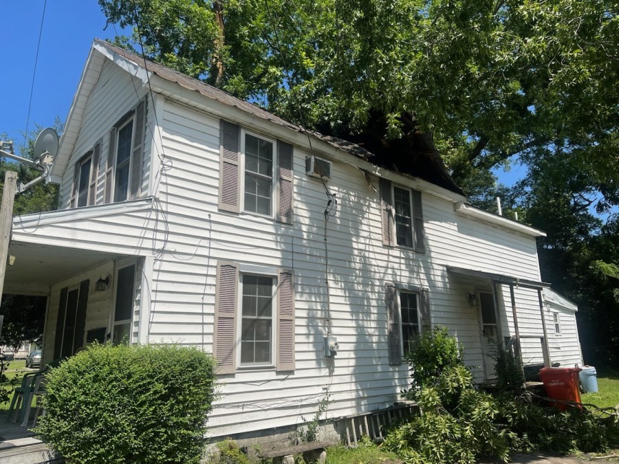
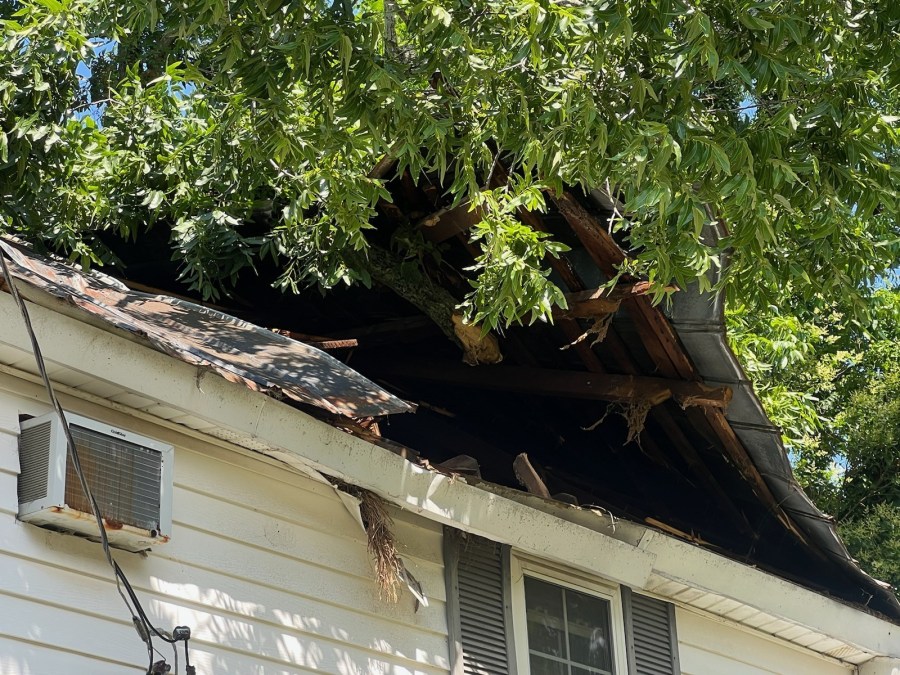
WAVY’s KaMaria Braye also learned a tree fall had fallen on a home at the intersection of Chesapeake Blvd. and Burksdale Rd. in Norfolk. The renter of the home said he was woken up by the tree falling and originally thought the sound was thunder.
” I literally felt the house shake. You heard a boom and I actually thought that was thunder, but also it was pretty loud. I mean it jumped me out of bed,” renter Gilbert Santos said.
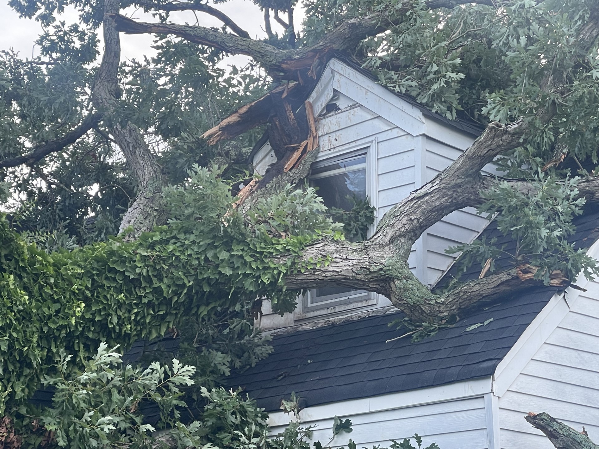
Photo Courtesy: WAVY’s KaMaria Braye 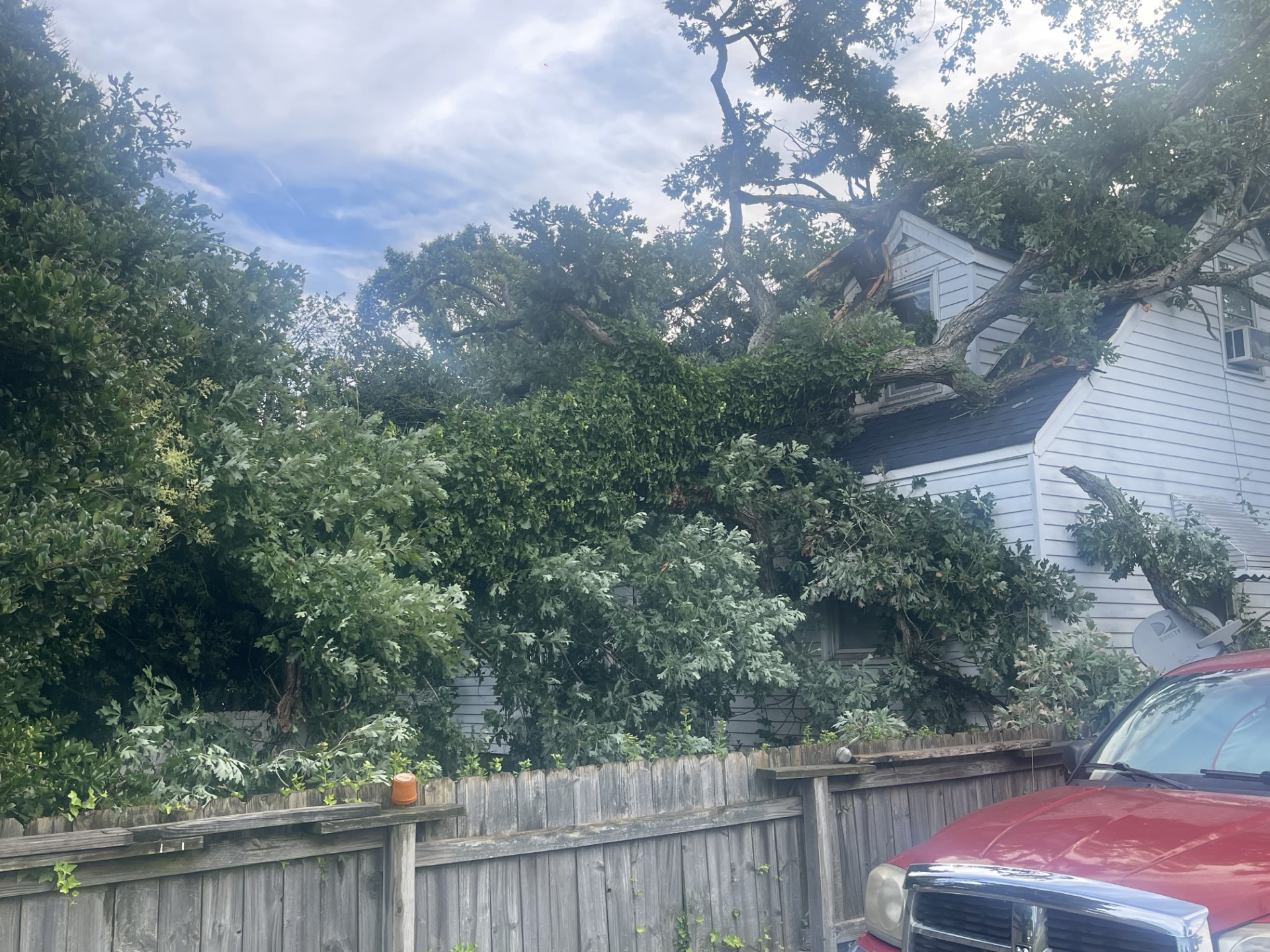
Photo Courtesy: WAVY’s KaMaria Braye 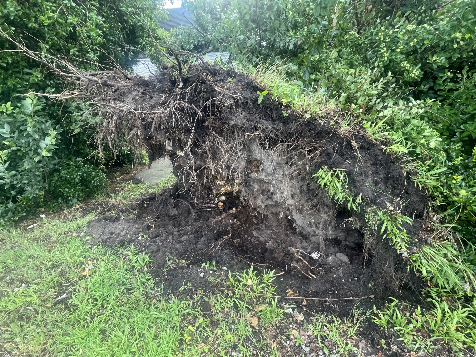
Photo Courtesy: WAVY’s KaMaria Braye 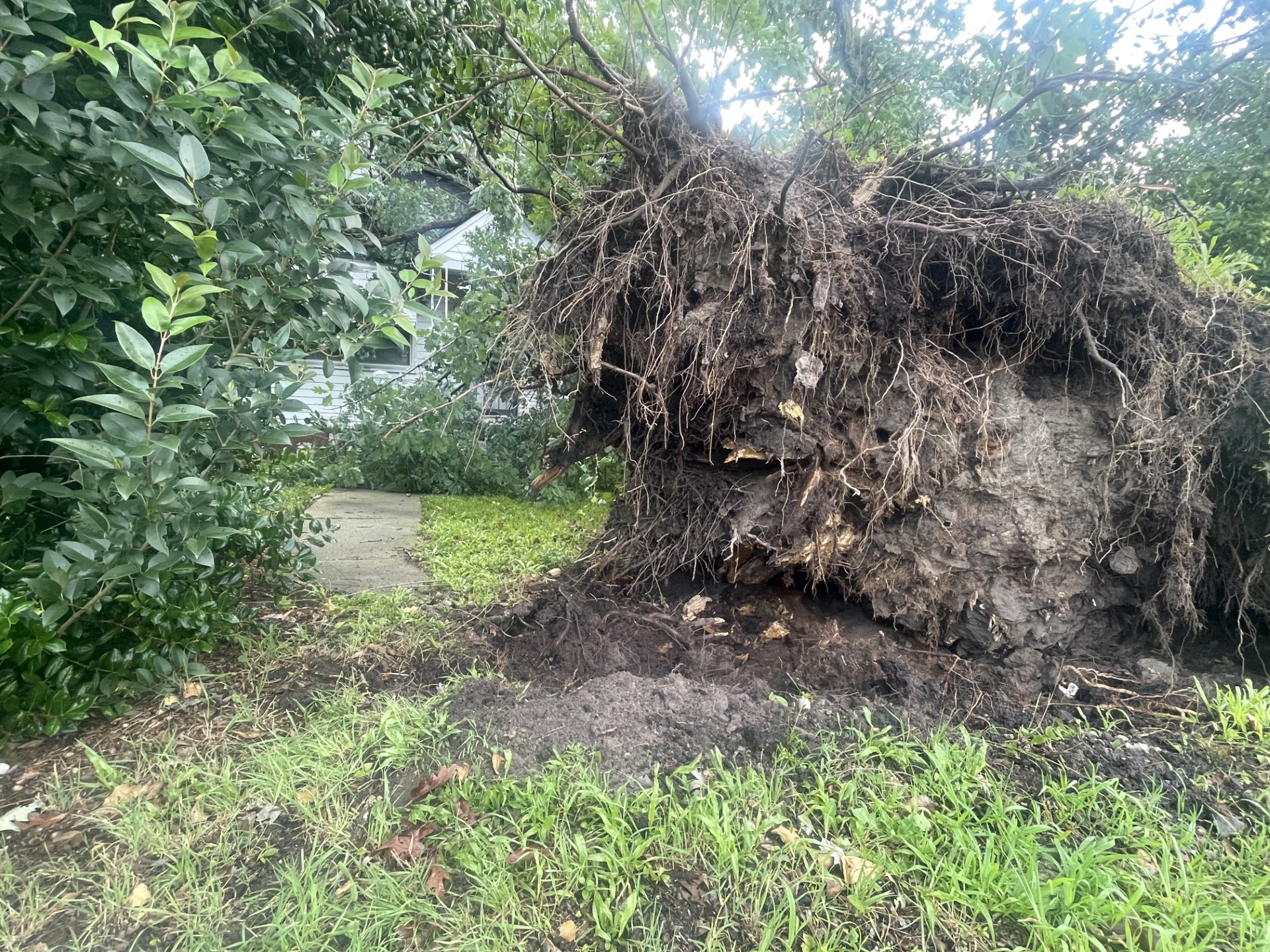
Photo Courtesy: WAVY’s KaMaria Braye 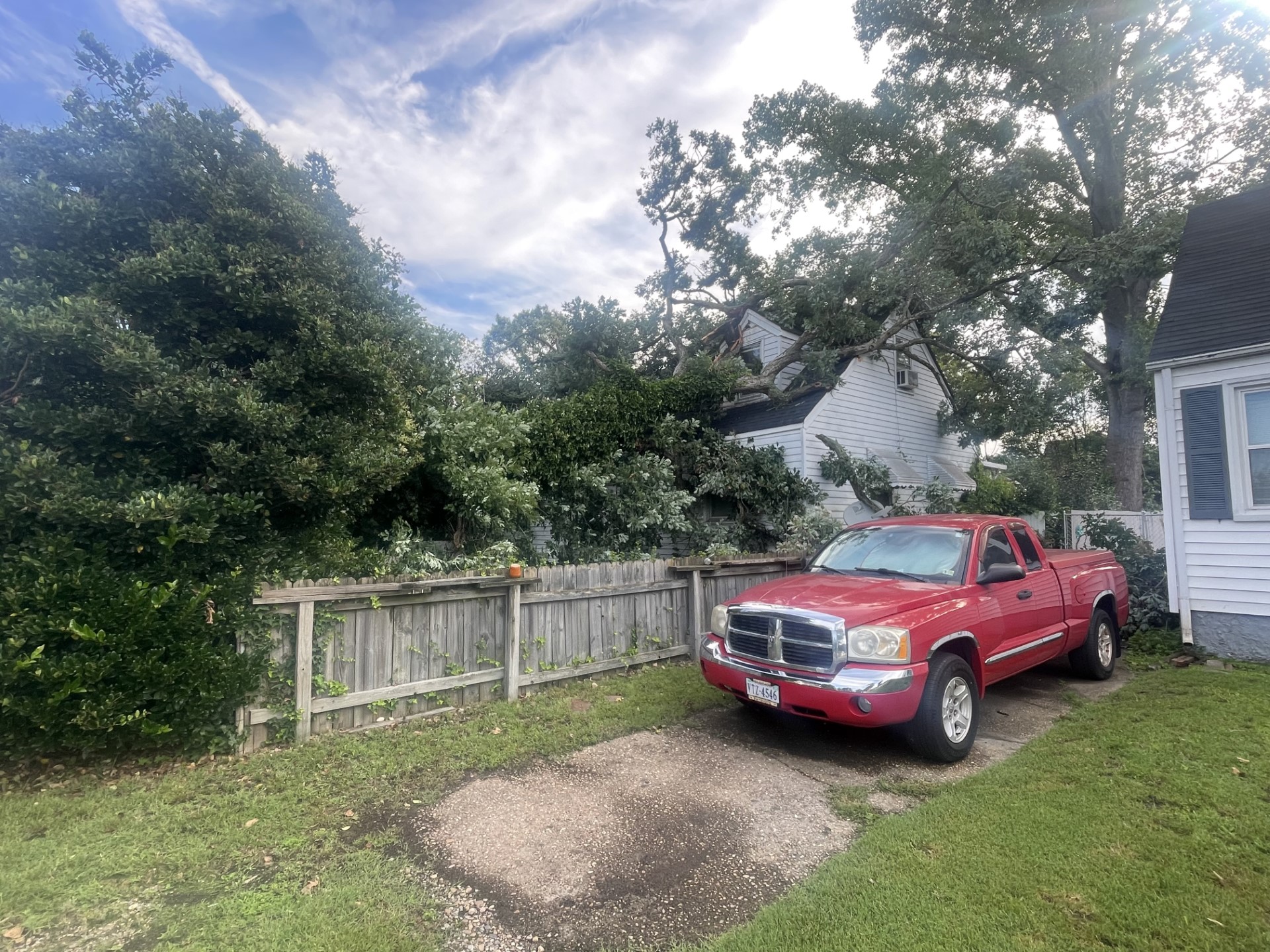
Photo Courtesy: WAVY’s KaMaria Braye 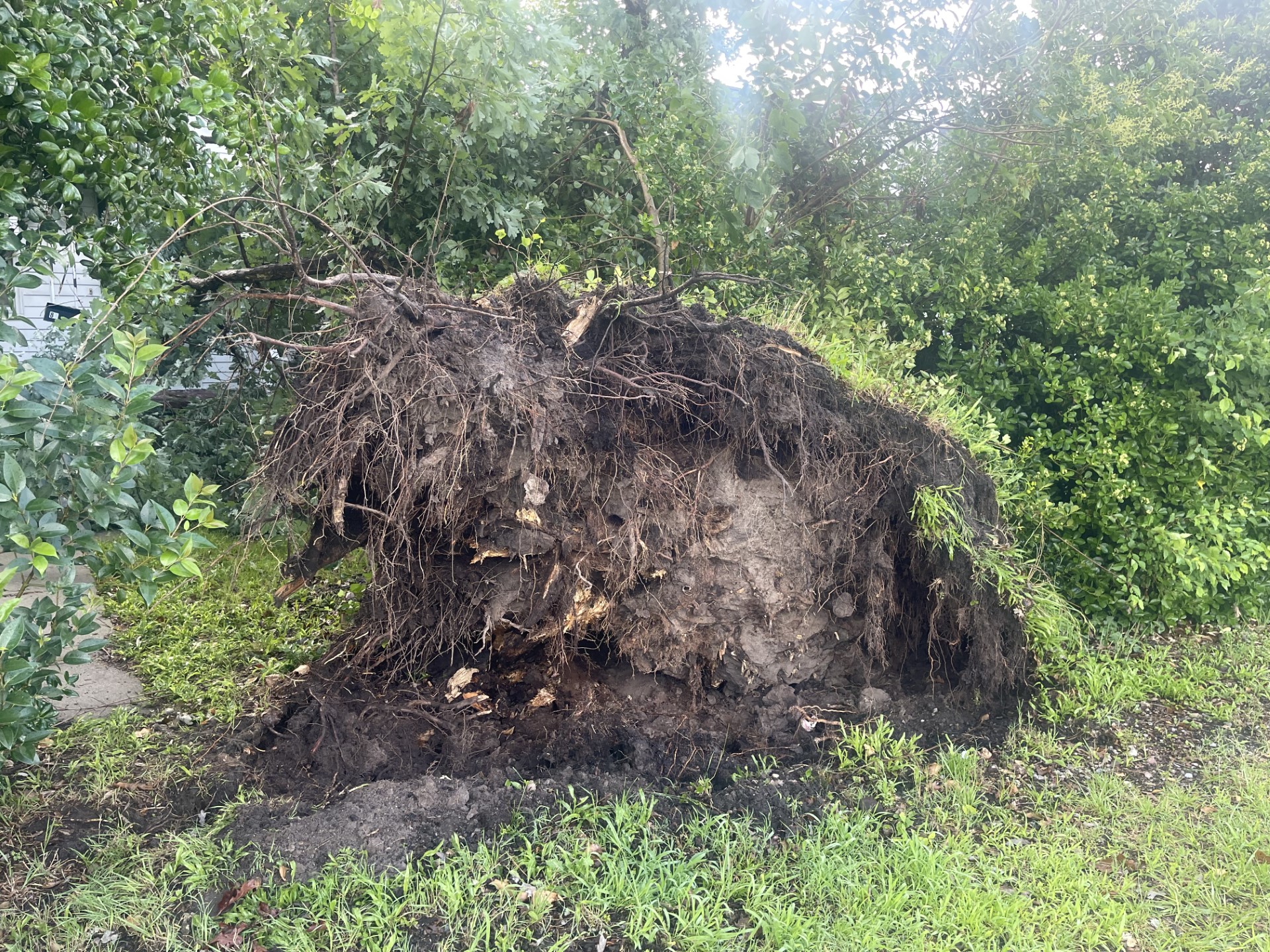
Photo Courtesy: WAVY’s KaMaria Braye 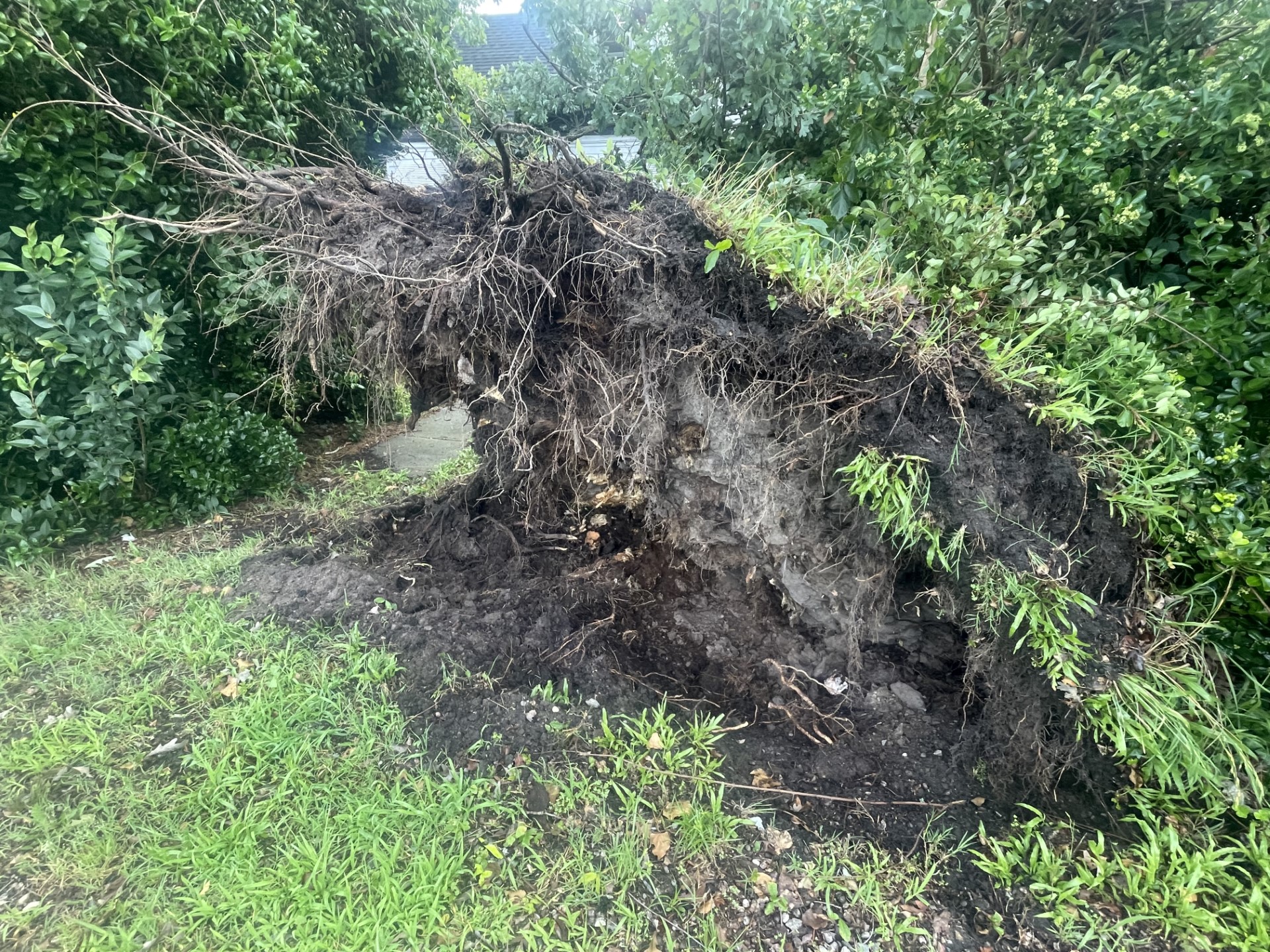
Photo Courtesy: WAVY’s KaMaria Braye 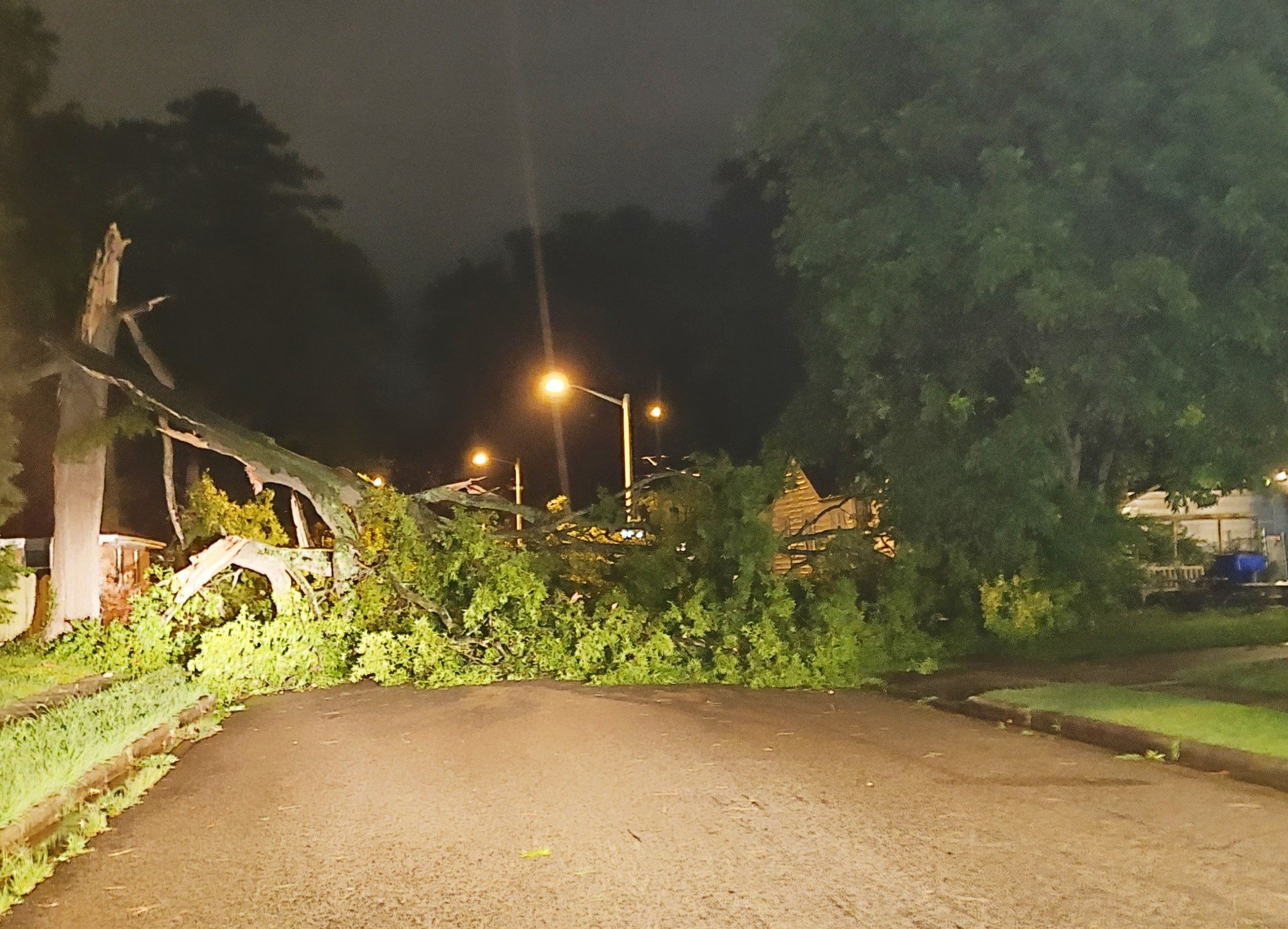
Downed tree on Pythian Avenue in Norfolk (Photo Courtesy: WAVY Photojournalist Lavoy Harrell) 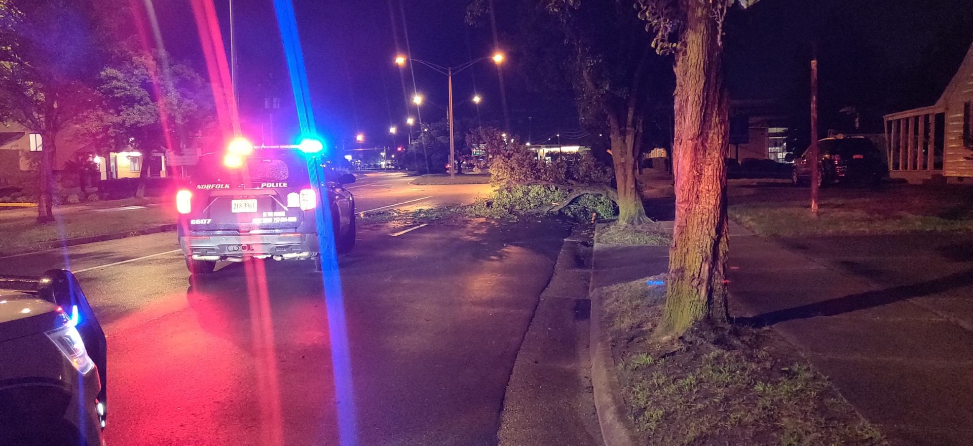
Tree down on Shore Drive in Norfolk (Photo Courtesy: WAVY Photojournalist Lavoy Harrell 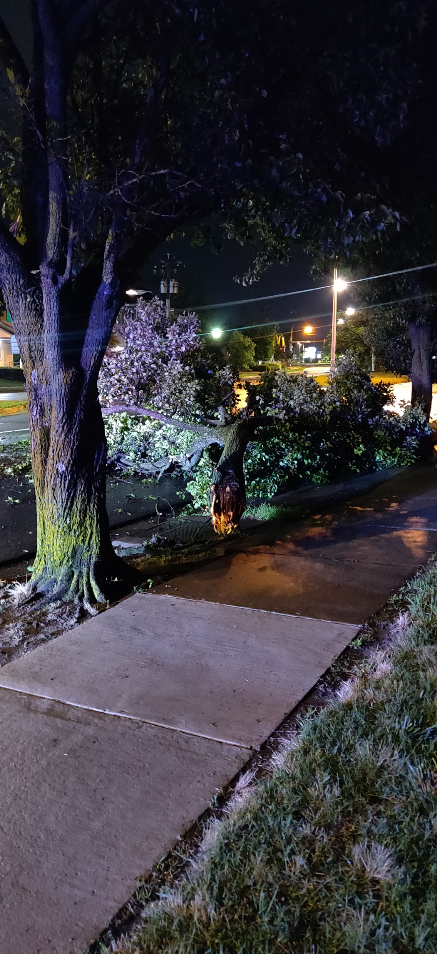
Tree down on Shore Drive in Norfolk (Photo Courtesy: WAVY Photojournalist Lavoy Harrell
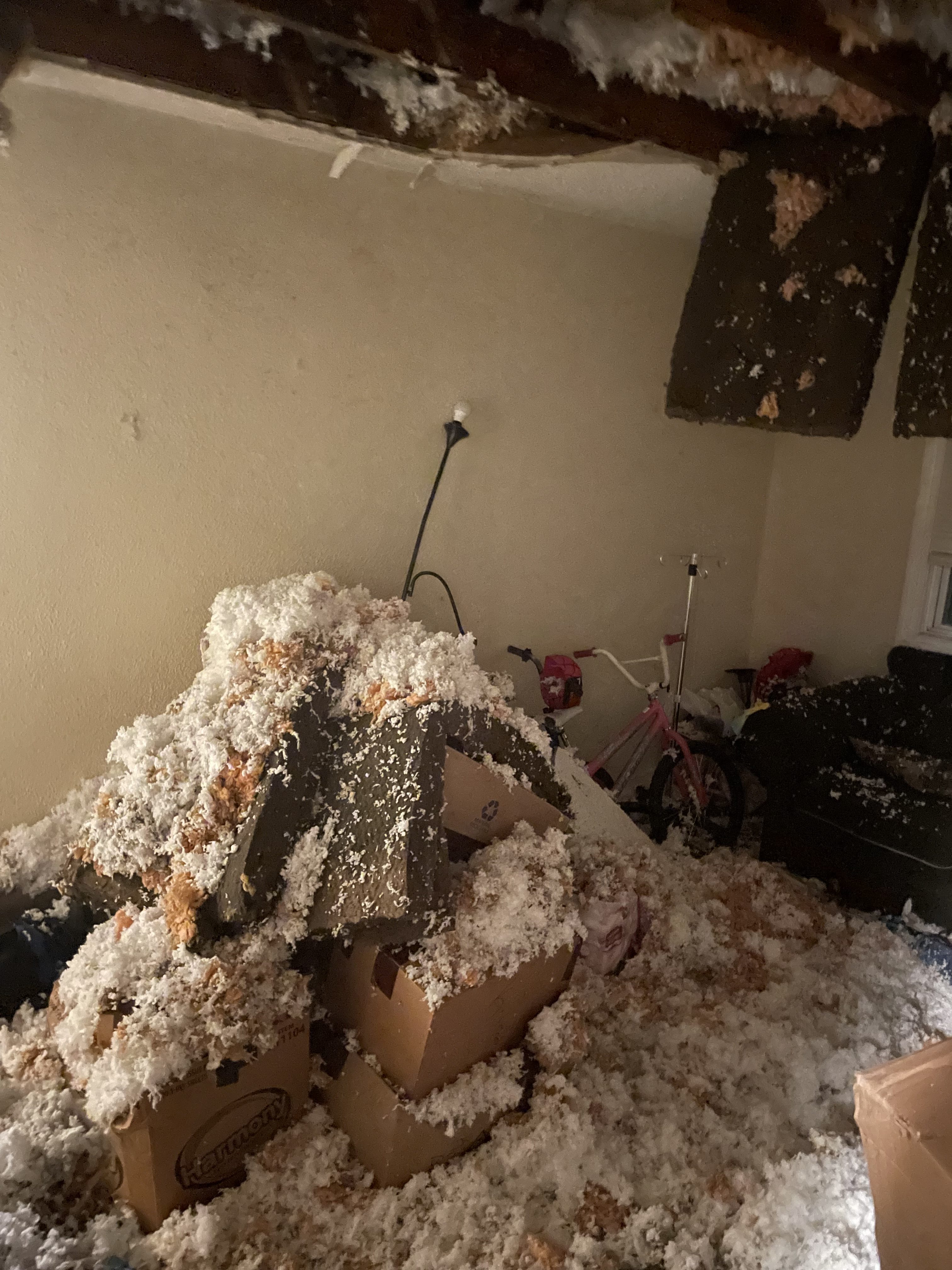
Abingdon Volunteer Fire and Rescue posted to Facebook that a shorted electrical wire burned through the insulation and charred a roof in a home’s attic on Severn Wharf Rd. Officials believe that the cause of the shorted wire was due to a lightning strike.
10 On Your Side also learned that a tree had fallen onto a home around 2:11 a.m. on West Grice Street in Elizabeth City. We are working to learn more information about this incident and if there are any injuries reported.
On Tuesday morning, Currituck County took to Facebook to warn residents that there is high or rising water in the following areas after the storm:
- Shingle Landing bridge, Moyock
- Marsh Rd., Wterlily
- End of East Ridge Rd.
The Virginia Department of Transportation said it prepared for statewide impacts due to severe weather Monday afternoon and evening.
Heavy rain and wind gusts were expected to hit Virginia between about 2 p.m. in the western parts of the state to midnight in the eastern areas, with regions east of Interstate 81 experiencing the worst conditions.
It cautioned that severe weather threats along and east of the I-95 corridor would include wind gusts up to 75 mph along with large hail and possible isolated tornadoes.
“Whenever severe weather is expected, we partner with the Virginia Department of Emergency Management and Virginia State Police to coordinate efforts,” said VDOT commissioner Stephen Brich. “Teams throughout the Commonwealth are prepared to address the impacts from this storm. We ask for the public’s assistance to remain safe and stay aware of changing weather and road conditions in their area and along their travel routes.”
VDOT cautioned drivers to obey all “road closed” signage and not try to drive through flooded roads. It said 6 inches of flood water is enough to knock an adult off of their feet, 12 inches can move most cars and 18 to 24 inches can carry away most large SUVs, vans, and trucks. It also said to be alert to downed trees, power lines, and debris, and to move over for emergency crews working in or near roads.
It called for people to pay attention to high wind advisories, especially on bridges or taller structures, and for high-profile and vulnerable vehicles such as tractor-trailers, SUVs or box trucks to not cross a bridge during a high wind advisory.
Across Hampton Roads, stay on top of weather alerts and updates through the WAVY Weather App, which can be downloaded through the Apple App Store or on Google Play.