
Last night we had numerous tornado warnings in the region. There were several tornado reports from the National Weather Service.
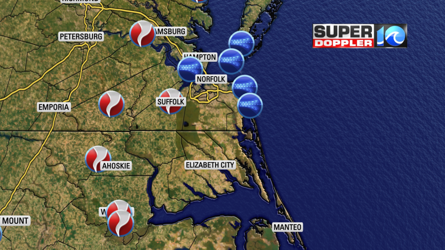
We covered numerous areas of damage this morning. It looked pretty bad in some locations. More storm reports may come in through the day. Also, the National Weather Service will likely go out and survey the damage. We’ll bring you those reports.
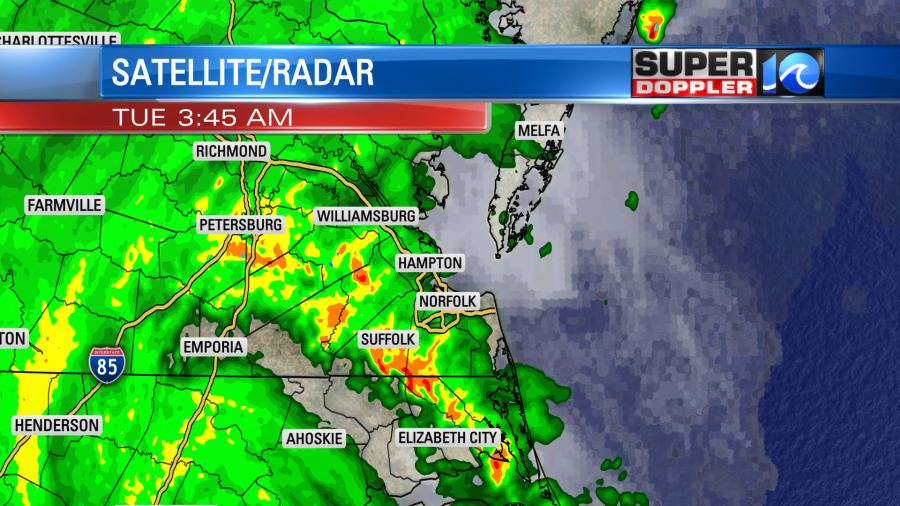
I’ve been trying to analyze the weather from last night. The tornadoes were caused by a slow-moving rain band that was basically a long stretch of heavy rain clusters.
There were other ingredients. There was a strong southeast wind at the surface which pulled in a very warm and humid airmass. Dew points were in the 70s overnight, and temperatures were in the low 80s. So there was actually a good amount of instability streaming in overnight along that band. There was a good amount of wind shear as well. The interesting thing about that is that typically a high amount of wind shear weakens a tropical system. However, for a couple of days the National Hurricane Center mentioned that this system would interact with some cooler air to the northwest and the jetstream overhead. So Isaias may have acted a bit like a hybrid system. Though I don’t think there was a big interaction with the cool air locally. I do wonder if yesterday’s rainfall helped to create a lingering boundary into last night. ??? There is always rotation and a chance for tornadoes with landfalling hurricanes and tropical storms, but perhaps some subtle features enhanced the tornado threat last night. I’ll have to delve into the details a little more on that.
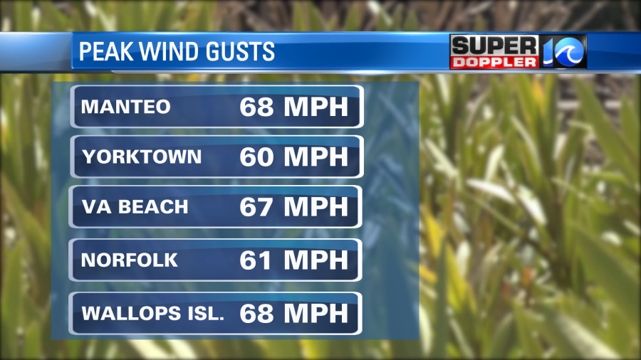
As the actual center of the storm moved closer to the region we had some wind gusts between 50-70mph. That caused some more damage in the region.
The winds started to come down around 8-11am. Skies also started to clear up in the metro. We’ll clear things up this afternoon, and the winds will really lighten up. Isaias will be long gone by the mid-afternoon. The jestream is pushing the system to the northeast at about 35mph. We’ll have partly cloudy skies and high temps in the upper 80s. There will be some isolated showers on the back side of the system this afternoon, but they will be very limited. Don’t be alarmed.
As expected…tidal flooding was not a big issue in the region. There was an exception. Locations along some of the sounds started to see a water rise. The Wind-Tide effect did happen from Knotts Island up to Southern Virginia Beach. The water level at Dawley Corners already rose up above 2 feet. It may rise to about 2.5ft before cresting.
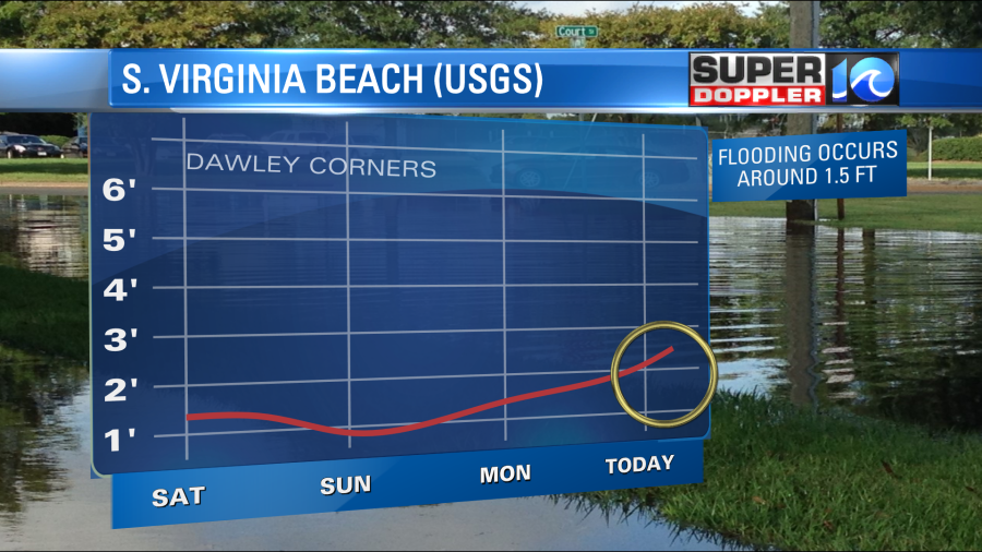
This water level should start going down late today, but it may take a long time to drop below 1.5ft (about the level that flooding starts).
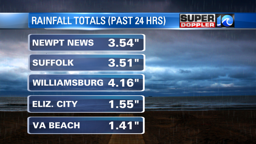
There was some heavy rain. We had a flooding report from the downpours around Williamsburg. The rest of the region absorbed the rain. Here are some 24 hour totals:
We’ll have more updates on the storm and the damage reports through the day.
Meteorologist: Jeremy Wheeler


