Yesterday, we had some flooding rain across the region. This rain was very heavy for a time. I saw one report that the Strawbridge area of Virginia Beach had about 7 inches of rain. One viewer that occasionally reports form there (Dave) reported about 6″.
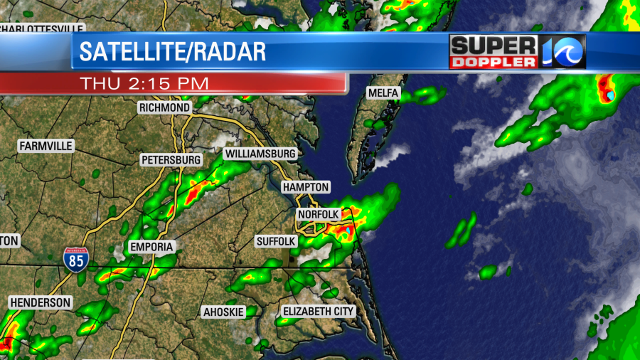
The clusters of heavy rain grew and spread out through the afternoon and evening. Here were some of the rainfall totals from the National Weather Service:
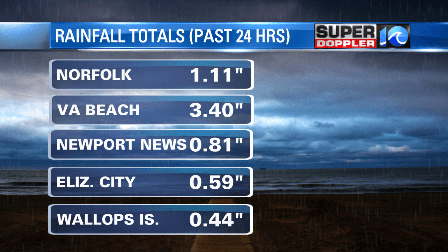
However, there were some other reports from viewers that were much higher. Barry, my weather watcher in Gloucester, had 4.3″ of rain. A.J. on the lower Eastern Shore had 1.94″. Scott in Yorktown had 1.2″.
We also had high amounts of rain between last weekend and Isaias. So the ground is basically super-saturated. It can’t hold much more rain until the recent rain soaks in more. Unfortunately, we have another chance for rain today.
Now, keep this in mind about yesterday vs today: Yesterday morning we had a lot of sunshine for a long time. This basically primed the atmosphere with a high amount of instability. The CAPE (Convective Available Potential Energy) was up to about 3,500. 1,500 is a pretty decent for strong to severe thunderstorms to occur. Also, there was a stationary front over the region. Today that front is a little more to the west.
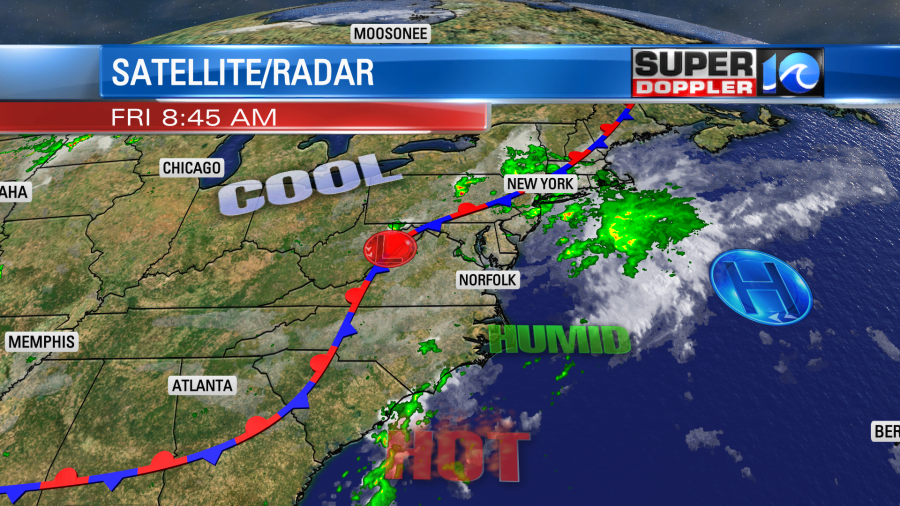
There was a very thick layer of of high humidity in the region all day yesterday. That is still around today. So the bottom line is that I don’t think we’ll see as much nor as many downpours as yesterday. However, it won’t take as much rain for flooding to happen as the ground is saturated. It should be much more localized though.
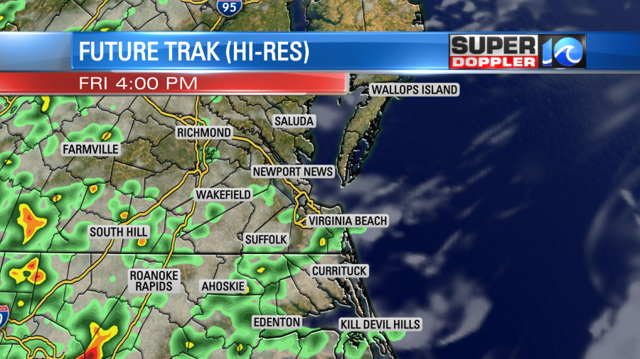
Our Future Trak model updated around the mid-morning. Earlier it had about a 60% coverage for the afternoon into the evening. Now it looks like more of a 40-50% coverage:
Maybe it’s picking up on these morning clouds and fog. We’ll see. High temps will be in the upper 80s, and again…it will be very muggy. We’ll have a light southwest wind. Tomorrow the front will still be near the region. We’ll have some isolated showers in the morning. We’ll have scattered showers and storms in the afternoon. Skies will be partly cloudy. Highs temps will be in the upper 80s to near 90. It looks like the front will drop to our south on Sunday. Though it will probably fall apart. I think this will bring us some slightly drier air. So for now I’m only calling for some isolated pm showers on Sunday. High temps will be in the upper 80s. Then we’ll have quiet weather Monday into Tuesday. High temps will be near 90.
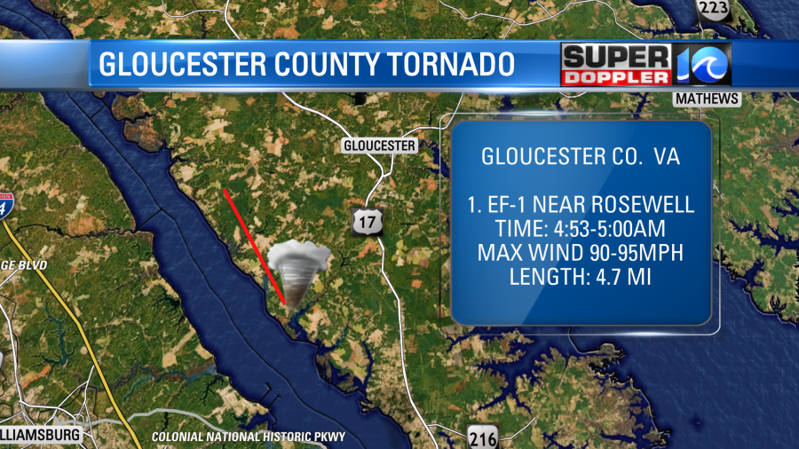
We had a couple more damage surveys come in from the National Weather Service. The first one was from western Gloucester county. On Tuesday morning an EF-1 formed over the York River. It moved over the Rosewell area and Gum Neck. It had winds of 90-95mph. There was some damage to trees, some roofs, and a bit of siding.
The other 2 reports that came in were for the Northern Neck. (I don’t have those mapped out yet). There was an EF-2 that moved through both Lancaster and Northumberland counties. That one had winds of 130mph. Numerous homes had damage. Another EF-1 affected another part of Northumberland county. That one formed over the Chesapeake Bay, and then moved onto shore near Fleeton, VA. There was some tree and home damage as well, but not as much as the EF-2. There may still be a couple more survey reports. Luckily I don’t see any severe weather today nor tomorrow. Hopefully, the flooding will be limited as well.
So much going on lately. Try to have a good weekend. At least we’ll have that stretch of quieter weather Sunday through about the middle of next week.
Meteorologist: Jeremy Wheeler


