
We are enjoying a nice day for a change. It’s been a tough Summer. Seems like the bulk of the time has been spent talking about severe weather, extreme heat, several tropical systems, and flooding. So it’s almost surreal to have a quiet day for a change, but that’s what we have today.
There is a cool front moving into the region. It is going to bring us some drier weather today. Temps will be mild, but not too cool. That’s because the front is going to stall out later today.
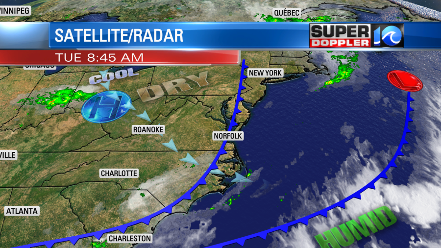
Winds will be light and variable. There may be a stray shower in the region, but it’s a very low chance.
Tomorrow as the front stalls out, it will probably drift back north a bit. This will allow the moisture to pull back northward. So we’ll have increasing clouds with scattered showers and storms developing later in the day.
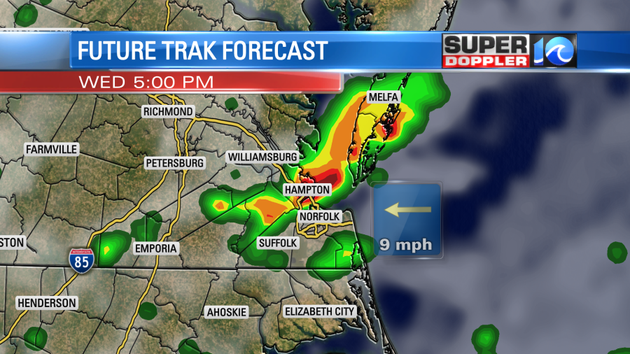
There is still a Flood Warning for the Blackwater river. It will likely crest on Thursday morning, but that also depends on how much rain falls over the next couple of days. Unfortunately, the stalled out front will create more scattered showers and storms Thursday into Friday.
In the tropics…There are 2 tropical disturbances. One has entered the eastern Caribbean. The other one is in the central Atlantic.
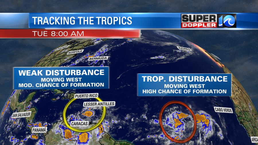
The one in the eastern Caribbean is moving west at a steady pace. It has a moderate chance of formation in the next 3-4 days. However, even if it does, it would likely affect central America. However, the disturbance in the central Atlantic has a high chance of formation. It is also moving west, but it will probably edge a little more north compared to the first disturbance’s track. So it will be something to watch, but it’s way out there. For now enjoy the quiet weather. We’ll have the update on the tropics for you tomorrow.
Meteorologist Jeremy Wheeler


