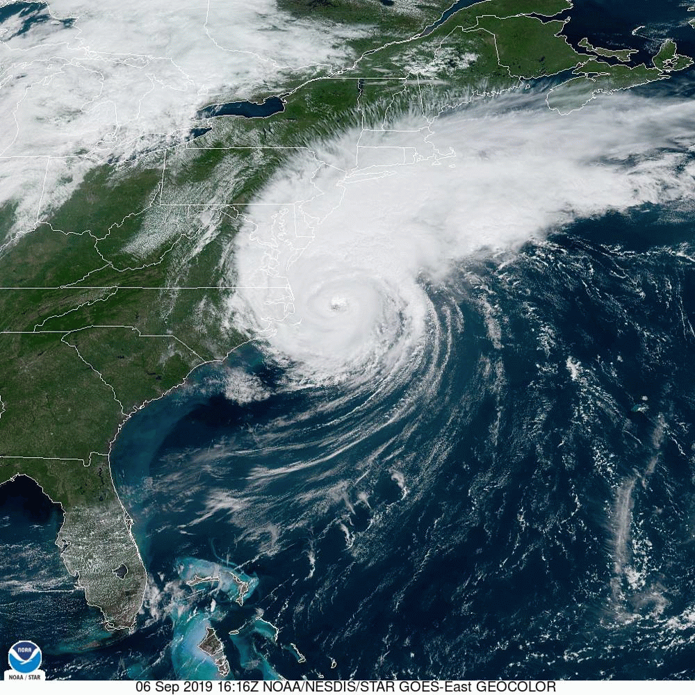
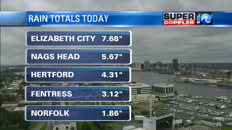
The heavy rain and the high winds that Hampton Roads and the OBX has seen from Dorian are now coming to an end for our Friday night. Overnight we will see clearing skies and temperatures stay cool, likely in the 60s across the region. As Dorian moves away from us, the storm is expected to strengthen back to 105 mph by tomorrow afternoon.
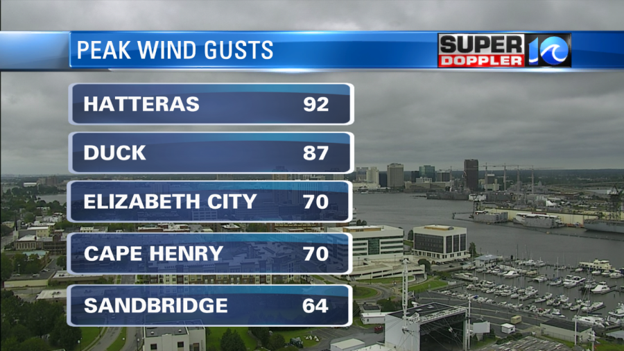
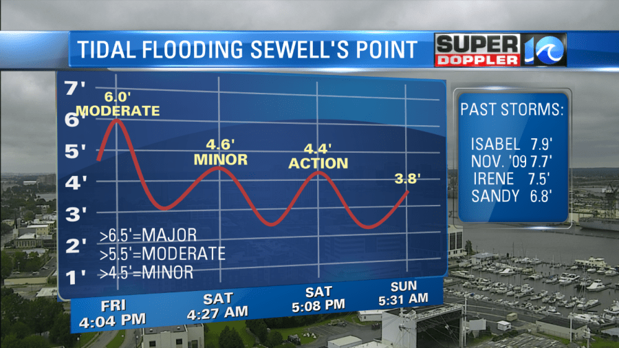
We had an unofficial report from Avon of 98 mph but I have not been able to verify that. One note, our reporter Jason Marks measured a gust of 83 mph during his live report with a handheld anemometer. Since winds are offshore now, the next few tides are not expected to be an issue. We could see minor tidal flooding tomorrow morning, but it will be much lower than what we had this afternoon.
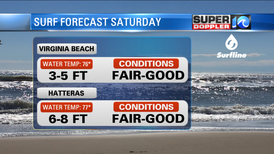
Surf Forecast
Our partners at Surfline.com have updated reports on their website, at the time of writing this their camera network was offline. Regardless, they are still expecting good surf for VB and the OBX tomorrow, however access to Hatteras may not be possible depending on conditions of Hwy 12 and restrictions issued by Dare County.
See you out in the water!
Meteorologist Jeff Edmondson