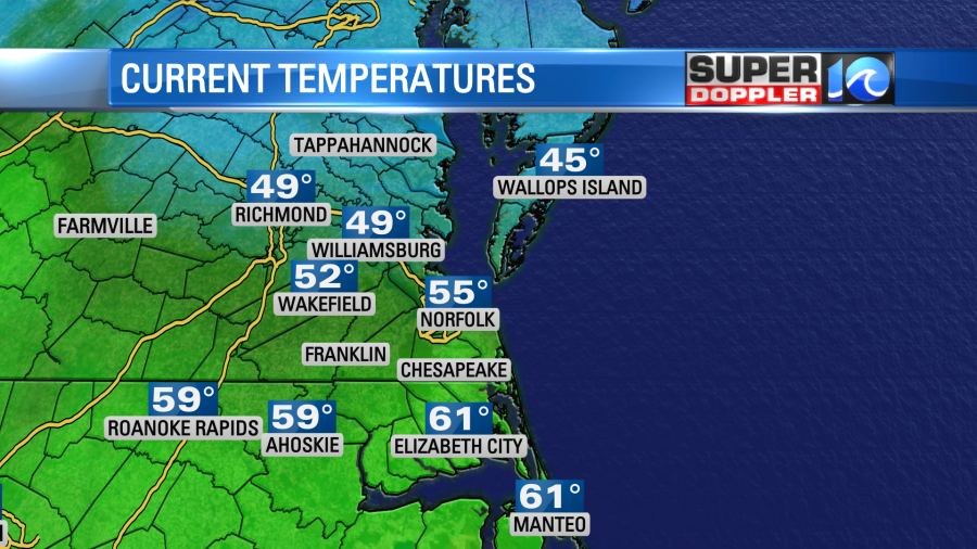
Technically, we hit our high temperature of the day well before sunrise. Temps had made it into the low 60s by around 5am in Norfolk and Virginia Beach. This was expected. However, temps fell a little as a strong and fast-moving cold front swept into the area.
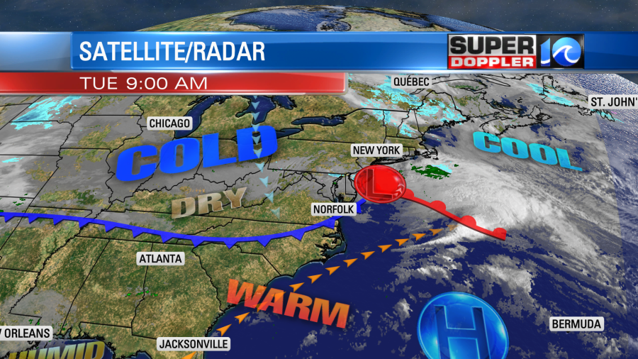
There wasn’t any precip along the front. There was only a small strip of clouds.
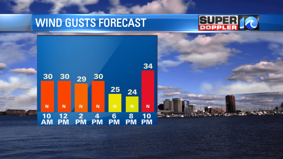
There have been some strong winds already. There were a few gusts to 30mph near the shore. This will become more common today behind the front today.
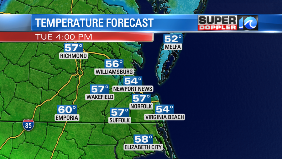
So despite a lot of sunshine through the day, temps will stay pretty steady. Our afternoon highs will be in the mid-upper 50s. There will be a few 60s west and south of the metro.
Tonight high pressure will build into the region. We’ll have clear skies. However, the strong winds will stay up out of the north. We’ll have some more gusts between 25 and 30mph. This will pull down lots of dry air. Temps will drop down to the 30s. Some inland locations may drop to the mid 30s. That will depend on whether or not the winds will ease up there. Either way wind chills will be in the 20s at times.
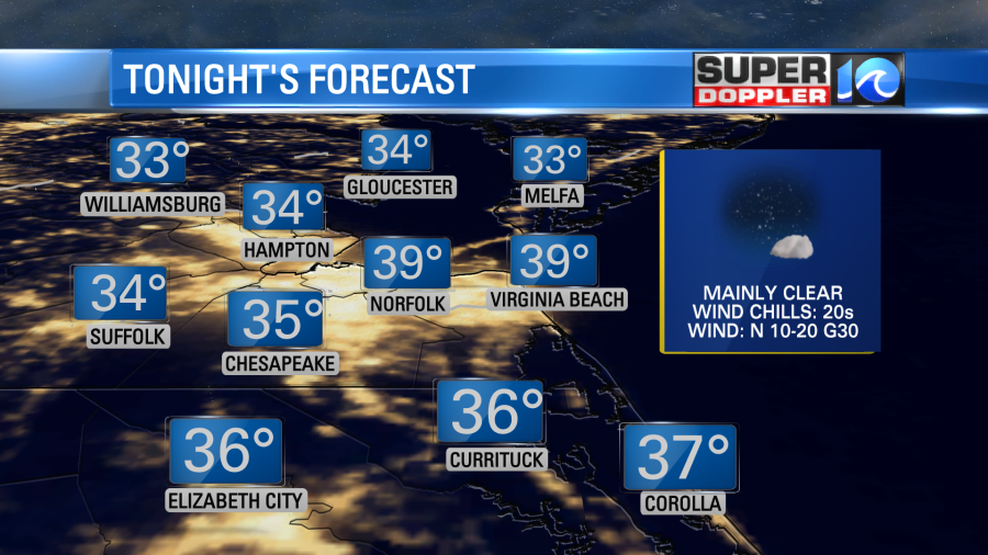
It would be a good idea to play it safe and bring in any potted plants. That is more-so for the inland locations. Plus, you may want to cover up the outdoor plants with some mulch or a tarp. Just be sure to tack down the plastic as the wind will stay strong. Maybe put some stones or bricks on the edges to hold them down. (Don’t crush the flowers!).
Tomorrow we’ll still have a strong north wind with lots of sunshine. High temps will aim for near 50 degrees in the afternoon. We’ll have more low temps in the 30s Thursday morning through Friday morning. (maybe even over the weekend). High temps will be in the 50s. We’ll stay dry until Friday afternoon. Then some scattered rain showers are expected to move in.
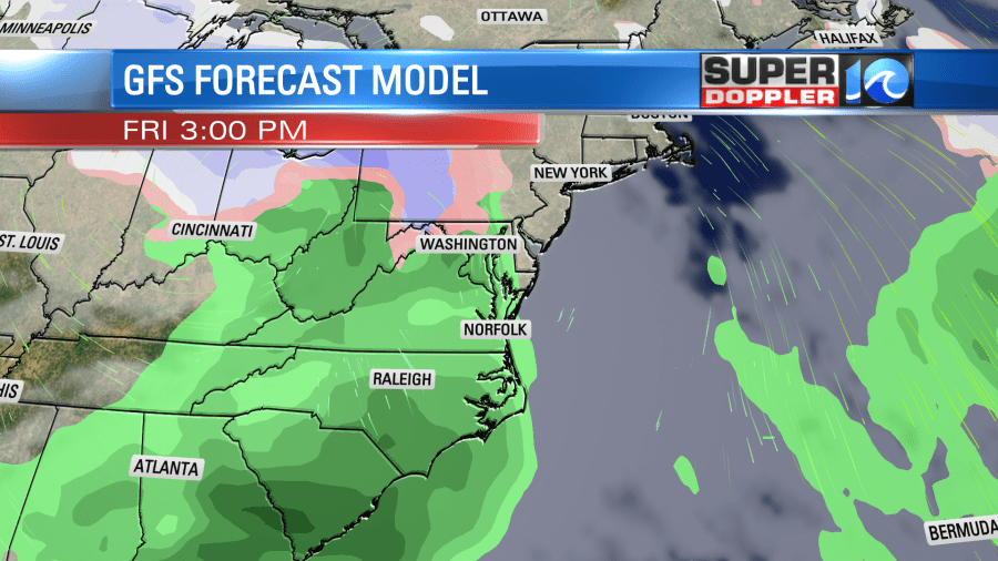
This will be from an area of low pressure that will quickly move skim our region. Luckily , the latest models show the low moving out by Saturday morning. So the weekend looks dry…for now. High temps will be in the 50s. We may have even colder air dropping into the area by the middle of next week. That is far out in time. So we’ll see.
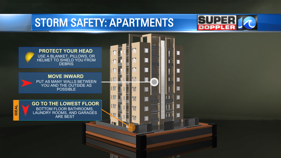
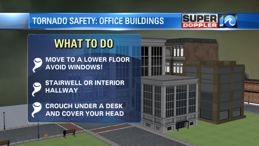
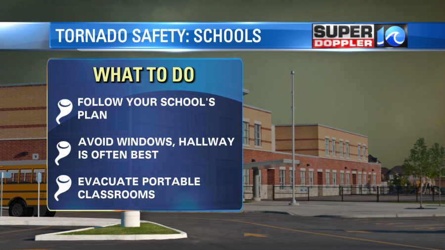
This is severe weather awareness week in Virginia and North Carolina. There is a state-wide tornado drill in Virginia Today at 9:45am. There is another one tomorrow in North Carolina at 9:30am. NO severe weather is expected. It is only a drill. It’s a good time to go over and practice your safety plan. We often talk about tornado safety in the home. Here are a few safety reminders for those not in their homes during a tornado warning:
Finally, snow amounts have been off the charts out west lately. Parts of California have snow packs that are taller than their homes. Many are stuck and can’t get food nor medicine. The pattern has been stuck. So, unfortunately, more snow is forecast. Here is an article with more information about it: Historic snow in the west.
Meteorologist: Jeremy Wheeler


