Yesterday was almost Summery outside (late Summer anyway). High temps were in the upper 70s, and it was humid. We were 2 degrees shy of the record of 79 degrees (2001). Then a cold front moved through late in the day. So today we’ll be back to more seasonable temperatures. Highs will be in the low-mid 50s this afternoon. The cold front is far offshore, and an area of low pressure is far to our north.
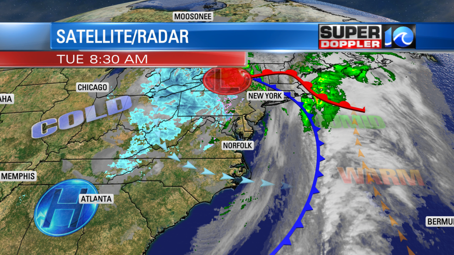
High pressure is trying to edge in from the west. One thing you can’t see on this map is that there is a large upper level low sitting on top of us. If we use the water vapor product, then you can get a sense of it.
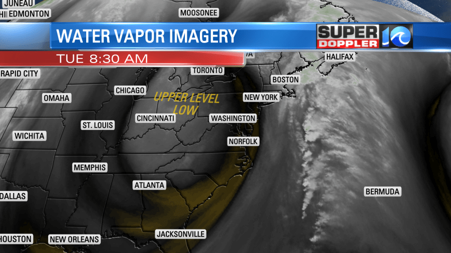
We’ll have a lot of sunshine today, but this feature will allow for a few clouds to form. There could also be a few sprinkles in the region. Winds will be out of the west at 5-15mph with gusts to 20mph.
We’ll clear out tonight with low temps dropping down to the upper 20s to low 30s. So folks will probably be back to putting their heat on. We’ll have a lot of sunshine tomorrow, but high temps will only be near 50 degrees. Then we’ll be cool and dry on Thursday. Highs will be in the mid 50s.
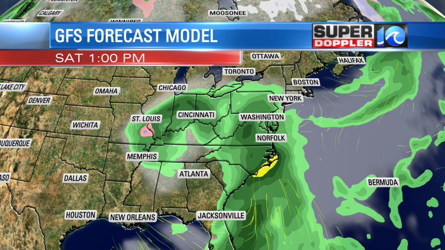
The Thursday to Friday forecast is very tricky right now. The GFS model has a dry Friday with a big area of rain moving in Friday night into Saturday. The latest 2 runs of the model have been very wet for most of Saturday.
Then there’s the European model. It has rain by late Friday with more rain Friday night. However, it kicks out the rain by Saturday morning. It has an area of low pressure to our south during the day.
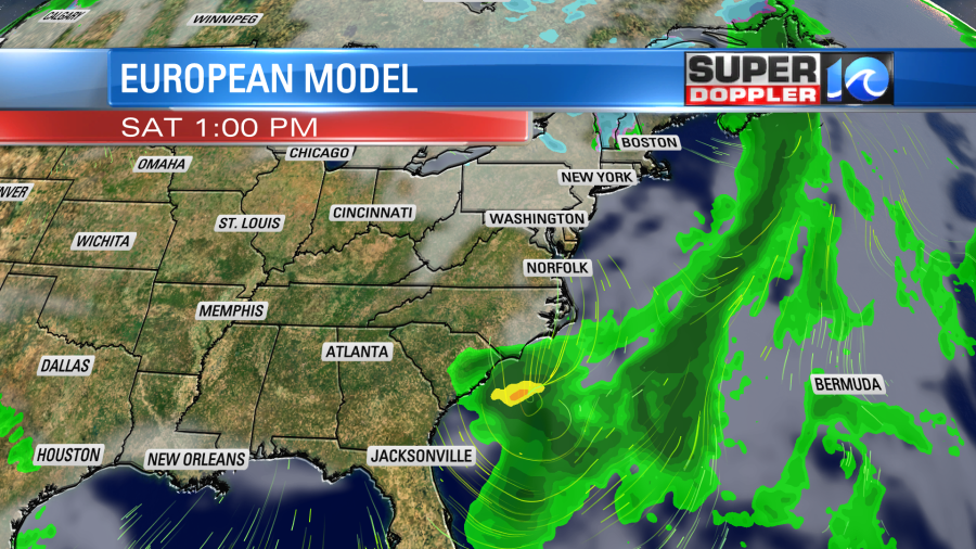
That is a huge difference. So hopefully by tomorrow the models will trend closer to the actual outcome. Stay tuned.
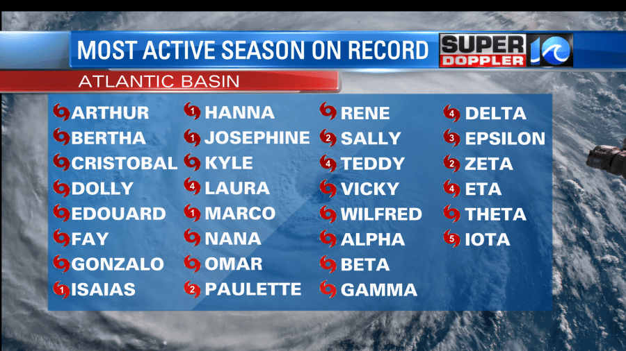
Yesterday wrapped up the busiest hurricane season on record in the Atlantic Basin. It beat out 2005 in terms of named storms. We had 30 this year. However, 2005 had more major hurricanes. There were several hurricanes that hit Louisiana in 2020. They definitely had it the worst this year (in the U.S.) Nicaragua and Honduras got hit by 2 major late-season hurricanes, and that whole area is devastated. Iota was a category 5.
There is currently a weak disturbance in the eastern Atlantic, but it only has a low chance of formation.
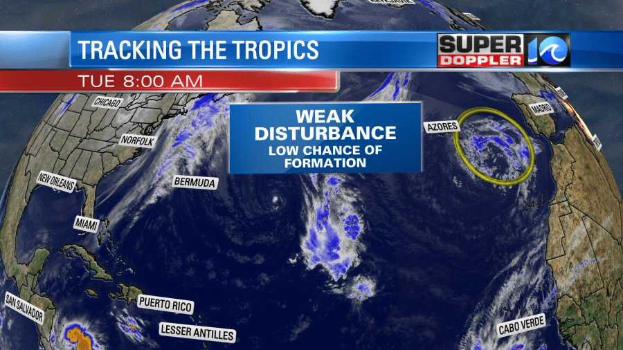
Despite the season being “officially over”, this system would get added to the total list if it were to acquire a name. We’ll see.
Meteorologist: Jeremy Wheeler


