
NORFOLK, Va. (WAVY) — On this day 90 years ago, one of the most damaging hurricanes ever in the Mid-Atlantic ripped right through Hampton Roads. The storm, the sixth named storm of the 1933 season, still holds records today.
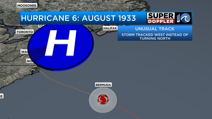
At peak strength, the Category 4 hurricane achieved winds of 140 mph deep in the central Atlantic. Remaining south of Bermuda, the west-northwest track was rare because of the large ridge of high pressure over New England. So instead of the storm bending back out to sea, it made a beeline for the Outer Banks.
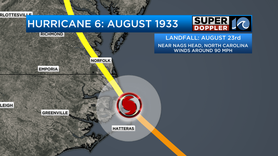
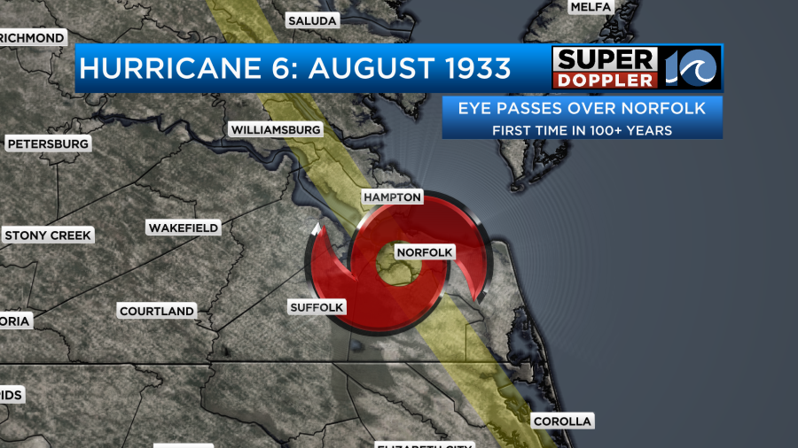
On August 23, the storm made landfall near Nags Head as a strong Category 1. From there, the eye of the hurricane briefly passed over Norfolk — the first time that had happened since 1821.
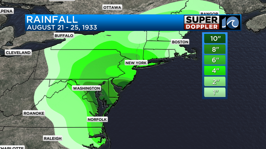
About a day later, the then tropical storm was up towards D.C., eventually going on to soak everyone in its path. Upwards of 10 inches of rainfall fell in many locations across the northeast.
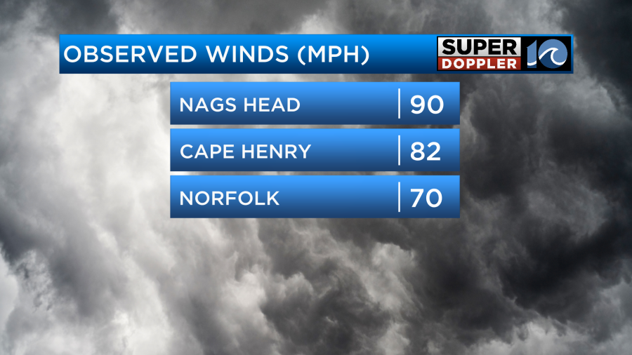
Here in Hampton Roads, the hurricane force winds damaged homes, power lines and crops. The high seas wrecked boats and washed out roads. But as with the majority of tropical systems, the majority of the damage came from the storm surge.
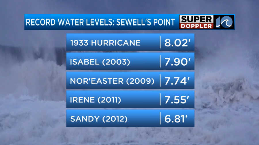
The 1933 Chesapeake-Potomac Hurricane still holds the record for the highest tide reported in Norfolk. It was even higher than Hurricane Isabel, which many of us use as a benchmark.
The area had a two-day notice ahead of the storm, which evacuated most in the community to some form of safety.
The 1933 Hurricane Season went on to become one of the most active on record for that time, but today we’ve seen that record fall as seasons grow busier and busier.
Back then, that two day notice was enough for some to get to safety. Nowadays, sometimes the five to seven day heads up isn’t enough.
90 years later, we look back on this storm to provide perspective on how to embrace hurricane season with preparation.


