Seriously, enough.
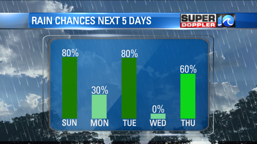
Five of the last seven days have featured some sort of precipitation, and only one of which provided abundant sunshine and that was nearly a week ago (Monday). I pride myself on being honest, so I’ll be honest, there isn’t much relief anytime soon either.
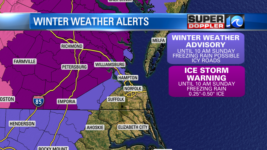
The chilly rain slowly tapers off through the night as that line of freezing rain inches to the north and west. Dangerous and icy conditions will prevail for locations to our north and west through Sunday morning. For us tonight, temperatures should remain above freezing, that being said some slick spots could still arise by dawn on Sunday.
Don’t expect much sun tomorrow, as we start cloudy and damp before more rain fills in by the afternoon and evening. This time around though we should be dealing with any sort of winter precipitation. Highs should be in the low 40s with a northeast breeze. Look for some showers around the noon hour to become widespread rain in the afternoon. Said rain should take us into the night before tapering off overnight.
Maybe, maybe a little sun on Monday. I’m trying to remain optimistic but with a northerly breeze and relatively moist air, we should be dealing with stubborn clouds. Highs temperatures should hit the mid 40s by the afternoon before a few showers slice in late.
Then we’ll likely get soaked again on Tuesday, then again later on in the week.
Good grief.
At least there’s a day in there (Wednesday) which should feature some sun (just cold, highs in the 30s) and the extended forecast (7+ days) looks pretty quiet.
Stay stoked! – Meteorologist Steve Fundaro


