This morning when I came into work the temperature was near 50 degrees. A cold front was dropping south, but it hadn’t made it into the metro by 4 a.m. The front is dropping south as I write this. It is just south of the state line.
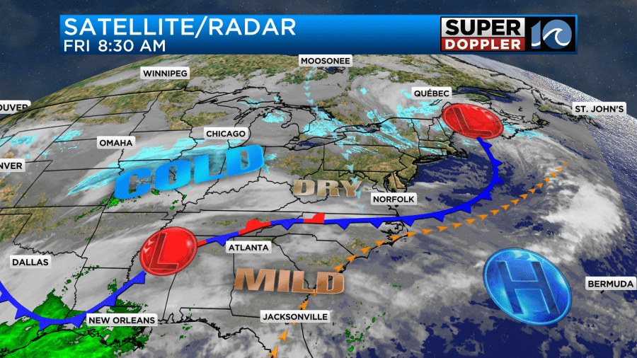
There is an area of low pressure moving out of the Northeast. There is another area of low pressure forming to our west. Today the front will stall out to our south. We’ll be partly cloudy with a little more clouds by the end of the day. The breeze will pick up for a bit this morning. It will be out of the north through midday. Then winds will lighten up and turn out of the east.
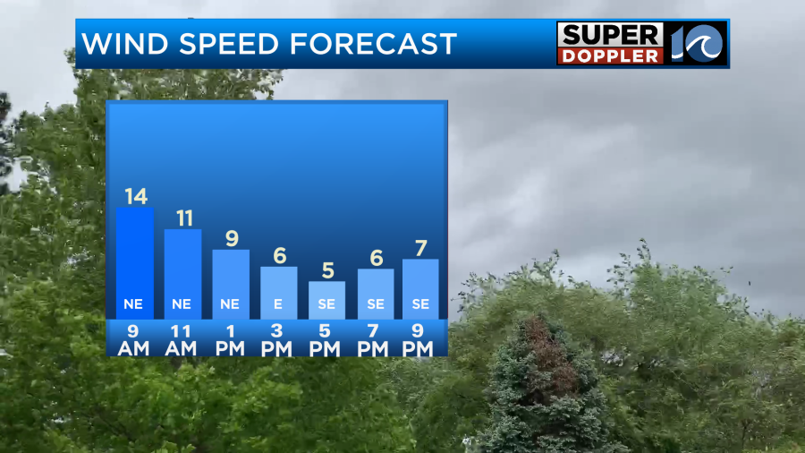
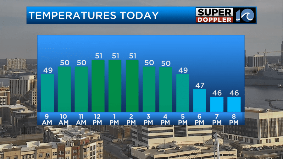
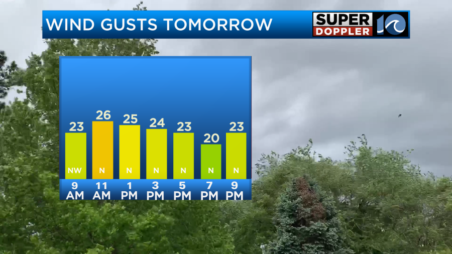
There will be a few gusts to 20 or 25mph this morning, but they will be brief. Temperatures will stay in the 40s for a while. Then we’ll rise to the low 50s this afternoon.
By late tonight that area of low pressure out west will quickly stream east through our region. We won’t have any precip until after midnight. By early tomorrow morning a few cold/scattered rain showers will fall in the region as the low slides east. There will be a wintry mix well north of Hampton Roads.

The low will already be moving away from our area by the mid-morning. The precip should be winding down by 7-8am. There may be some flurries though on the Eastern Shore until about 10am. After that we will be dry and partly cloudy for the rest of Saturday.
The models have really backed off of the snow forecast. They keep that rain/snow line much farther north now. So the snowfall totals have also backed off.
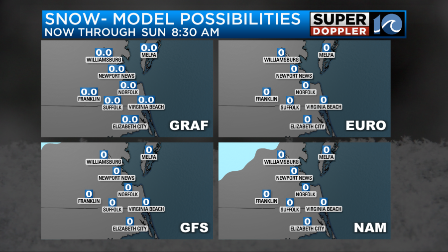
I’m not surprised. It is still possible that the rain/snow line will dip a little more to the south, but even then almost all of that mix would melt anyway. At least in our viewing area. Ground temps are well above freezing, and air temps would probably be just above freezing.
Through the day Saturday we’ll be partly cloudy. The wind will be strong at times out of the north. Gusts will be up to 25mph.
That is going to keep the temperatures down. Highs will only be in the 40s.

It will feel like the 30s for a while with the wind chills. We’ll be mostly sunny on Sunday with less wind. High temps will be near 50. Then we’ll have cool/dry weather early next week.
Meteorologist: Jeremy Wheeler