Finally, we have some window opening weather moving into our region. It feels like it’s been forever since I opened the windows in the house. (Ok I cleaned the bathrooms with bleach yesterday, and I did open the windows for a bit. But that doesn’t count). Temps are cooling down. Humidity is dropping. Locally, we have some pretty nice weather, but there will be a few minor issues. Let’s talk about it…
There is a cool front that is dropping to our south today. Low pressure is strengthening offshore, but it is moving farther away. High pressure is to our northwest.
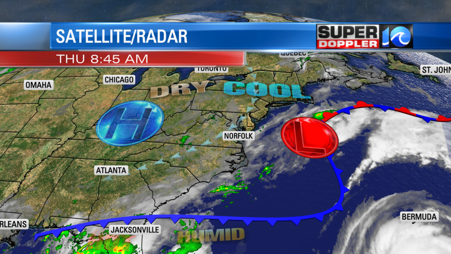
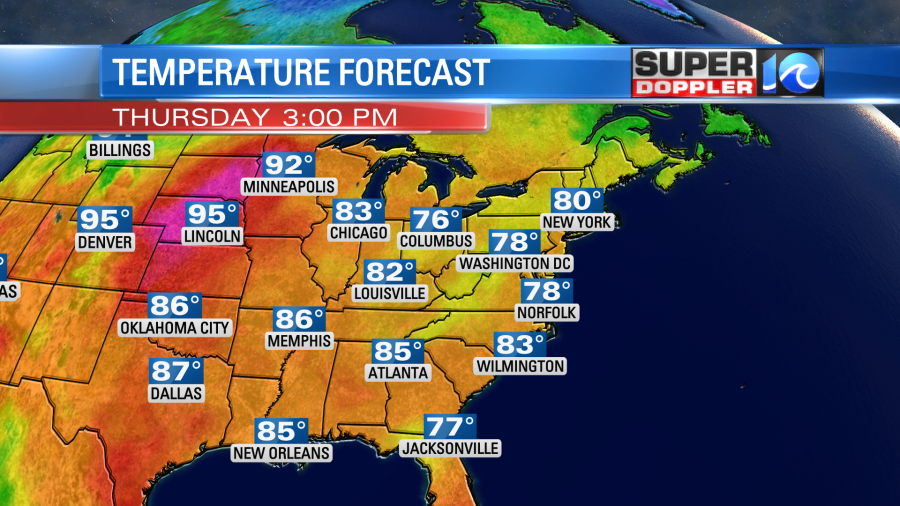
This setup is going to produce a pretty strong northeast breeze through the day. It will run at 10-15mph with gusts up to 25mph. Especially near the shore. This is going to drop our humidity even more. Dew points are already falling into the mid 60s, and they will drop more to the upper 50s to low 60s this afternoon. The temperatures are also going to be held down. Highs this afternoon will only run in the upper 70s with a few 80s inland.
Skies will be partly cloudy for most of the day. There will be some isolated showers rolling-in from the northeast and pushing to the southwest. However, the chance is pretty low.
By tomorrow the low will push a little farther out to sea. High pressure will edge a little more to the east. So it should be a pretty nice day. There will still be a northeast breeze, but it won’t be as strong as today. We’ll be partly cloudy with high temps near 80. Humidity will be moderate. We’ll have a repeat on Saturday.
By Sunday, there will be a much deeper layer of moisture moving up from the south.
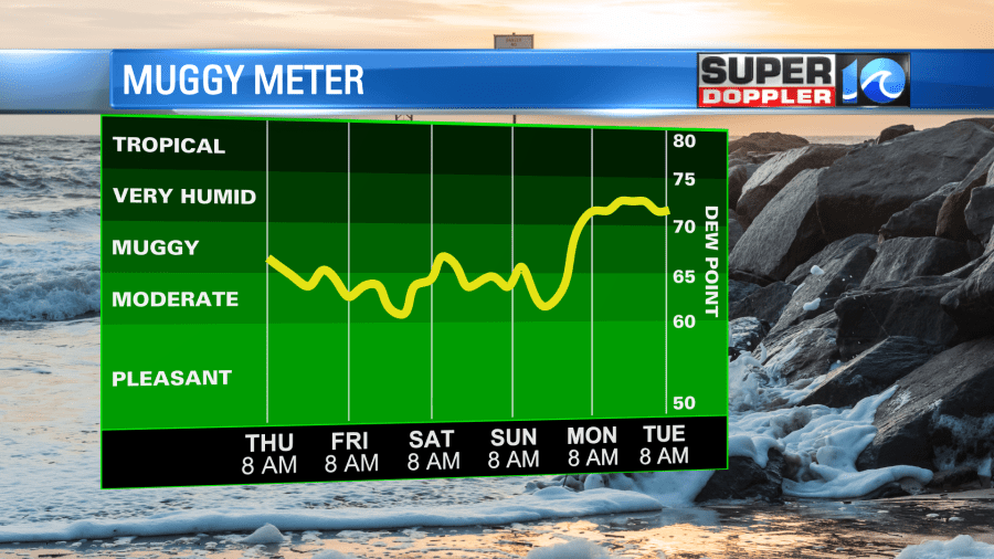
Also, there will be an upper level low rolling in from the west. So late Sunday into Monday looks pretty wet. I don’t want to get my hopes up too much, but it could be a long stretch of wet weather next week. Stay tuned for updates.
Meanwhile in the tropics things are busy. We still have 2 official systems. Hurricane Earl has strengthened since yesterday. As of this writing it was a category 2 hurricane moving to the north.
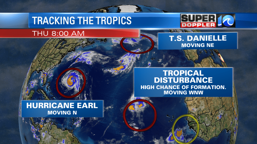
This system will take a northeast turn, and that will allow it to miss Bermuda. However, they will probably be on the outer edges of the storm giving them some rain and some wind.
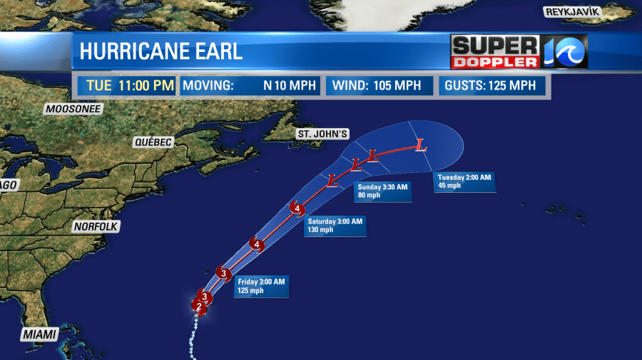
Waves will be pretty high out there. They will also be pretty high here compared to average.
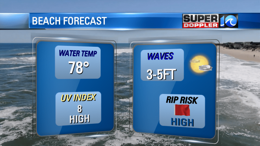
There will probably be some 6 footers down across the Outer Banks. Maybe higher! The problem is that there will be a HIGH threat for rip currents at all our local beaches. So there should only be experienced surfers in the water today. This high threat will likely continue into tomorrow and probably over the weekend.
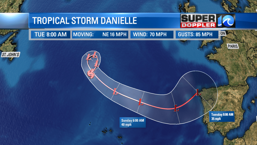
The Atlantic is also churned up from Danielle. Danielle is a tropical storm now over the north-central Atlantic. It is moving northeast. It is still forecast to do a loop and then head for parts of Europe as a non-tropical system.
There is also a tropical disturbance in the middle of the Atlantic that is showing some signs of organization.
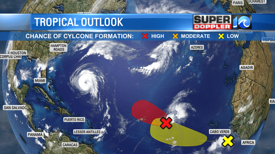
This area could become a tropical depression or storm later today or tonight. It has a high chance of formation either way. However, it also would likely stay out to sea. The weak disturbance coming off of Africa has a low chance of formation in the short-term, but it also has more of a westerly track. So we’ll watch all of this over the next few days.
One last thing before I go. We will have some minor tidal flooding over the next couple of days. It shouldn’t cause too many problems, but it will affect the usual low-lying areas.
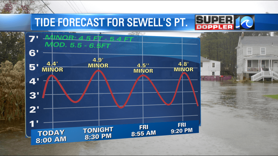
It might be almost up to moderate levels over part of the northern Outer Banks. It’s possible that there may be a little ocean overwash this evening, but it shouldn’t be too bad. Stay tuned for updates!
Meteorologist: Jeremy Wheeler


