Yesterday was hot! We were just shy of the record, but Norfolk International Airport did hit 99 degrees.

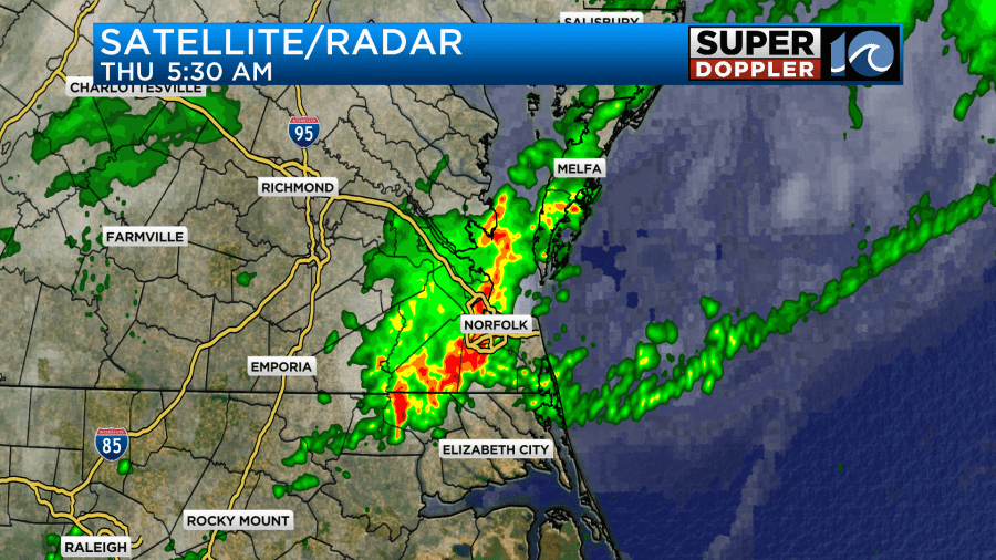
There wasn’t much rain yesterday during the day, but there were some heavy rain showers last night. There was one round on the Northern Neck and Accomack county around 8pm. Then a second round made it a little more to the south around 2am.

This was great as it hit some areas that really needed it. After a while a 3rd round made it into Hampton Roads around 5:30am. It was great to get the rain, but the timing affected the morning commute.
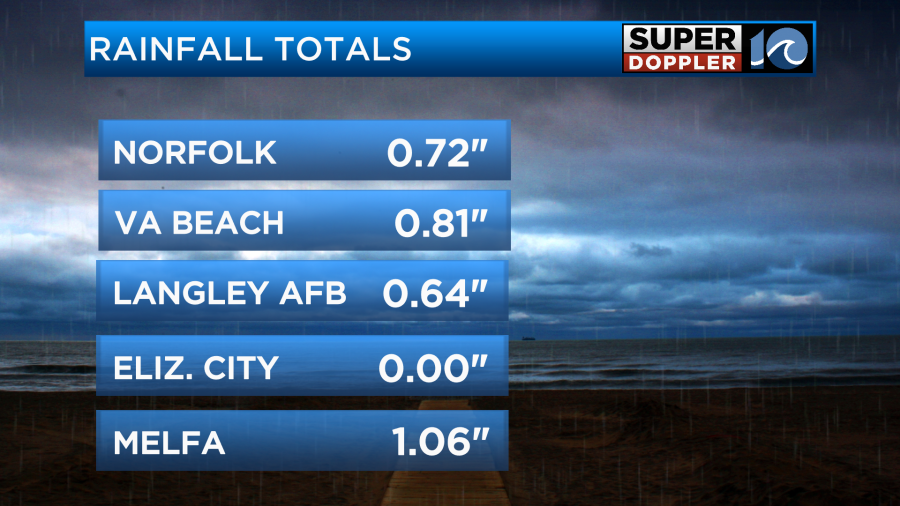
The rain added up in the rain gauges pretty good. Especially north of Hampton Roads.
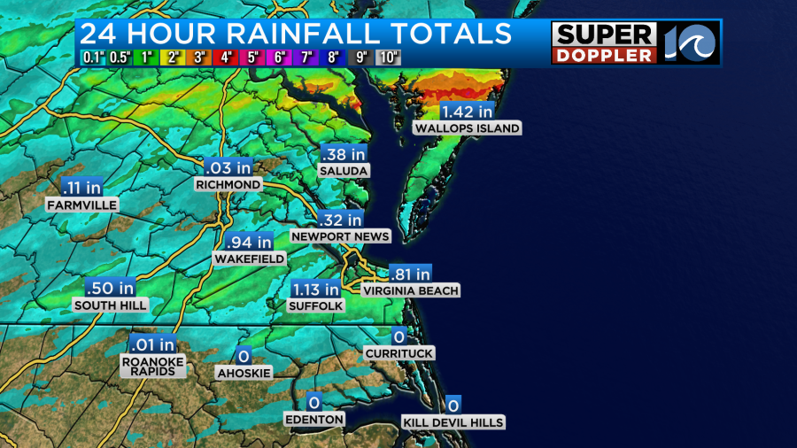
As you can see though, this time, most of North Carolina missed out.
Most of the rain moved out by 8am. There was a cool front over the Southside during that time.
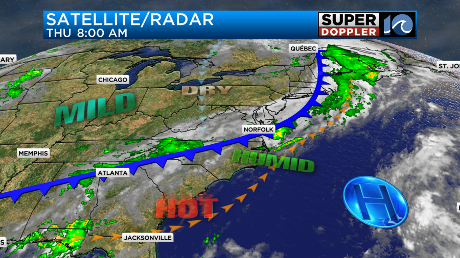
The front will slowly sink to the south today. Going forward we’ll only have some isolated rain showers. Otherwise, we’ll have a mix of sun and clouds. Temperatures will cool down this afternoon. They will only be in the upper 80s with a couple of 90s inland and south.
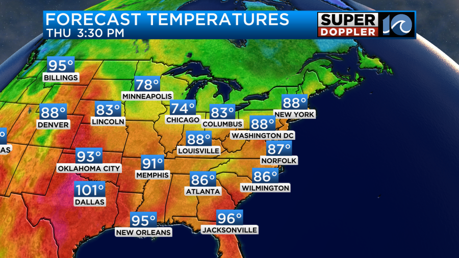
However, the humidity won’t drop much. Dew points will hover in the mid-upper 60s for much of the day. We’ll have a light north breeze develop behind the front.
The weather is looking good for tomorrow as the front sinks to our south and stalls out. We’ll be partly cloudy with high temps in the low-mid 80s.
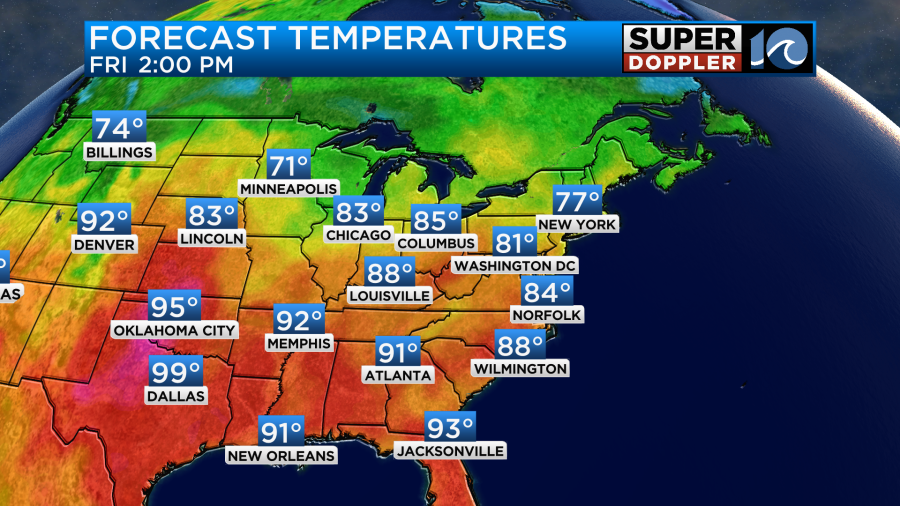
The humidity will dip a little bit, but not much.

It will be a pretty nice day with partly cloudy skies. By Saturday the heat and humidity will climb back up. Temps will rise to the low 90s, but it will feel like the mid 90s with the heat index.

We’ll be partly cloudy with some isolated showers or storms. By Sunday the heat, humidity, and rain chances will all go up a little more. High temps will be in the mid 90s. The heat index will be near 100. We will have some scattered showers and storms. After some rain Monday morning we will dry out and cool down some more. Highs will be in the low-mid 80s.
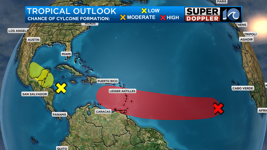
Things may be heating up soon in the tropics. There is still one weak feature in the Caribbean that has a low chance of formation over the next 3-5 days. However, the feature over the central Atlantic has a high chance of formation during that time.
Meteorologist: Jeremy Wheeler