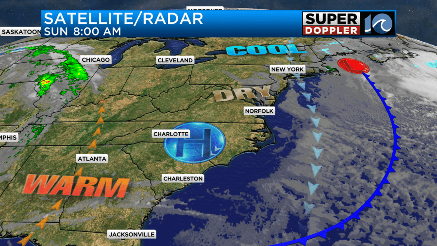
Over the last few days we’ve had an area of low pressure in the northeast with a large upper level low over our region. High pressure has been to the west. This has produced sunshine in the mornings with clouds and spotty showers in the afternoons and evenings. I am happy to report that things are changing today. High pressure is building in from the west at the surface with the upper level low moving east.

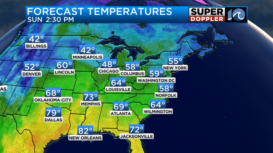
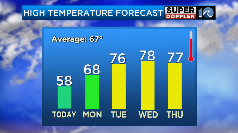
This means that we’ll have lots of sunshine through the day with just a few clouds in the afternoon. There will still be a breeze out of the north, but it won’t be as strong as the last couple of days. It will run at 5-15mph. High temps will be in the upper 50s in the metro with some 60s inland and south.

There will be some mid 50s near the shore.
Tomorrow the weather looks decent here for the eclipse. There are many locations in the path of totality that will have decent viewing, but there will be a lot of clouds, rain, and storms over Texas.

Things look pretty good over the Mississippi River Valley and over most of the northeast states. We’ll be partly cloudy here through the day tomorrow, and that includes during the eclipse.

The eclipse starts around 2pm and ends around 4pm. It peaks around 3:20pm.

Some reminders for folks:
- You can’t look at the eclipse without special (approved) glasses or welders masks.
- You can project the eclipse onto the ground using a telescope or binoculars. Just do NOT project it onto paper if you do it that way. Use the shadow to line it up.
- Bug repellant? Yes. During the 2017 eclipse the mosquitoes came out in droves as they thought it was the evening twilight. I got bit pretty badly. It was warmer out then. So there were more of them in general. Still…
- There will be some clouds tomorrow, but they should be moving. So you may have to have a little patience to get the view.
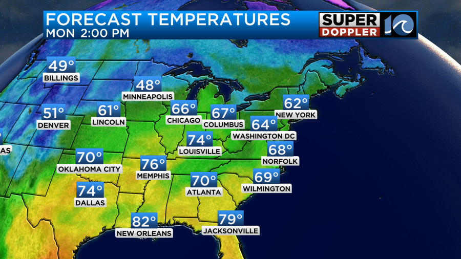
It will be warmer out tomorrow. High temps will be in the upper 60s. It should be a pretty nice day.

It will be cooler near the shore. Winds will be light and out of the south.
We’ll warm it up even more towards Tuesday and mid-week. High temps will be in the mid-upper 70s.

I’ve even got some models suggesting we’ll hit 80 one day. (We’ll see). There will be some isolated showers on Tuesday and Wednesday, but rain chances will increase on Thursday ahead of a cold front. The front will cool us down by Friday. I’ll have more on that in tomorrow’s weather blog.
Meteorologist: Jeremy Wheeler


