
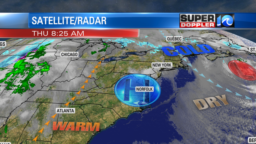
Last night the wind had finally dropped off. It made a huge difference. I let the dog out at about 8pm, and I was comfortable in a T-shirt. That was a stark contrast to earlier in the day when I had on about 4 layers with a hat and gloves…and I was still chilly. Today we’ll continue with the lighter winds. High pressure is now centered over the region. The nor’easter has moved out to sea.
We’ll have a light northwest wind this morning. Then we’ll have a light southwest wind this afternoon. Temps will warm fast.
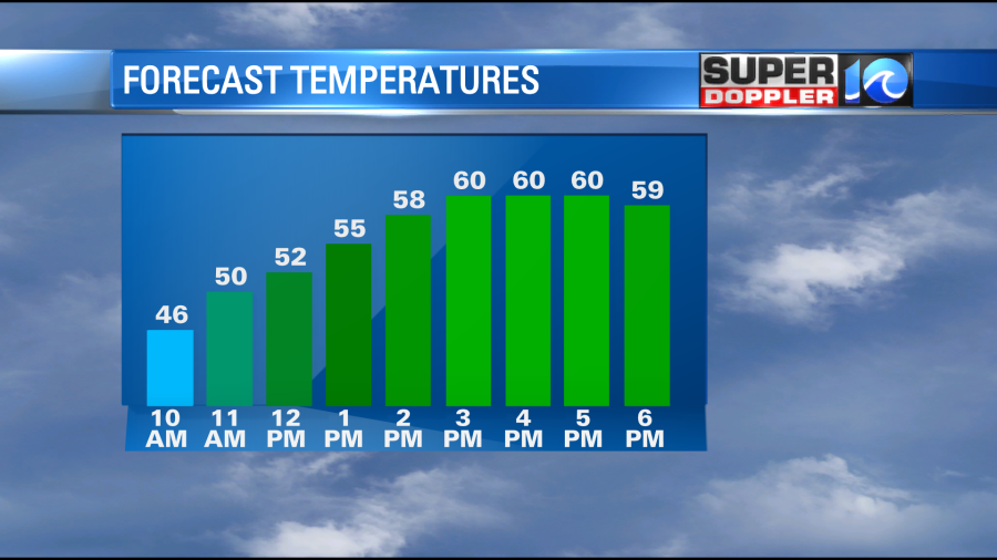
We’ll be in the 50s by midday, and we’ll top off near 60 this afternoon.
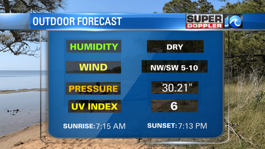
it will be a nice day to head outside and get some fresh air. Dress in layers!
Tomorrow the high pressure system will roll offshore. We’ll have an increasing wind out of the southwest. Some of the gusts could be up to 30mph. This will pull up some moisture out of the south. So clouds will increase through the day. There will also be some scattered rain showers later in the day.

This is a big shift forward in time since yesterday. The good news is that it might end sooner on Saturday. Before then there will be a lot of rain Friday night into early Saturday morning.
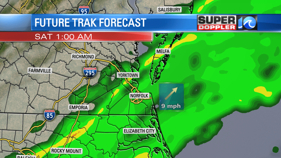
Hopefully, the precip moves out by 8am. Our model now kicks out most of the precip by 8am, but it may not depict any drizzle that could linger for longer.
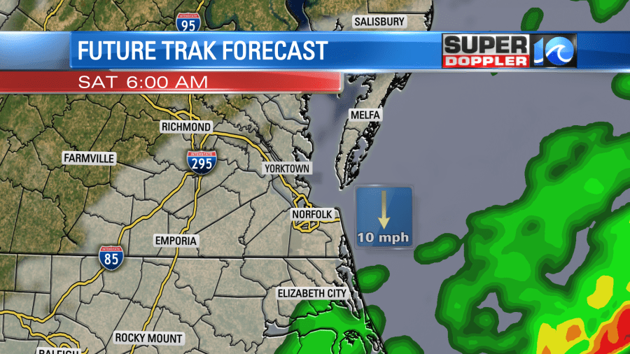
However, the GFS model still lingers the rain showers into the late morning and midday.
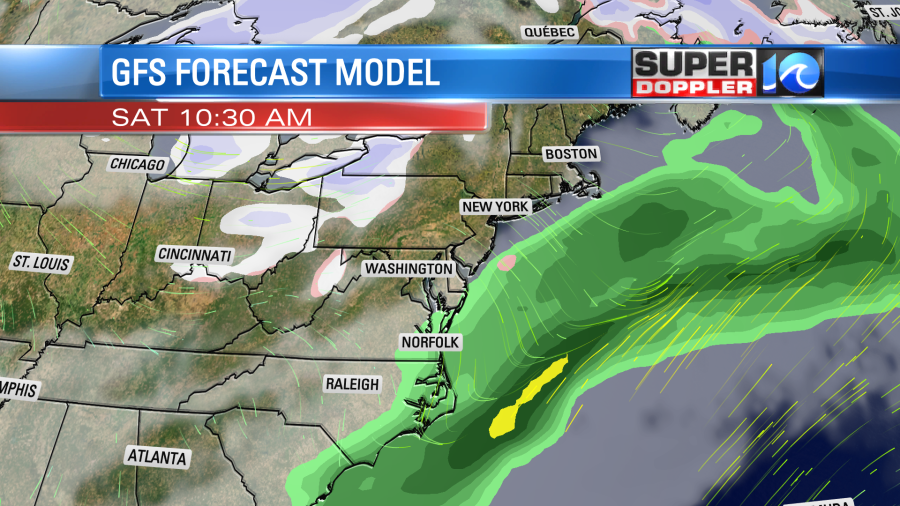
It, at least, tapers off the rain by the mid-late morning. Either way things look much better in the afternoon. We’ll dry out with temps in the 50s. Yeah….the chill returns for the weekend. This will get even worse on Sunday. High temps will only be in the upper 40s despite fair skies. I don’t mind cooler temps, but 40s in March is a bit much. I’ll have more/finer details on the weekend forecast in tomorrow’s weather blog.
In world news… It appears that the La Nina weather pattern that has dominated the last 3 years has come to an end. This makes sense since the western U.S. has been getting pummeled with rain, snow, and storms lately. That is more of an El Nino pattern. The National Oceanic and Atmospheric Administration officially announced that La Nina is over, and that we are likely to go into an El Nino pattern this year. Here is the article with more information: La Nina ending.
Meteorologist: Jeremy Wheeler


