
We are finally getting some of that much-needed rain in the region. There were only a few scattered showers yesterday afternoon, but last night we had a broken line of showers march over the area. It was actually pretty heavy in some places like Gloucester, Suffolk, and parts of Hampton.
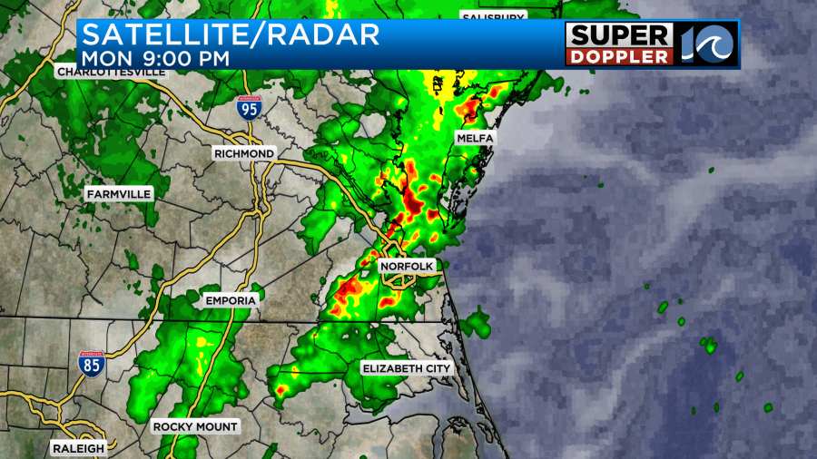
In the last 24 hours we have had some varying amounts of rainfall. Most locations picked up about a quarter to a half an inch. However, some isolated locations picked up over an inch.

This includes Saluda and Langley AFB. Today we have high pressure to the southeast. There is a stationary front still to the north, but it is a little closer than yesterday.

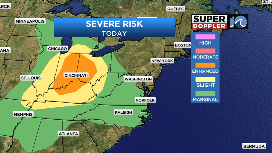
One feature that probably sticks out to you is the strong line of showers and storms over the Mississippi River Valley. This is the area that created multiple severe storms and tornadoes last night over the central U.S. There was a lot of damage out there. Here is an article with more information: Oklahoma tornado damage. That cold front will impact us later this week. Until then we will be in the warm and humid zone.
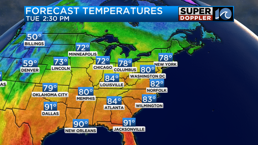
High temps this afternoon will aim for the low-mid 80s.
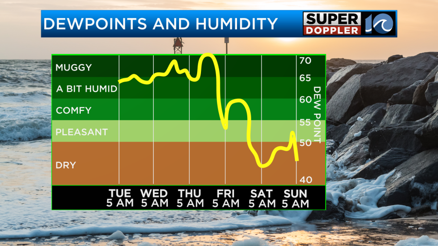
The humidity is up. Dew points are in the mid 60s. There will be a very light breeze out of the west/southwest. So that will help a bit in how it feels. There may be some isolated showers this morning, but we’ll have some scattered showers and storms for during the afternoon.
The coverage won’t be too high, but a few of the thunderstorms may be strong to severe. We do have a marginal risk for severe weather today with the higher risk towards the Ohio River Valley.
We could get a few heavy downpours along with strong gusty winds. There may be some small hail as well, but that will be less common. A few storms could continue into the early evening, but they should decrease by the later evening. Due to the scattered nature of the rain amounts will vary quite a bit.
Tomorrow the front will slide north a bit, and high pressure will edge north as well. This will give us partly cloudy skies for most of the day with little rainfall. It may even be mostly sunny for a time. Winds will increase a little out of the west. This means that temperatures will be able to reach close to 90 degrees.
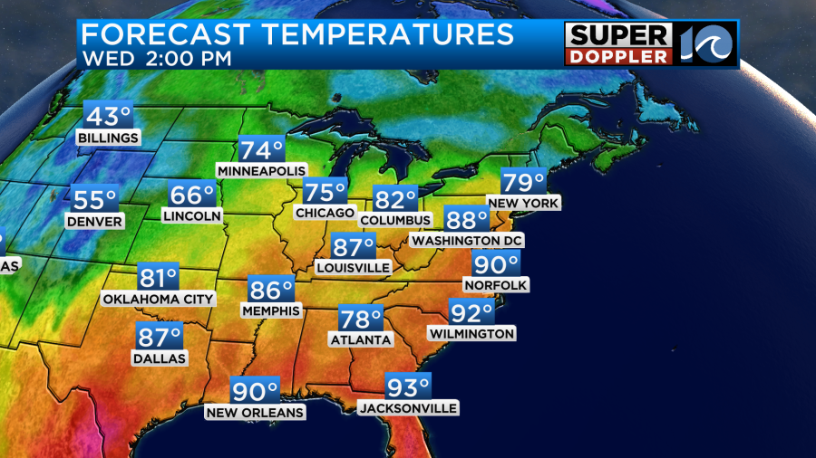
With dew points in the upper 60s it will end up feeling like the low-mid 90s with the heat indices. That is more common in mid-Summer than mid-Spring. There could possibly be some scattered storms by the evening, but our model doesn’t even have that. By Thursday there will be a cool front coming in from the north with a stronger cold front still to our west. The cool front will probably stall out just to our north, but it will help to bring us more clouds and some scattered showers and storms again. This will keep our temps more in the 80s, but it will be in the upper 80s.

The stronger cold front will move through on Friday. This will bring us another day with showers and storms, but at least it will knock down the high temps to the 70s.
We’ll have much drier air move into area on Saturday.
It will be a nice day with partly sunny skies and highs in the mid 70s. An upper level low will be overhead on Sunday. This may create some isolated showers for Mother’s Day. However, it will be pretty dry at the surface. So I don’t think there will be much rain. Overall the weekend is looking good, but check back for updates to that Sunday forecast.
Meteorologist: Jeremy Wheeler


