Over the last couple of weeks we have had some ups-and-downs. We had some mild temps a couple of weeks ago, but then the big shot of cold air came in.
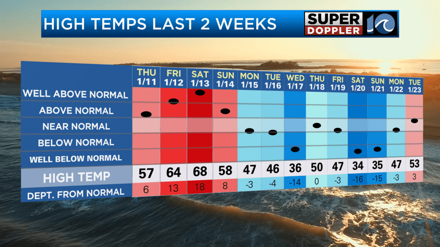
The cold air lasted for a few days, but it started to warm up nicely yesterday. High temps made it into the low 50s.
Today we are going to warm up quite a bit more. A warm front is moving to our north. Winds are going to pick up a little out of the south.
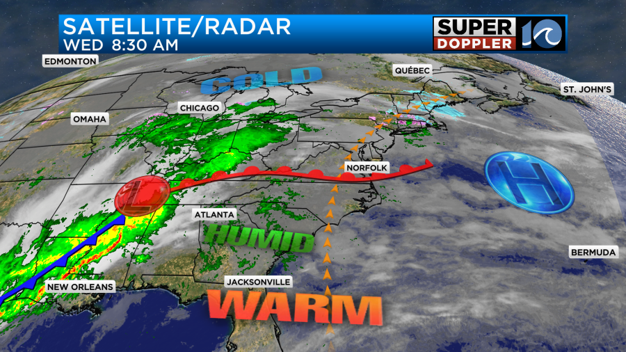
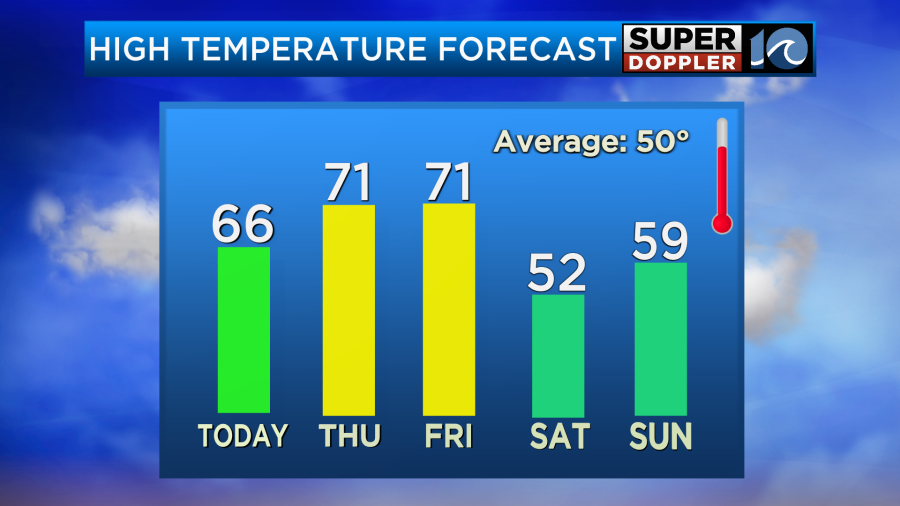
We started the morning with lots of clouds and temps in the 40s and 50s. Temps will keep going up today. We’ll probably reach the mid-upper 60s.

There may be some upper 60s over parts of North Carolina. It will probably be more in the low-mid 60s north of the metro. Either way temps will be well above the average of 50 degrees. The morning clouds that we had should break up quite a bit by the late morning. We’ll have some clearing this afternoon, and winds will be out of the south at 8-12mph. So it will be pretty nice to get outside for a while. Here is the outdoor forecast:

We have about 10 hours and 8 minutes of sunlight today. By the middle of February we’ll have 10 hours and 50 minutes.
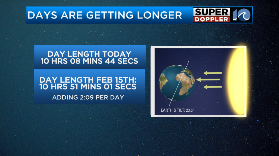
It’s nice that the sun is setting after 5pm now, and soon it will be closer to 5:30pm.
Having said that…some models have the clouds building back in during this evening. They also have some isolated sprinkles and showers. I put that in my forecast, but I don’t think there will be much. That should go away overnight.
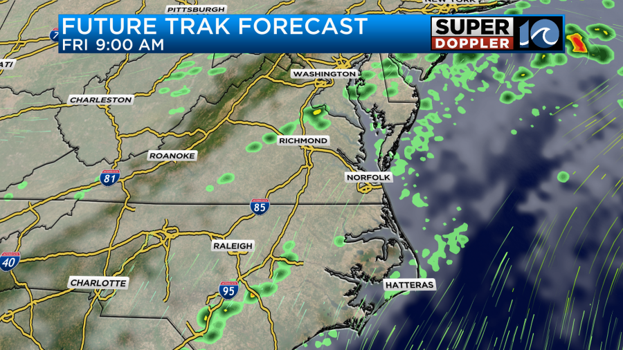
Tomorrow we’ll have increasing clouds in the morning with only some spotty showers in the whole region. However, through the afternoon we’ll develop some scattered rain showers.

The scattered showers will continue into the evening. Despite the increasing clouds and scattered showers we should be able to warm up to the low 70s.

The standing record high temperature for tomorrow is in the upper 70s. We likely won’t reach those. We’ll have a south wind at 5-15mph. So there will be some time to get outside and enjoy the warm temps, but not all day.
Now as for Friday… The jury is still out on the rain chances. Some models (like Future Trak) don’t have too much rain during the day. It has a few showers in the morning with some scattered showers late in the day.

The NAM also doesn’t have too much. However, the GFS is pretty wet in the morning, and it has some scattered showers continuing into the afternoon.
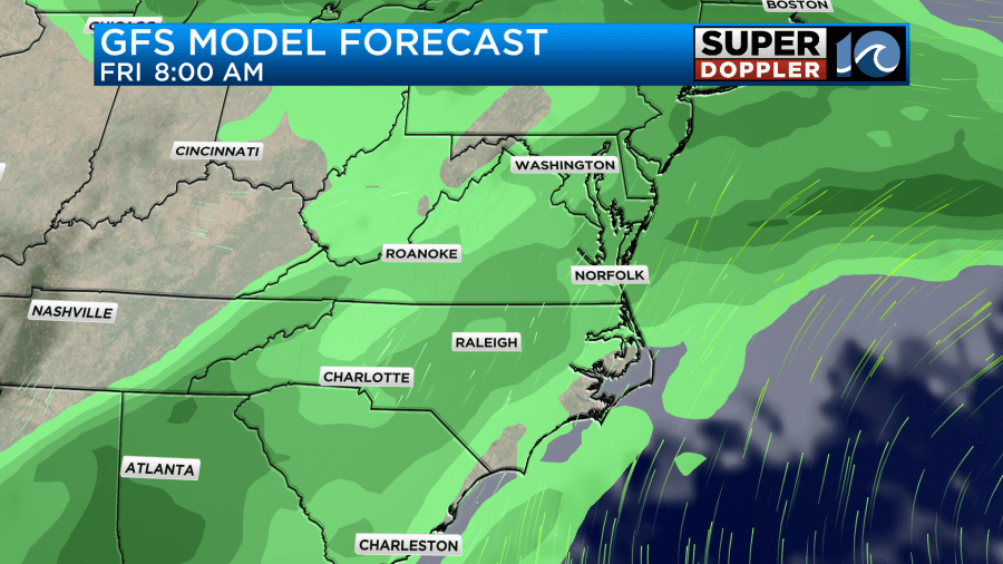

It’s hard to tell which models have the right idea. For now I’m calling for a 50% chance for rain. The Euro model kind of splits the difference. So I am siding with that.
I am keeping the high temps in the low 70s, but if the GFS is right about the rain then it might be more in the upper 60s.
Unfortunately, temps will drop over the weekend, and the rain chances will increase.
No day looks like a washout, but there will likely be scattered showers at times. I’ll have a more detailed weekend forecast in tomorrow’s weather blog. Until then enjoy the warmer temps.
Meteorologist: Jeremy Wheeler