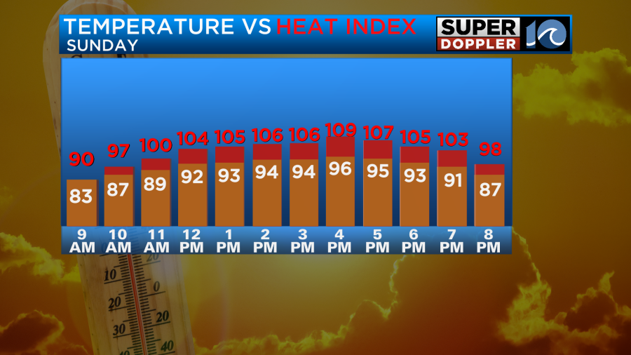
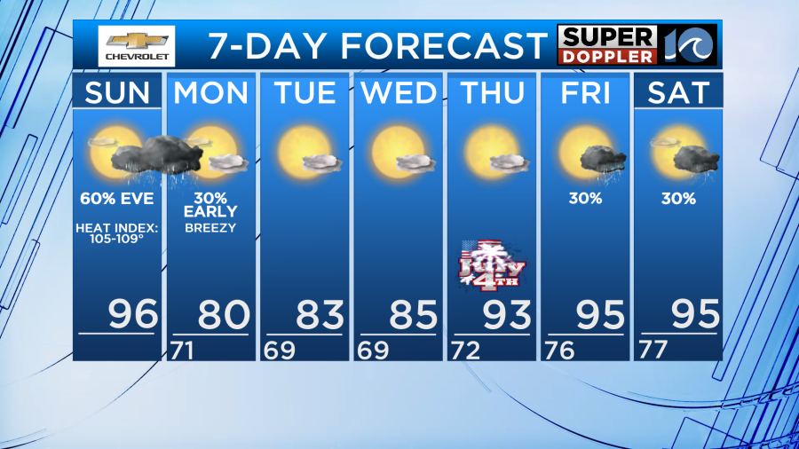
Heat and humidity continues with temperatures in the mid 90s for Sunday. Heat index values will make temperatures feel about 105°-109°!
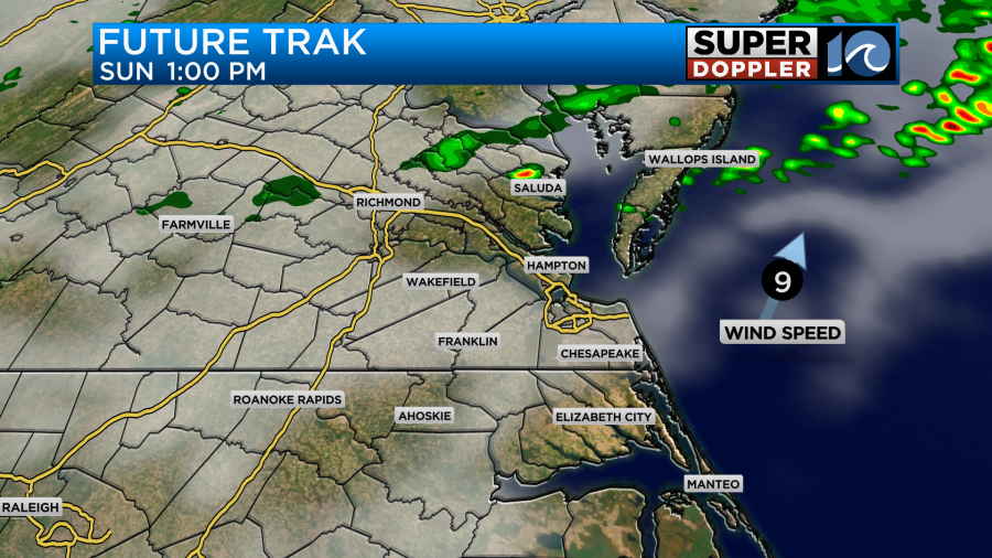
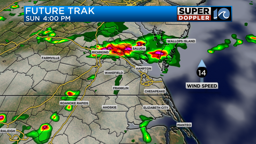
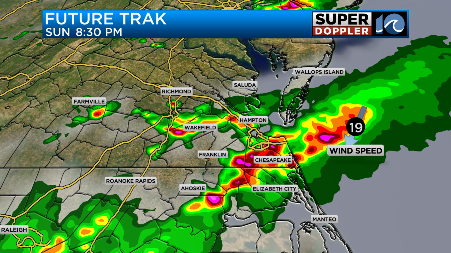
Better rain chances arrive Sunday afternoon with an approaching cool front. Expect scattered showers and thunderstorms to develop across the region Sunday later afternoon and evening. Some of those storms could be strong or severe, so be sure to stay weather aware. Heavy rain, potentially damaging winds, frequent lightning, and areas of torrential rain could accompany some of the thunderstorm activity.
Storms could start to develop around 1pm, becoming more widespread around 3-4pm and continuing through 8-9pm across the metro. Storms will likely linger longer into NE NC, where we could see storms through the entire overnight into the early AM hours of Monday around daybreak.
Behind the cool front comes a big drop in the humidity on Monday and Tuesday next week with highs of 78° to 83°. More summer heat by the 4th of July!
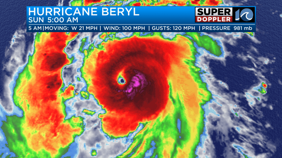
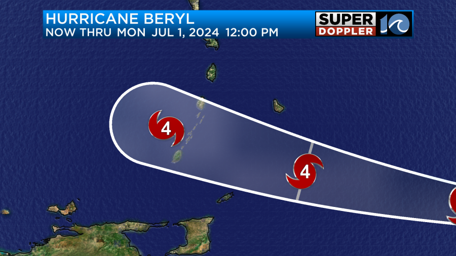
Hurricane Beryl has developed in the south central Atlantic. The system will move westward, impacting the Lesser Antilles and the Caribbean over the next next few days.
Beryl has rapidly intensified, becoming a powerful hurricane less than 48 hours after it formed. The National Hurricane Center expects this will become the first major hurricane (cat. 3+) of the season.
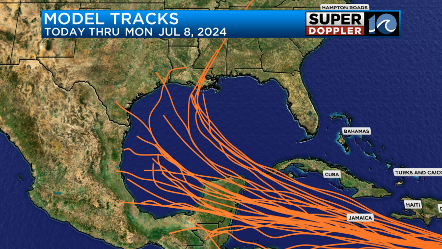
The storm is expected to impact the Windward Islands tomorrow, as a powerful and destructive Category 4 storm. It will then track west through the Caribbean, and could end up in the Gulf of Mexico late in the upcoming week/next weekend. No concerns from this storm for us at this time.
Stay cool and weather aware this afternoon!
Meteorologist Ricky Matthews
Follow Ricky on Facebook and Twitter