
It’s been a little while since I’ve looked at the U.S. Drought Monitor.
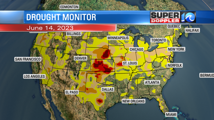
You’ll notice that things have greatly improved over the West while the central U.S. has developed severe to extreme drought. My mom in Illinois has been saying for a while that they have not had much rain. The crops up there are currently struggling. There is a lot of corn and soybean up that way. We’ll see if it will affect prices down the road. Around here we need some rain too. Some need it more than others.

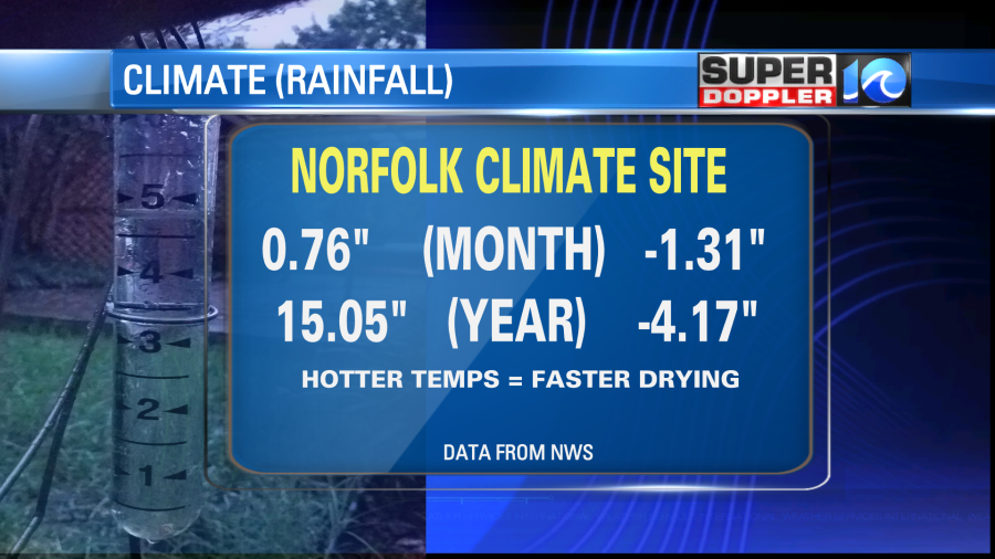
We have had some rain lately, but most of the recent rain showers have been scattered or of short duration. There were a couple of exceptions. So I’d say that a lot of our lawns are doing ok for now, but rain will be more important now that warmer temperatures are sticking around. We are about 1.3″ below average for the month for rainfall. We are down a little over 4 inches for the year.
We likely won’t get caught up on rainfall any time soon. There is a stationary front nearby, but it will only bring us some isolated showers in the forecast today.
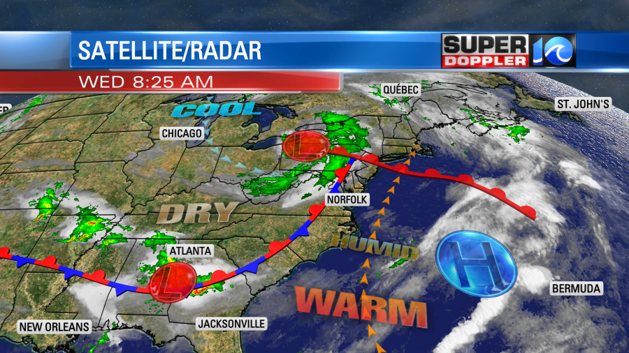
The front drifted north last night. Now we are in the warm zone. We’ll have a southwest breeze increasing to 10-15mph with some gusts between 20 and 25mph. We started with lots of sunshine this morning.
We will have a little more clouds as we head into the afternoon. There may also be some isolated showers in the region, but the chance is low. High temps will climb to the upper 80s later today.
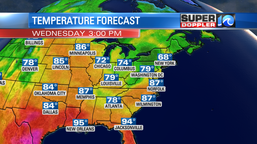
We may hit 90 in a couple of inland spots. Even mid-upper 80s will feel hot if you are in the sun and out of the breeze. Especially with dew points climbing to the upper 60s through the day.
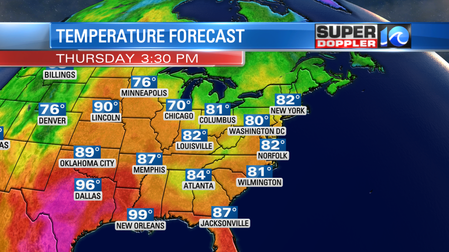
There may be some more isolated to scattered showers tonight as the front sinks south again. This will cool us down a bit tomorrow. High temps will be in the lower 80s.
We’ll be partly cloudy again with some isolated showers possible. We’ll still be warm on Friday, but there will be a little higher chance for rain.
There is some good news for the weekend though! The latest models coming in have dried out Sunday. So, for now, I have partly cloudy skies both days with highs in the 80s. Juneteenth also looks drier. Highs will stay in the 80s. It’s nice that we have a long stretch of 80s. It will make for some good beach weather at times. It would be great to have that this weekend again.
What about the smoke? The thick Canadian wildfire smoke is wrapping into an area of low pressure over the Great Lakes.
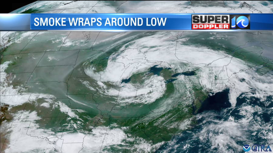
A little thin haze may form down here, but it should stay elevated. I don’t think we’ll have much of that in our region for the next 48 hours. However, we’ll have to check back to see if it will try to return this weekend. Hopefully not!
Meteorologist: Jeremy Wheeler


