We had some on-and-off light rain showers yesterday as a warm front stalled out over the area. It was cool but not cold. Then last night as an area of low pressure moved east/northeast along the front there was a line of heavy showers that swiped through the region.

The rain moved out early this morning except for a few lingering showers over the southern Outer Banks. Clouds stayed thick through the morning commute over the entire area.
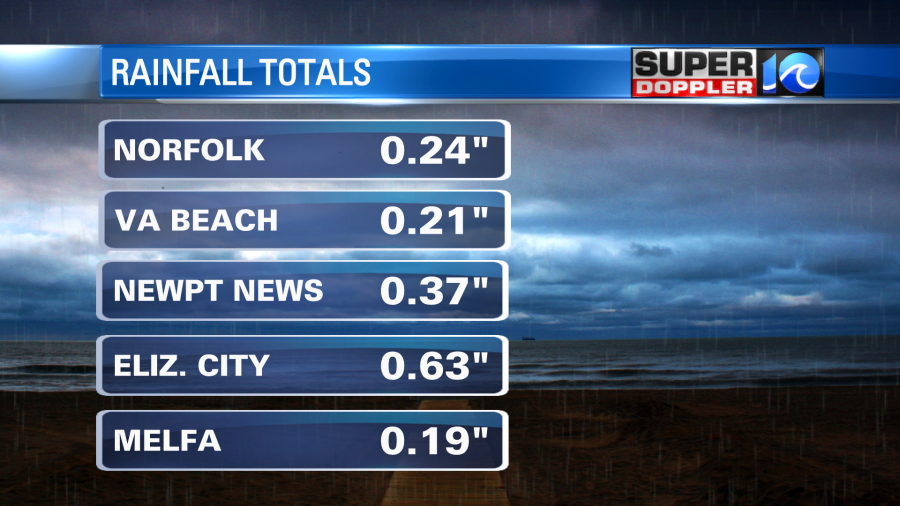
We picked up about a quarter of an inch of rain over the region with a few locations getting about a half an inch or so.
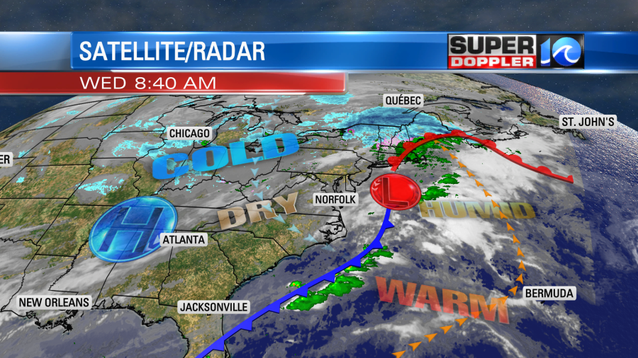
The warm front, a trailing cold front, and area of low pressure are all moving offshore today. High pressure is building in from the west.
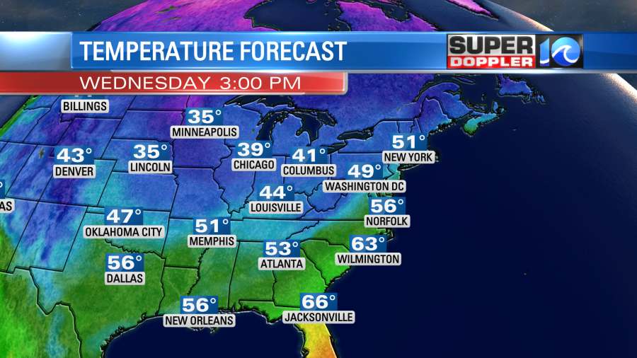
We’ll have gradual clearing today. High temps will struggle to reach the mid-upper 50s.
We’ll have a steady northwest breeze. Tomorrow we’ll have lots of sunshine as the dry air really kicks in. High pressure will dominate the weather over the eastern 2/3rds of the country for the next few days. We’ll have a lot of seasonably cold and dry air through Sunday. High temps will only be in the upper 40s to low 50s. The low temps will be in the 30s with possibly some 20s inland. It is time to bring in the potted plants if you haven’t already. We could see some freezing temps closer to the coast this time around. It’s about that time of year.
The weather does look good for travel in the region this weekend for the upcoming holidays. However, it’s still early to call the Thanksgiving forecast. For now at least the trend is warmer (60s…maybe 70s?) We’ll see.
Meteorologist: Jeremy Wheeler