Monday, Hurricane Milton had a rapid intensification in a short period of time. At one point late yesterday the system had strengthened into a Category 5 hurricane. It’s pressure dropped down to 897mb (millibars of pressure). This made it one of the 5 strongest hurricanes on record in the Atlantic basin in terms of pressure. Hurricane Wilma (2005) was the strongest, with a lowest recorded pressure of 882mb. Tuesday morning, Milton was still a powerful high-end Category 4 storm.
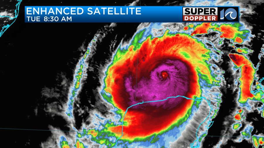
The pin-sized eye from yesterday has gradually been replaced by a larger/less-focused eye. Milton has been lashing the north end of the Yucatan Peninsula with strong winds and heavy rain. It will move away from there later Tueday. Through the day Tuesday, Milton is forecast to move east and then turn to the northeast. It will interact with an upper level trough to its northwest and a weak stationary front the north. Scattered rain showers will stretch away from the center of the storm all the way up into Florida.
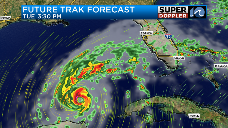
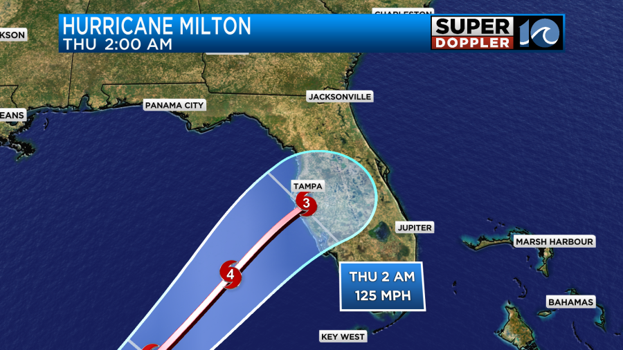
The storm will aim for the Tampa Bay region some time late Wednesday night or early Thursday morning.
The latest forecast for the storm surge put a rise of water to about 12-15 feet down there.
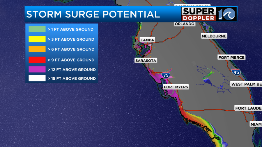
The storm has been compact up until Tuesday morning. However, the storm is forecast to grow in size before landfall. So that will be able to create the high surge over a large area.
Going through Friday, Milton will move through central Florida. Orlando will be on the edge of the hurricane-force winds.
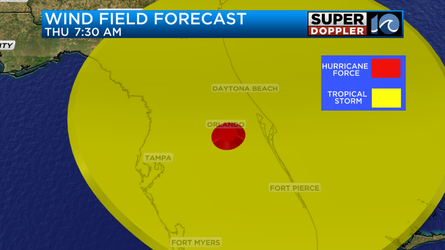
I can’t remember the last time a hurricane moved directly over (or adjacent to) Orlando. After moving off the east coast of Florida as a Category 1 hurricane, the storm is expected to move east, interact with a cold front, and become post-tropical.

The latest track and the latest models all keep Milton to our south.

Even the rain looks like it will stay to our south with very dry air in place up here.
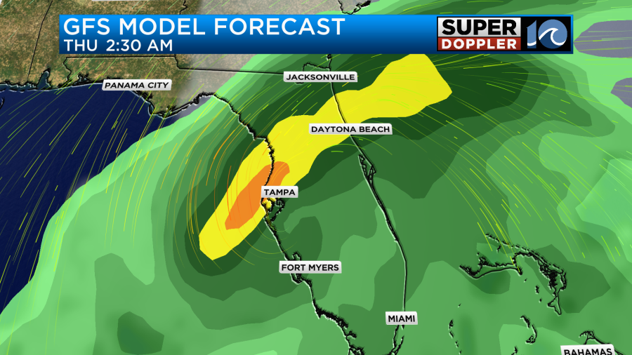
However, flooding rains are expected across parts of the Florida Peninsula.
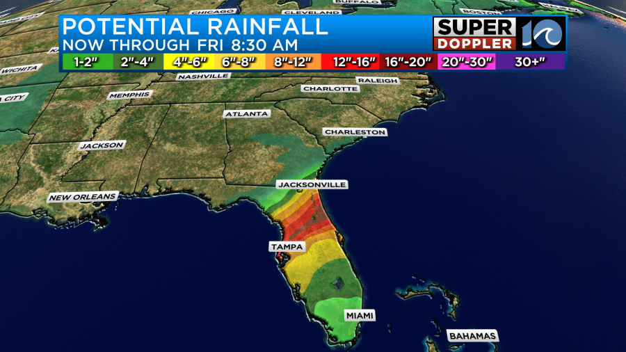
This will impact the thousands of residents trying to go north to get away from the storm.
We’ll have more updates on this throughout the day.
Meanwhile, Leslie is now a tropical storm in the middle of the Atlantic. It will continue to weaken as it moves more into the northern parts of the Atlantic.
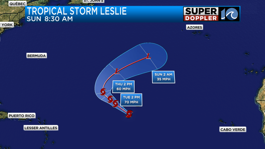
It will stay out to sea as Kirk did.
The ocean is still churned up from all of the activity in the Atlantic. So waves are running 4-5 feet across the Outer Banks and 3-4 feet near Virginia Beach.
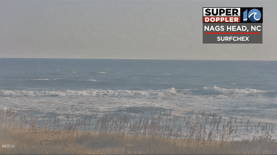
Other than all of that, our local weather looks great. We have a cold front dropping to our south with high pressure building into the region.

We’ll have lots of sunshine Tuesday. Very dry air has FINALLY moved into the area. Dew points have fallen into the 40s and 50s.
The humidity will stay down for a few days.
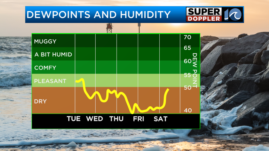
It may go up a little over the weekend, but not too much.
High temps will be in the low 70s this afternoon. Then we’ll be in the mid 70s Wednesday.
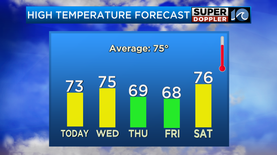
We’ll even drop to the upper 60s Thursday and Friday. We’ll have lots of sun all the way through the weekend. It may be a little breezy on Thursday as strong high pressure will lie to our north with post-tropical Milton to our south. Try to get outside and get a taste of the fresh air. Open up the windows in the house. Enjoy the fall weather!
Meteorologist: Jeremy Wheeler


