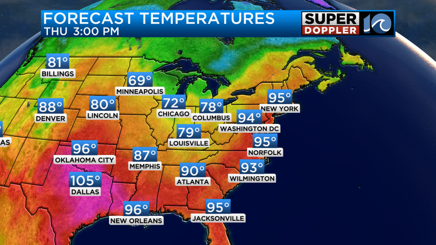
The Summer heat is still sizzling in our region. Yesterday our high temps hit the low-mid 90s, but the heat index was up to around 100 degrees for many. Today we will be a little bit hotter and a touch more humid. So our afternoon high temps are aiming for the mid 90s. The heat index will be near or over 100 degrees. It will be much cooler over the Midwest.
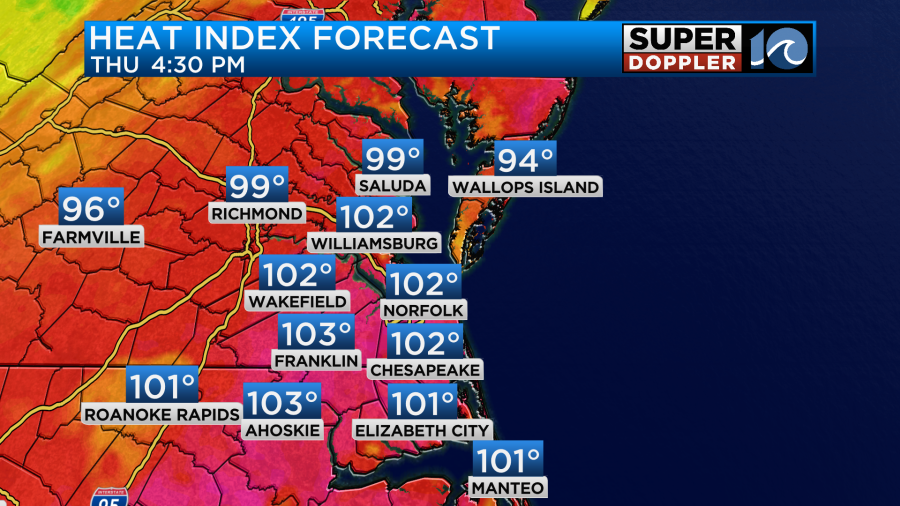
These local numbers are just under Heat Advisory criteria. So please keep that in mind as you go out and about. Kids need to stay well hydrated and take plenty of breaks if they are playing after school sports.
Aside from the heat we will be partly cloudy today with only a stray shower or storm in the region. We’ll have a light south wind.
We have an area of high pressure to our southeast now (it was to our southwest over the last couple of days). There is a cold front over the Tennessee and Ohio River Valleys.
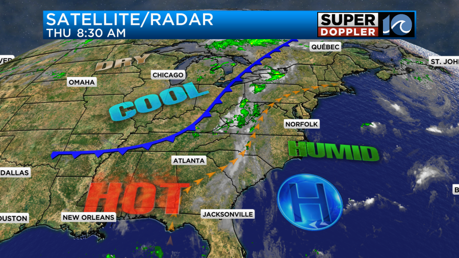
The front is very slow moving. So it will get a little closer to our region by tomorrow, but it won’t be close enough to cool us down. I’ve got us in the low 90s tomorrow instead of the mid 90s, but that is mainly from some extra clouds and a few isolated to scattered showers/storms in the afternoon.

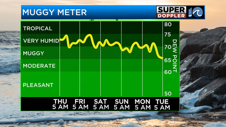
We’ll have some cooler temps finally arriving by Saturday. High temps will drop to the mid-upper 80s. Keep in mind it will still feel like the low 90s with the heat index. That is because the humidity isn’t really forecast to sink until some time next week.
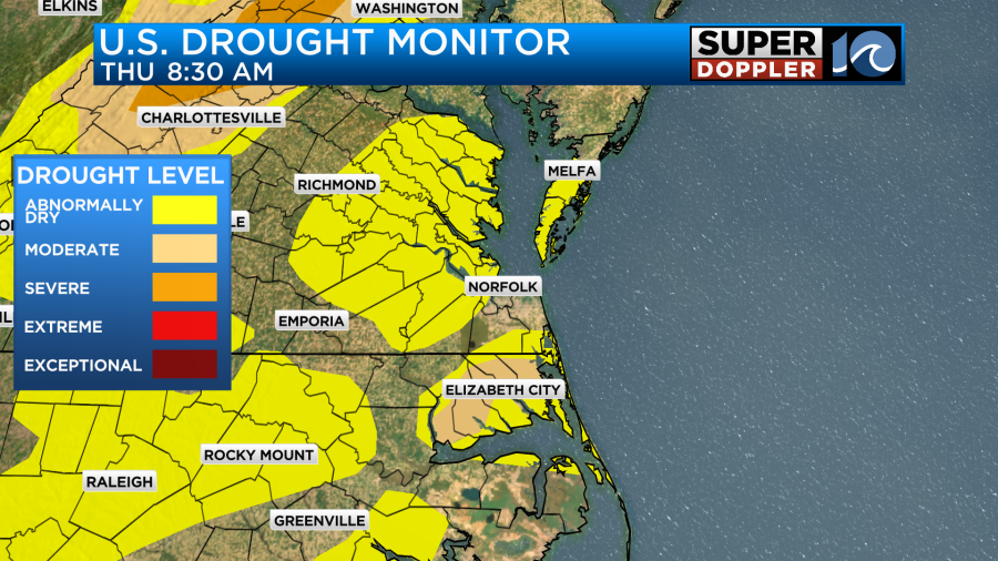
There will be a few scattered showers and storms on Saturday. There may be a few more on Sunday. Neither day looks like a washout. Having said that, we do need some rain in the region. Some of our area is in a moderate drought. There many pockets of “Abnormally Dry” conditions on the local map.
So hopefully, we get at least some rain this weekend.
This leads to the question… Will there be any rain here from Hurricane Lee? The short answers are that A. It’s too early to tell, and B. The latest trends say no. Let’s take a look.
This morning Hurricane Lee was gaining structure on satellite. It looked like the eye was starting to become visible.
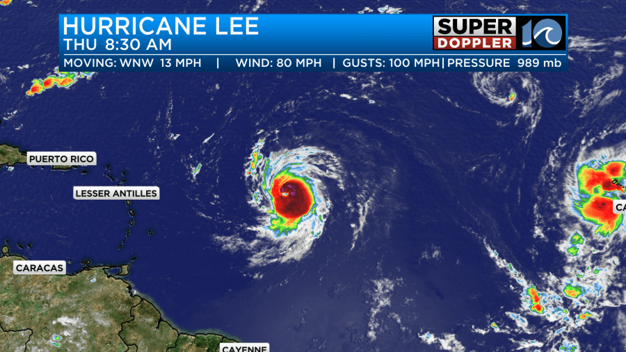
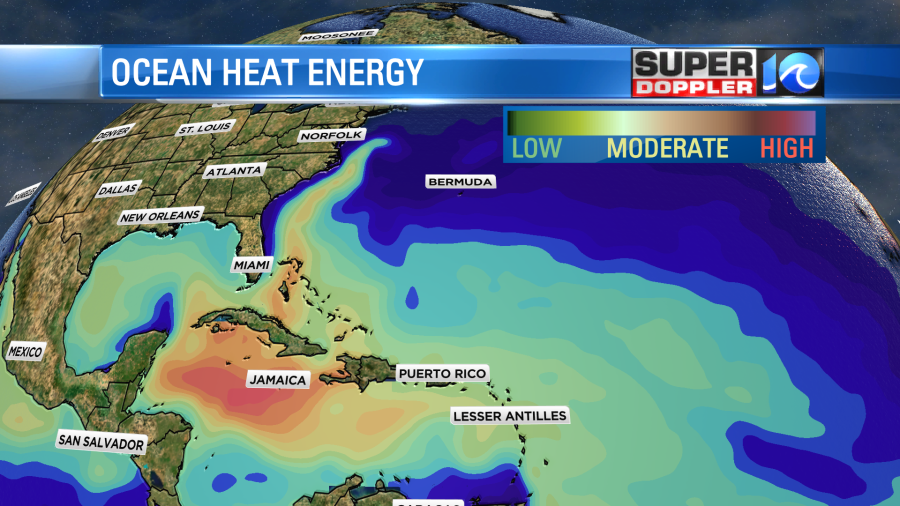
Lee was a category 1 this morning, but it was on the way to quickly becoming a category 2. Its track takes it over a region of very warm water. It is also warm to a depth. So there is a moderate to high heat energy potential.
There is also very little wind shear along its path. This is why the National Hurricane Center has it as a category 4, and there has even been talk of a 5 at times.
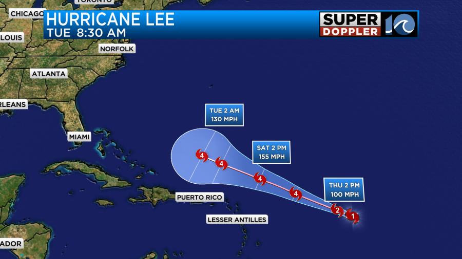
The latest models are in good agreement that it will pass north of Puerto Rico and the Lesser Antilles. However, the storm may get so large and strong that they could still have some tropical storm forced winds there along with rough surf.
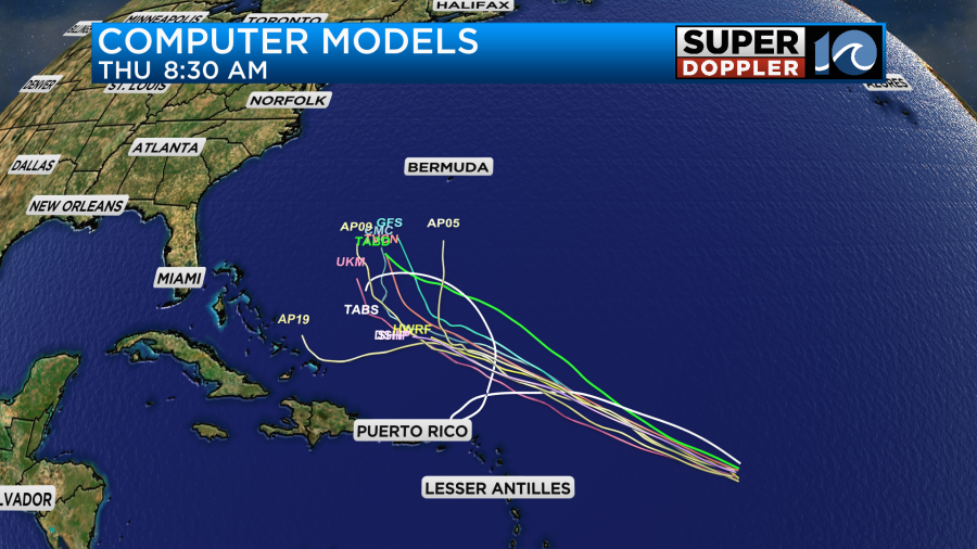
There is pretty good agreement that Lee will take a turn to the north. However, the models disagree on how soon that happens. I’d say that most models keep it between the U.S. and Bermuda. This would be due to a ridge to the northeast and a large trough over the U.S. The GFS and Euro are in pretty good agreement with these features. So they are currently in pretty decent agreement on the long-term track.

They also take it between the U.S. east coast and Bermuda. The Euro is a little farther to the east. So I don’t want to write off Lee just yet. It still could track farther west than the models show, and there is a lot of time for the forecast to change. If the trough or ridge strengthen/weaken more than forecast, then the track will likely change. Even if it is just a little. At least the latest trends are looking good.
Even if Lee were to stay offshore, we would still likely get some big waves, a high threat for rip currents, and possibly even some tidal flooding along the coast. So we will watch this carefully, and bring you updates.
There is another tropical disturbance in the eastern Atlantic. It has as high chance of formation, but it will likely stay out to sea.

Meteorologist: Jeremy Wheeler