Yesterday, I participated in the annual “raking of the leaves”. Luckily, I had some help… My Daughter. It was very warm out for the chore. High temps ended up hitting the upper 70s to low 80s over the region.
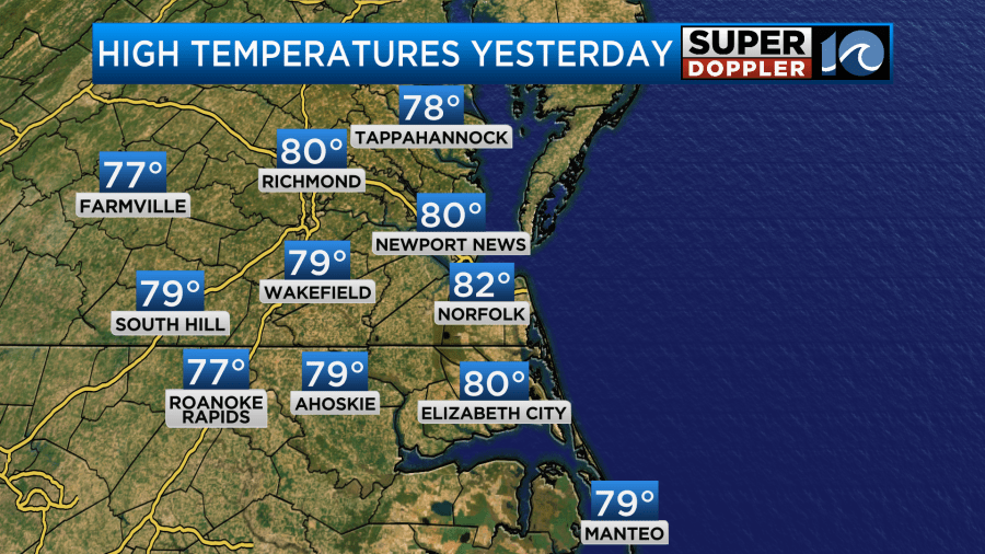
It wasn’t terrible, but it was definitely a tank top and shorts activity with frequent water breaks.
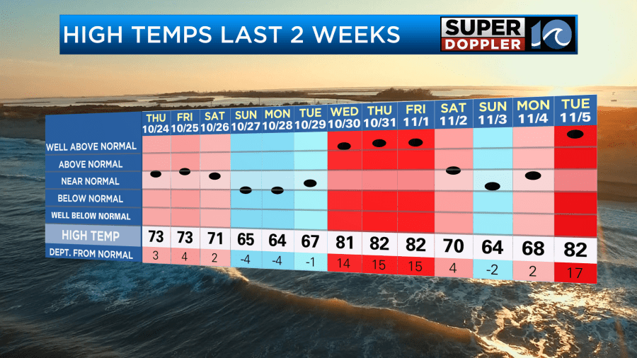
This recent heat is embedded in a pattern where we have about 3-4 days of warm temps with 2-3 days with highs in the 60s in-between.
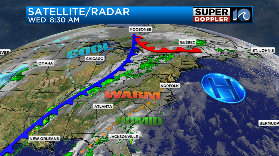
Today we will be in the warm zone. High pressure is offshore. A warm front is off to the north.
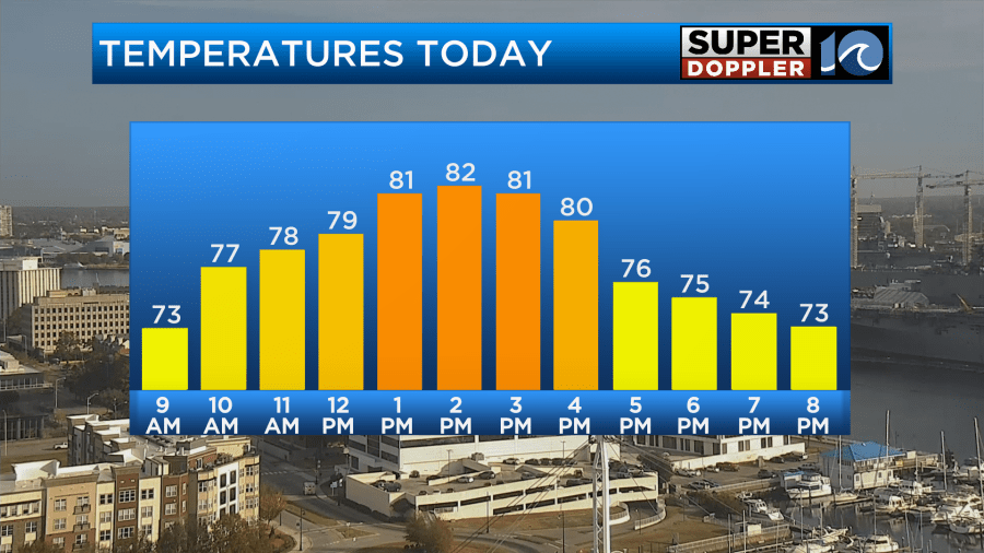
So temps will push back up into the low 80s this afternoon with a light southwest wind.
We’ll be partly cloudy today with dew points rising into the 60s.
Tomorrow the moisture will increase even more. This moisture push will create a mix of sun and clouds on Thursday with some isolated showers possible. The cold front will be closer, but it won’t be close enough to cool things down. So high temps will be able to hit near 80 degrees.
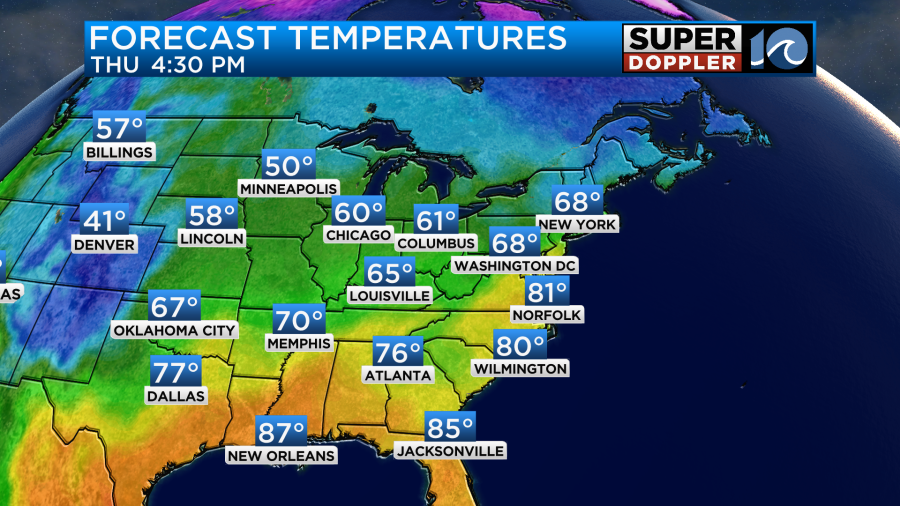
We’ll have a mix of sun and clouds with some isolated showers or sprinkles possible. I’m not expecting much rain during the day. However, by the evening the models are showing some scattered rain showers in the region.
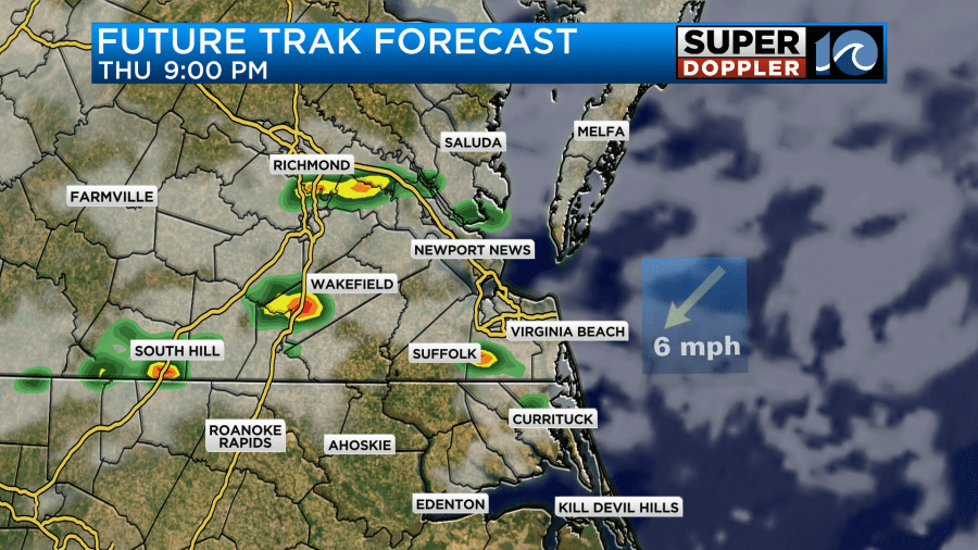
This will be our first chance at some measurable rainfall in over 34 days. However, don’t get too excited. The models aren’t showing much.
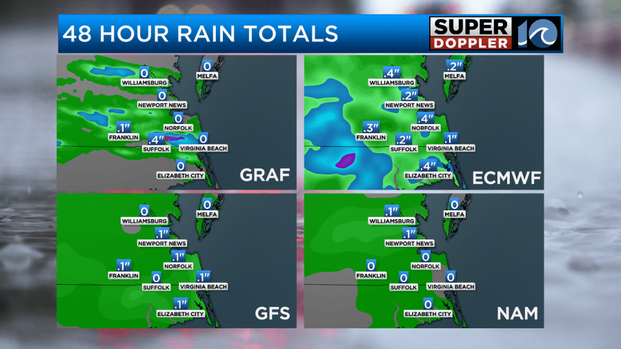
This could range from a couple one-hundredths of an inch up to three-tenths of an inch. Due to the scattered nature of the showers, some folks will likely miss out on the rain. One interesting thing is that there may be some isolated thunderstorms in the evening. It’s been even longer since we had one of those.
Friday morning the front will slowly be sinking to the south. There may be an isolated shower in the morning along with mostly cloudy skies. Then we’ll have some clearing in the afternoon. There will be a northerly breeze. That will keep high temps down in the 60s.
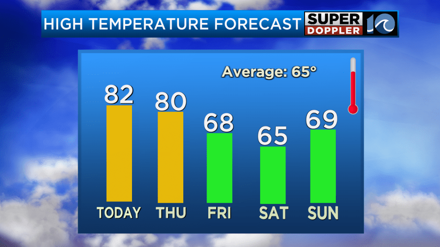
We’ll dry out on Friday. Dew points will drop down to the 40s.
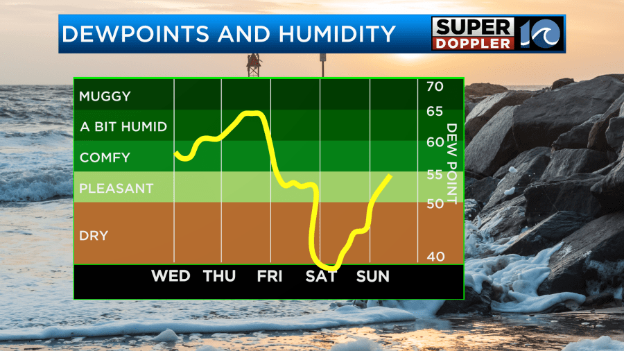
We’ll stay dry and cool on Saturday. Then we’ll be in the upper 60s on Sunday. I’ve dried up the Sunday forecast for now. However, I do have some scattered rain showers coming in on Monday. That will depend in-part on some long-travelled tropical moisture. Cue Rafael.
Rafael became a hurricane early this morning. It is now a category 2 storm.
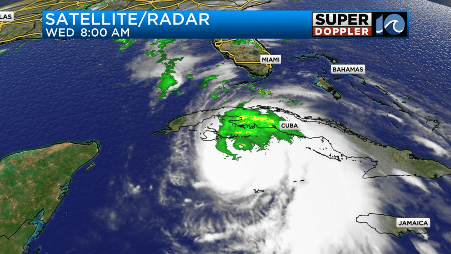
The hurricane will move over western Cuba later today. Havana will be impacted along with other cities/towns in that area. The storm will then move northwest over the warm waters of the Gulf. It will maintain strength for a while. However, in the 3-5 day range Rafael will start to encounter drier air, slightly cooler water, and increasing wind shear. So the system is expected to weaken Sunday into Monday.
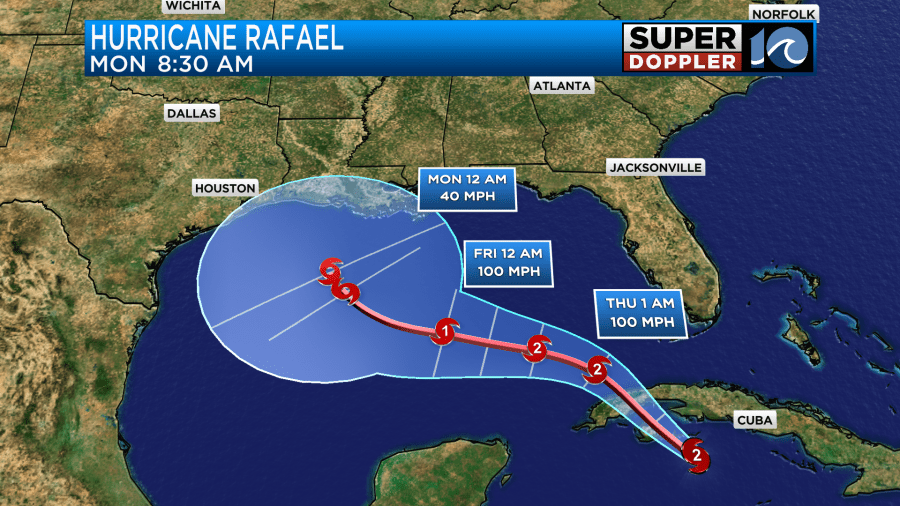
This is good news, but it’s still a bit early to celebrate. I will say that the GFS Model keeps it very weak as it strafes the coast during that time.
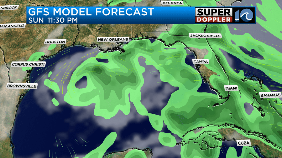
There are even some models now that have it either falling apart or moving back to the south.
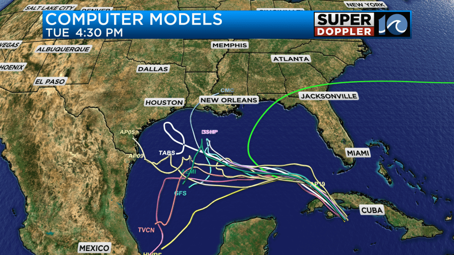
This would be a great scenario as they would get some rain along the coast but not much wind. We’ll see where this goes. In the meantime, hopefully, it won’t be too bad for Cuba.
Stay tuned for updates.
Meteorologist: Jeremy Wheeler


