Yesterday was very nice here locally. Our high temps were in the low 70s with lots of sunshine and dry air. Though it was a bit breezy at times. The dry air created some problems to our west and northwest where they had several wildfires break out. Some of the wildfires are still burning today. There will be some smoke to our west, but I think we’ll be fine in this region.

Overall, today will be a decent day, but it is going to be much cooler. A cold front is dropping to our south with high pressure building to our northwest.
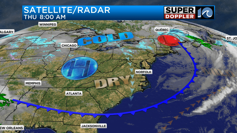
High temps will only rise to the low 50s this afternoon in the metro.
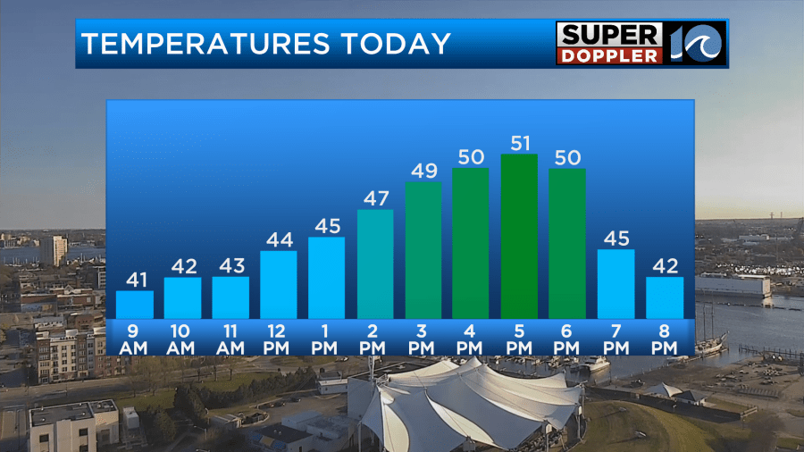
We’ll probably only be in the upper 40s north/northeast of the metro, but I think we’ll be able to reach the mid-upper 50s in some inland locations and areas to the south. Winds will be out of the north at 5-15mph. The wind won’t be too bad, but it will make it feel chilly at times.
Tomorrow high pressure will slide offshore with an area of low pressure forming to our southwest. We’ll have increasing clouds and moisture, but we’ll be too dry for rain during the day. There may be some isolated showers by the evening. Despite the increasing clouds we should be able to warm up to the upper 50s to near 60 degrees.
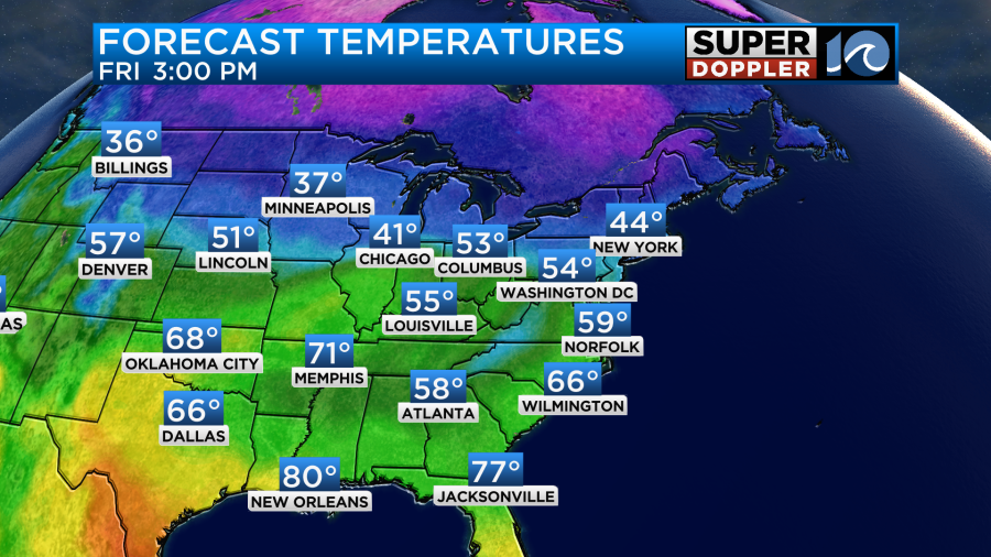
We’ll have a southeast wind at 10-15mph. There may be a few higher gusts near the shore.
The area of low pressure will move in by tomorrow night. Rain will increase around midnight. It will then become widespread and heavy by Saturday morning.
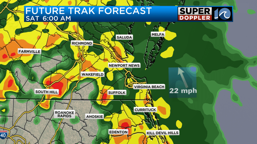
The latest trend in the models is to break up the rain from midday into the afternoon. They now have scattered showers with isolated thunderstorms.
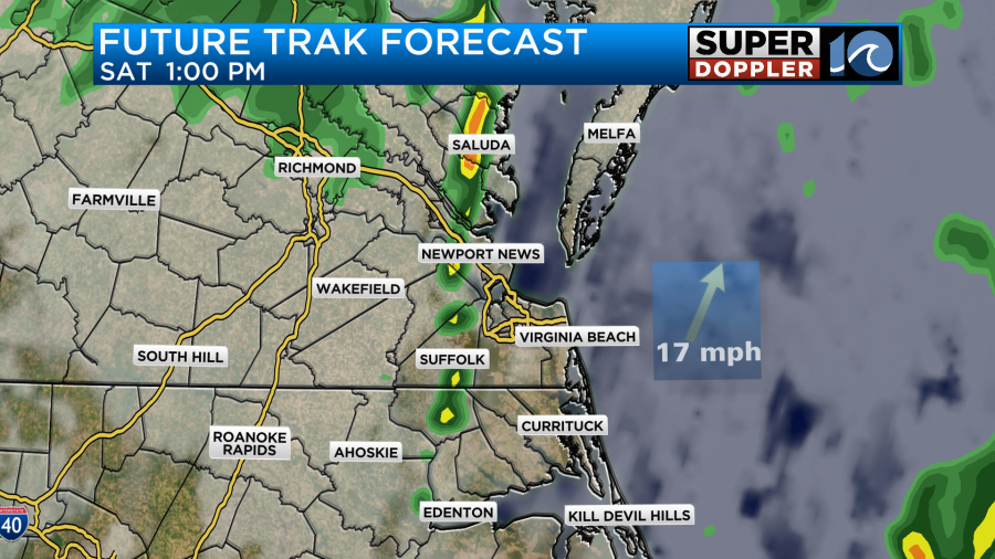
With this new trend the models are also coming in a little warmer now. A warm front will lift to our north. Our Future Trak model has highs in the low 70s for Saturday.

I’ve been trending the temps up, but I only have upper 60s for now. However, I haven’t gone with 70s yet. I may by tomorrow if the models keep leaning that way.
By Sunday the area of low pressure should move out of the region. We’ll have high pressure building in. After a stray shower early in the morning we should be dry for the rest of the day. High temps will be in the 50s.
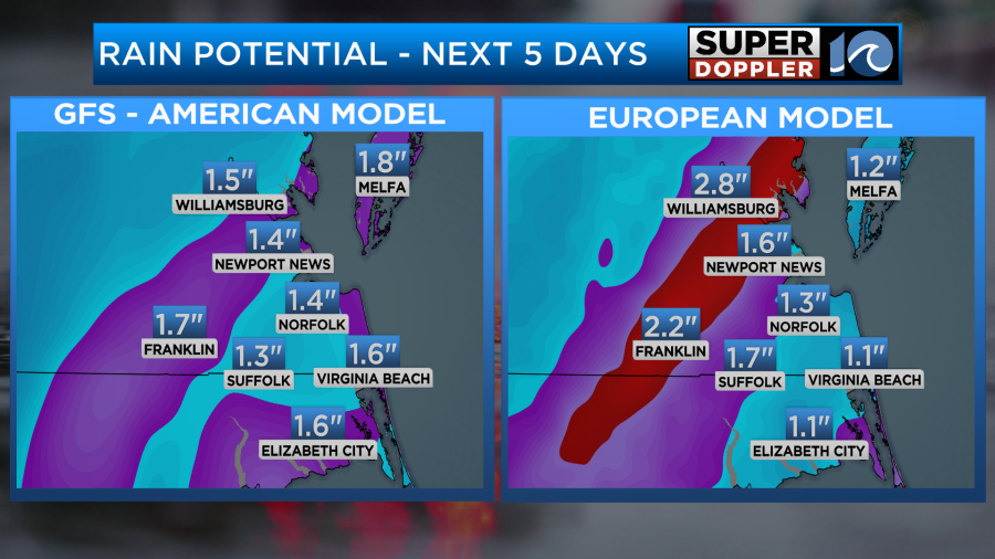
Before the rain ends we will probably pick up about a half inch to an inch-and-a-half.
Check back for updates to the Saturday forecast.
Meteorologist: Jeremy Wheeler


