Today we had a little moisture push into the region. It wasn’t super muggy, but there was enough moisture for some thick fog in a few places.


Other than the fog this morning we should have a nice/quiet day. High pressure is over the region, but it is moving a bit more to the east.
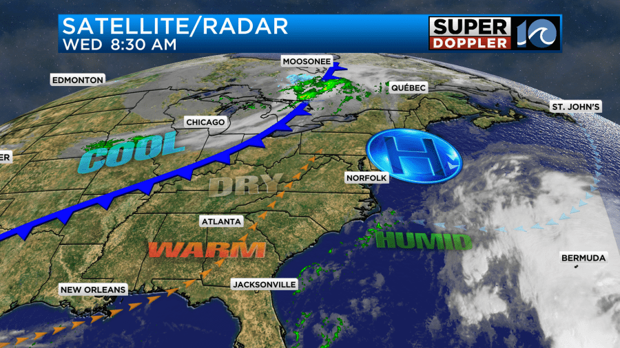
There is a cold front over the Midwest that will be a factor in our weather over the next 24 hours. Once the fog burns off today we’ll have fair skies for a long stretch. Winds will be light and variable, but they should be out of the southwest for a while. This will allow for temps to build up to the upper 70s to low 80s this afternoon.
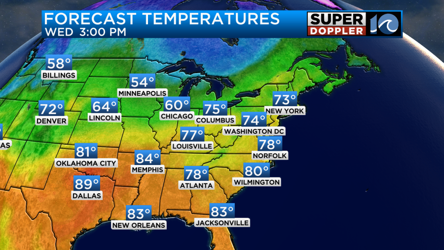
We won’t break any records today, but it will be about 10 degrees above average. In fact, a lot of the country is running above average for temperatures today.
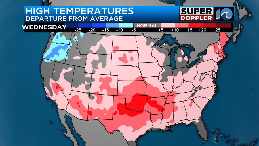
The Deep South is especially running warm.
Tomorrow morning the cold front will sweep through our area. Unfortunately, it’s dry on both sides of the front. So we are not going to have any rain showers. We’ll be mostly to partly sunny. Wind gusts will be up to 25mph at times.
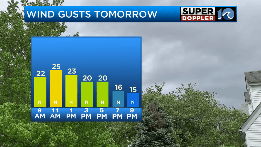
This will keep our high temps down in the upper 60s despite the sunshine.

Humidity is up a bit today, and that helped create the fog, but it should go down over the next couple of days.
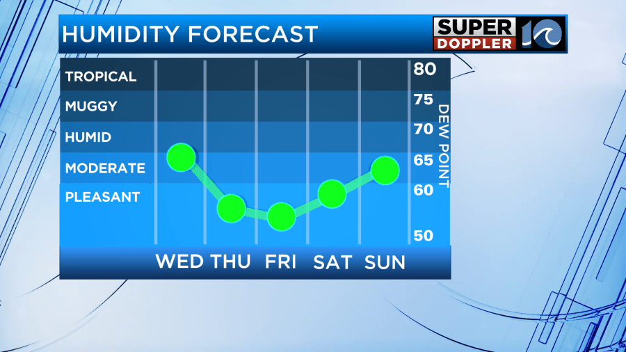
We’ll stay cool and dry on Friday with highs in the upper 60s. Then we’ll be mild and dry on Saturday.
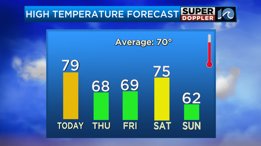
A stronger cold front is forecast to move through the area late Saturday into Sunday. It may create some isolated showers, but that’s all I expect for rain for the next few days. Then we’ll have lots of sunshine Sunday with high temps only in the low 60s. We’ll stay cool and dry early next week.
For the first time in a long time there is nothing brewing in the Atlantic basin.
Meteorologist: Jeremy Wheeler


