Yesterday was rough! The temps had made it solidly into the mid 90s, but the heat index was over 100 in most locations. It’s hot for walking pets. It’s been hot for afternoon practices. It’s been good for the beaches though.
We are going to finish off the week on a hot note. However, we should land just a little shy of yesterday’s high temperatures. Today they will aim a little more towards the low 90s with some mid 90s inland.
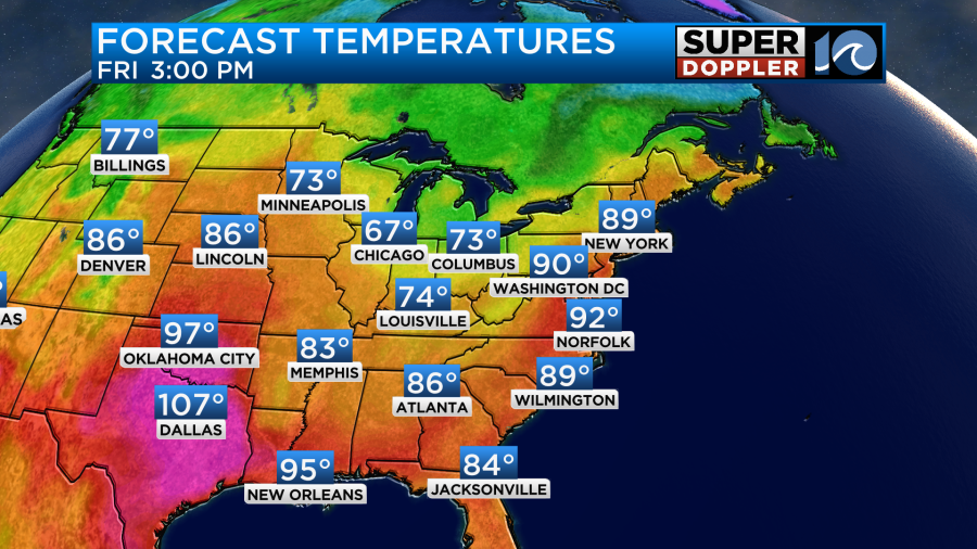
The heat index will also be a little lower. It should run more into the mid-upper 90s with some spots close to 100 degrees.

We have high pressure offshore with a cool front to our west.
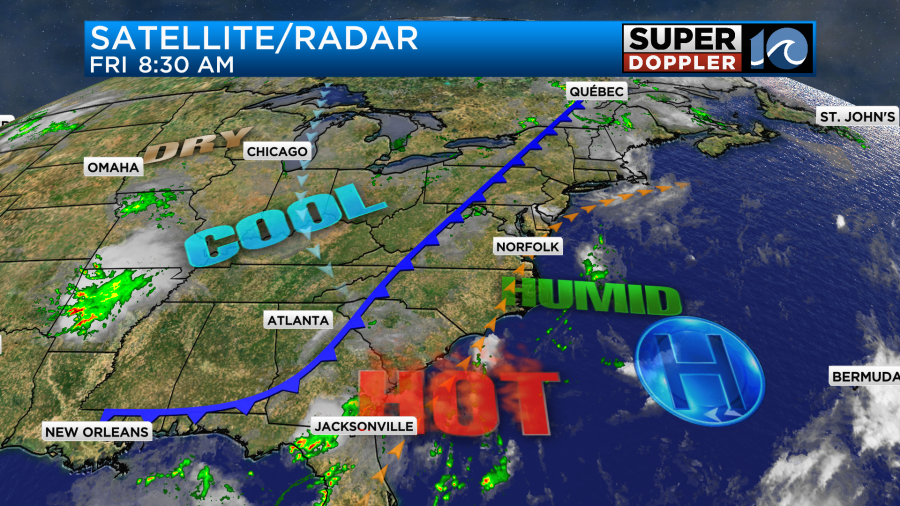
The front will not move in today. It will only edge a little closer. We’ll be partly cloudy with a little more clouds popping up in the afternoon. It will be hazy! There will also be some isolated showers or storms popping up as well. It’s this subtle combo that should keep the temps down a little from yesterday, but it’s not enough that you’d really notice.
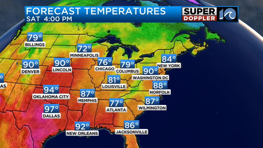
Tomorrow the front will be in the region, but it will be super slow moving. High temps will be in the upper 80s, but it will feel like the low 90s with the heat index.
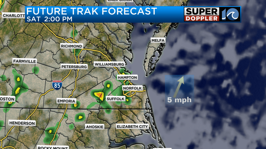
We’ll have a mix of sun and clouds over the region. There could be some isolated showers in the morning, but some scattered showers and storms will be possible in the afternoon.
We do need rain at this point. We are down about an inch and a half below average for the month so far. We are up about an inch above average for the year.
At least it will be cooler tomorrow and Sunday. High temps will be in the mid 80s on Sunday. Plus, it will be a little drier as the front stalls out just to our south. It will be close enough to create some more scattered showers and storms. The weather will pretty much stay the same through the middle of next week.
Tracking the Tropics
Meanwhile…Hurricane Lee exploded in strength yesterday. It became a category 5 hurricane by the evening. It is still a category 5 this morning.

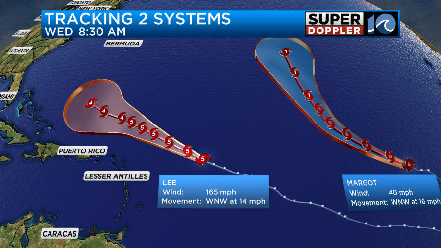
Lee has a very distinct eye. However, the hurricane force winds are pretty close to the center. So far it is powerful but compact. Eventually, that will change. Lee is currently northeast of the Lesser Antilles. It will steadily track to the west/northwest over the next few days. It will run over very warm water. Plus, there won’t be much wind shear over the next 2-3 days.
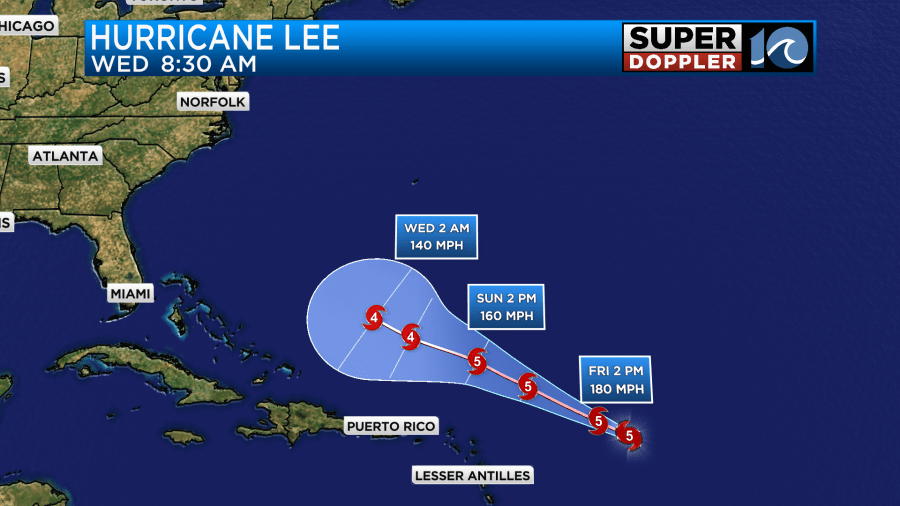
The track is fairly straight, and it goes out to 5 days. However, by next Wednesday many of the models have Lee hooking to the north. Some even track it to the northeast towards Bermuda.
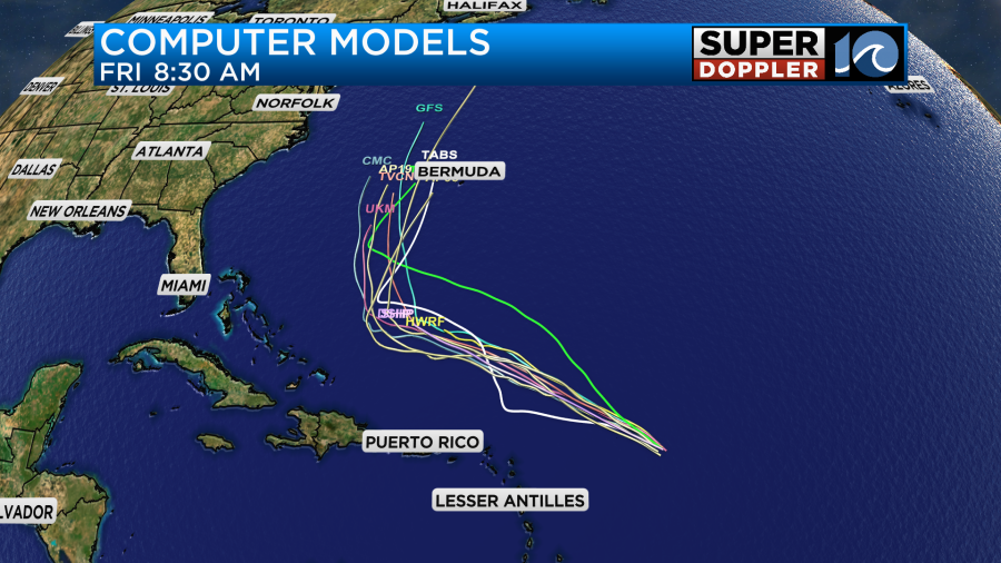
The GFS and Euro are actually in decent agreement this time. They are in very good agreement until Wednesday. After that they really only differ in timing.
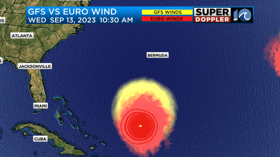
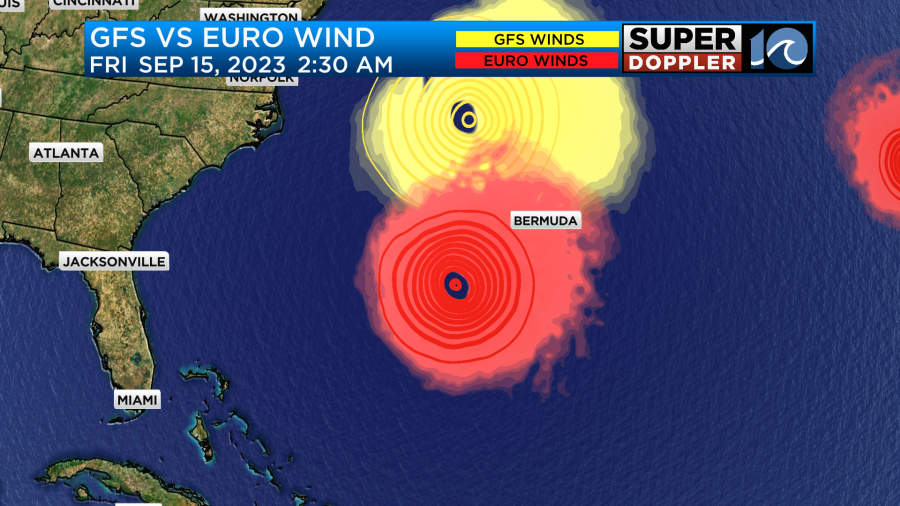
So over the weekend we should see the official track turn northward as well. However, we definitely can’t write it off. It still could try and head more to the west. Though I like the most recent trends. Keep in mind that even with an offshore track we would still likely have impacts here. We can expect some high waves. The waves out near the center were around 40-50ft this morning. Those highest waves will follow the center of the storm. However, there may be some 10-12 ft waves traveling to near the Outer Banks late next week.
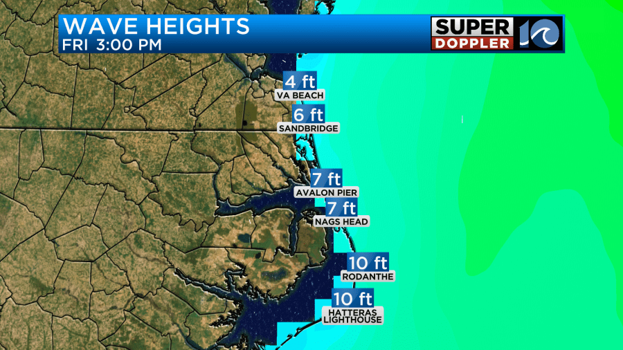
Again…This is with an offshore track. If it gets closer, then that forecast will definitely increase. We will also have a high threat for rip currents. Ocean overwash, beach erosion, and some possible tidal flooding will also be something to look out for. So check back for updates over the weekend.
There is another system in the eastern Atlantic. That is tropical storm Margot.
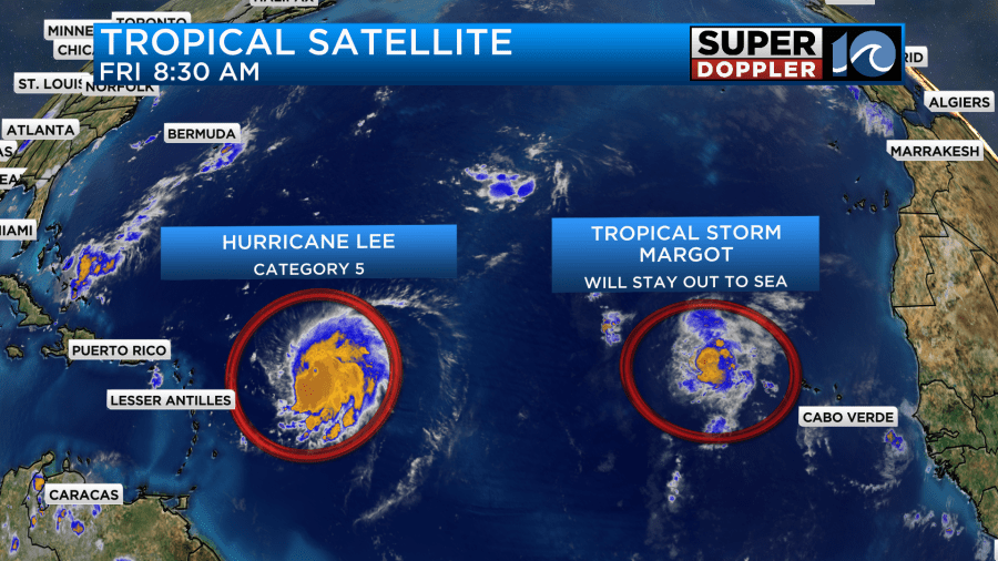
That storm will stay out to sea. It could briefly become a hurricane, but it shouldn’t affect any land masses. Hopefully, it stays west of the Azores islands.
Meteorologist: Jeremy Wheeler


