Over the last 2 weeks we have had a couple of cool and warm streaks.
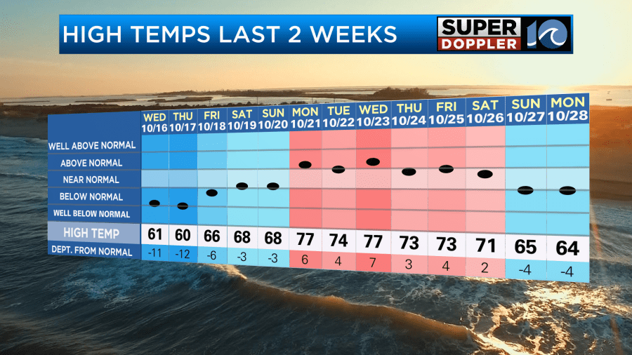
It’s actually been kind of like this for the whole month. Last week we had a milder week, but the last 2 days were in the mid 60s (which felt great by the way). Now today we are going to start warming up for a bit. This morning we had some chilly temps. They started off in the 30s and 40s with lots of sunshine.
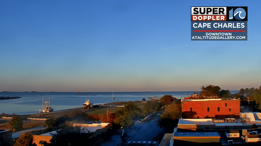
We have high pressure over the area, but it is sliding to the east.
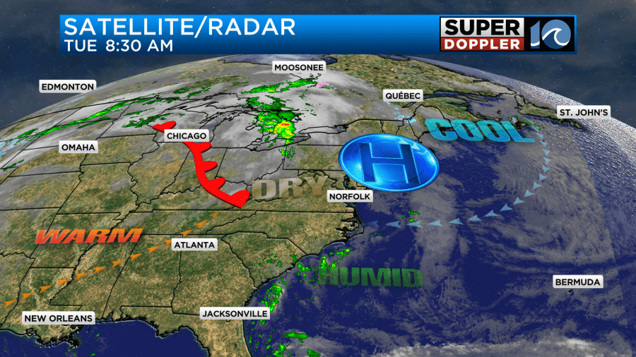
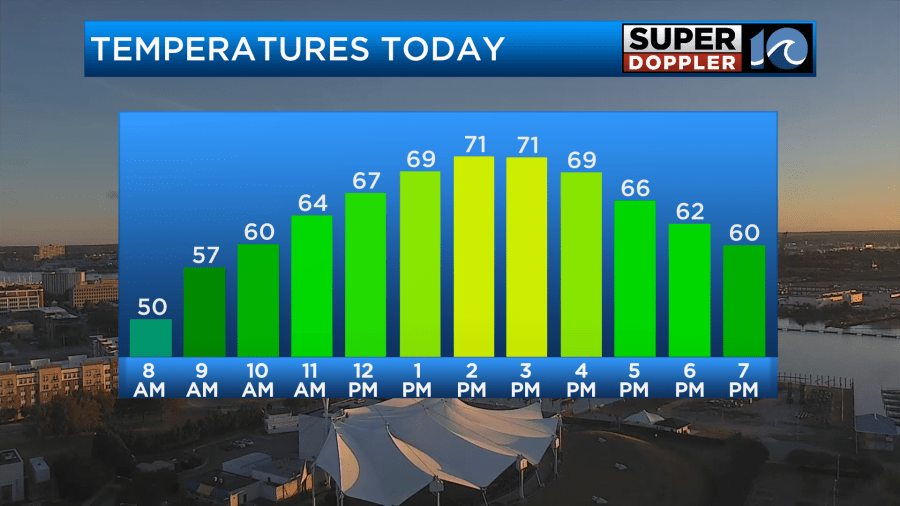
While we are starting with lots of sunshine today, we will develop partly sunny skies. Winds will be light, but they will turn from northeasterly to out of the east. These conditions should allow temps to warm up to the low 70s this afternoon locally.
It will feel very nice locally with dew points still in the 40s. However, the heat will be on over the central U.S. all the way up into the Great Lakes region.
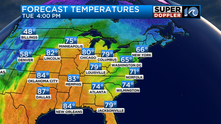
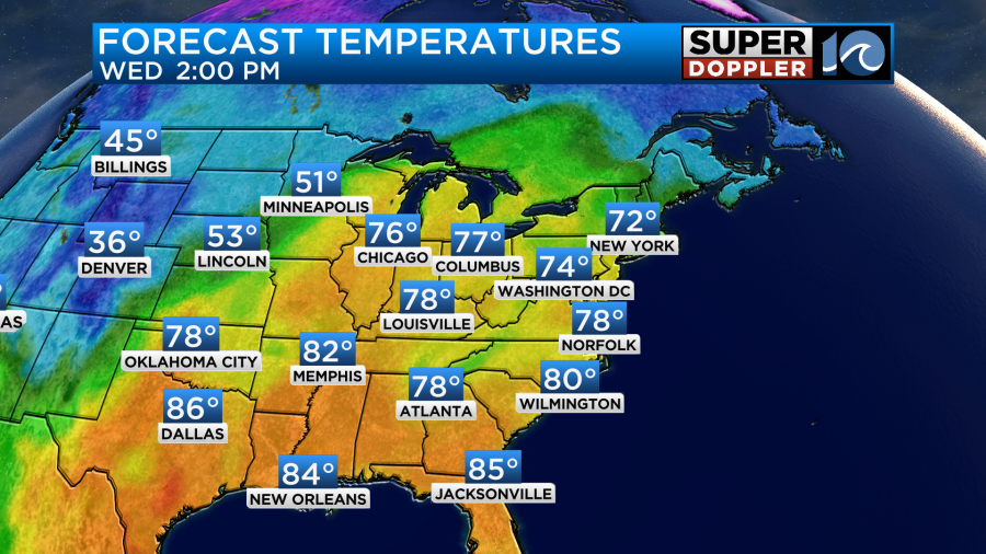
Tomorrow the high pressure system will slide more offshore. Plus, a warm front will skirt our region from the west. Winds will turn out of the southwest. We’ll start with partly cloudy skies, but then we’ll have more sunshine during the afternoon. This is going to push the high temperatures up into the upper 70s.
The humidity will be going up at the same time. Dew points will be in the 50s up to near 60.
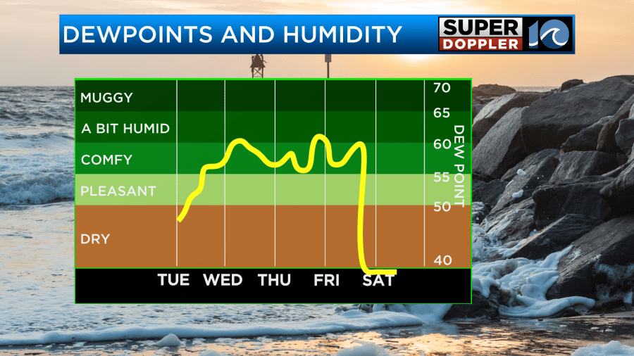
So the A.C.s will likely be running again on Wednesday. Not a fan? Well, It will actually get warmer. On Halloween we’ll have a similar setup. We’ll have a good amount of sunshine with a southwest breeze. This will push the high temperatures up to near 80 during the day.
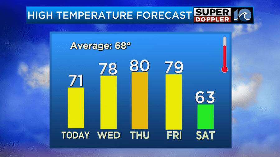
This won’t be a record, but it will be well above the average. Record high temps for the next few days are in the mid-upper 80s. It will still be mild during the evening for the trick-or-treaters.

Keep this in mind for the costumes this year. It will definitely be warm for the thicker costumes. Especially as the kids walk and run around.
We’ll stay warm on Friday. High temps will be in the upper 70s to near 80. We’ll have increasing clouds with isolated showers later in the day. There may be a few showers Friday night into early Saturday morning as a cold front slides in, but the models are not showing much. Behind the front on Saturday we’ll have clearing skies, breezy conditions, and our high temps will drop to the 60s.
We are still monitoring the tropical disturbance in the Caribbean.
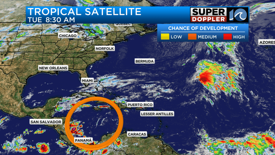
It’s really hasn’t been doing anything lately, but it does still have a medium chance of formation over the next few days. We’ll keep an eye on it.
Meteorologist: Jeremy Wheeler


