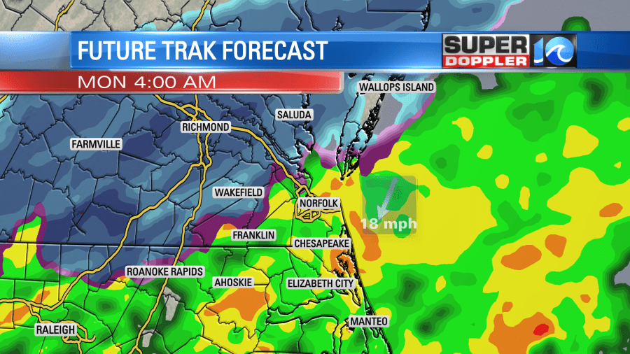
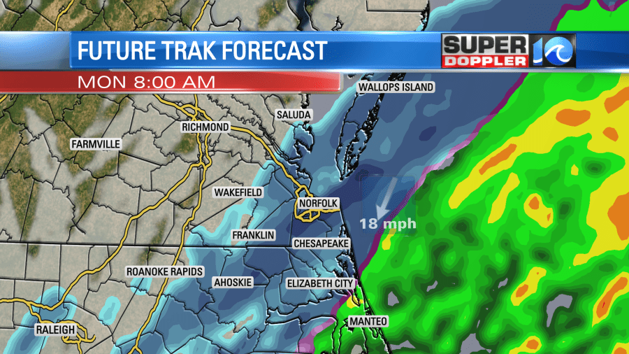
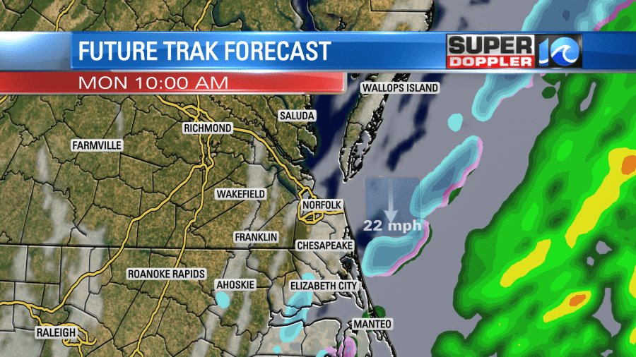
Our first chance of snow for this winter season is coming up on Monday morning. A storm system will bring in a blast of colder air, heavy rain and snow to start the week. While I believe this snow will be exciting for many of us to see, the impacts on travel should remain low.
Let’s take a look at the models.
During the morning, it looks likely that most of us will see the rain change over to snow around sunrise, or likely before. The rate at which the snow falls will determine how much accumulates on the ground. The main roads should stay wet, the side roads could get slushy during the morning commute. 4-inch soil temperatures are at 55 degrees, the Bay is 52 degrees. These two factors will take away from accumulations, but not prevent them.
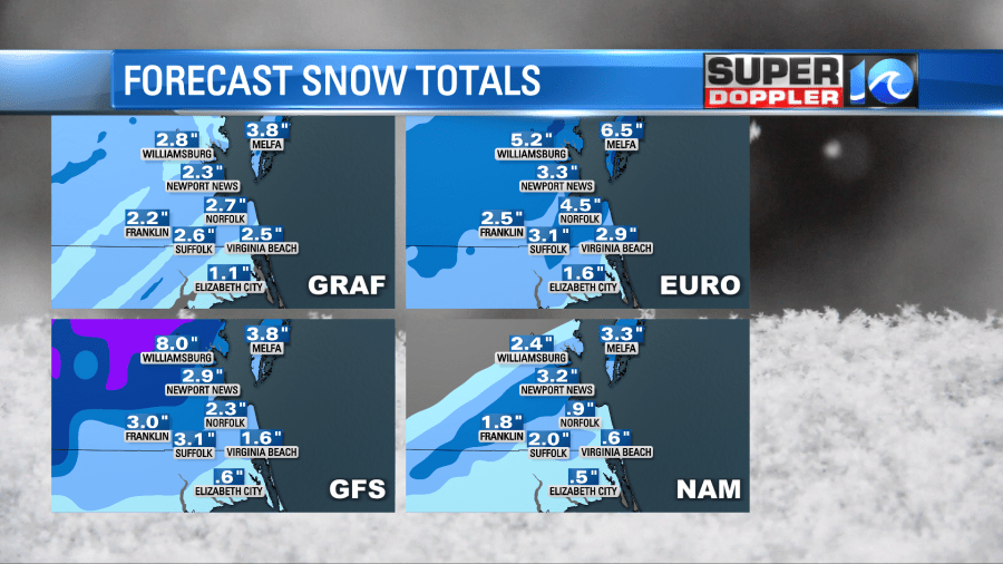
For fun, here are all 4 models output for snowfall. 8 inches in Williamsburg, almost 3 inches in VB. I don’t think so…
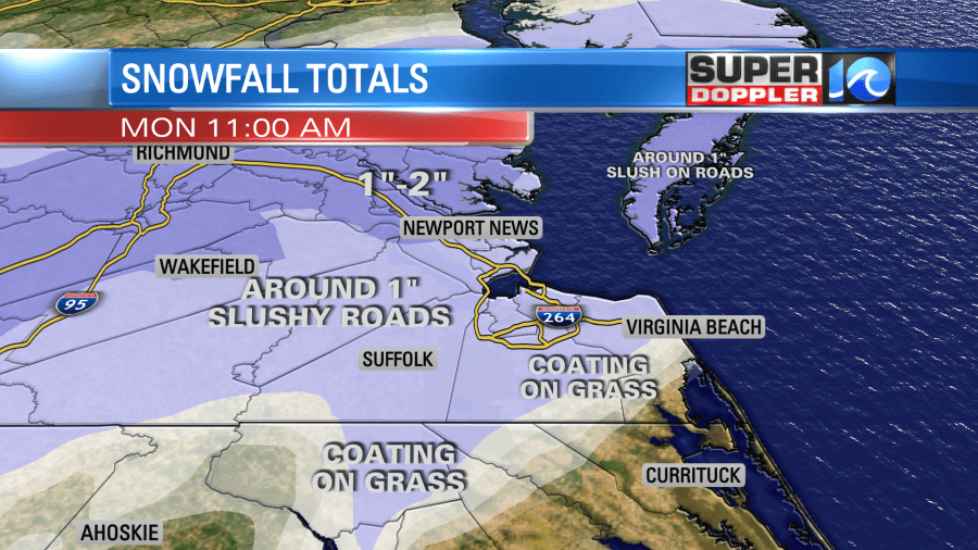
I think this is going to be an exciting snowfall event. We all have a great chance to see snow falling from the sky. Most of us have a great chance to see the ground turn white. Drivers should be OK as the roads will remain wet or slushy. Air temperatures Monday will be above freezing during the entire event. I might trend these numbers up if it looks like the temperatures will be cold enough to support more snow. Stay tuned…
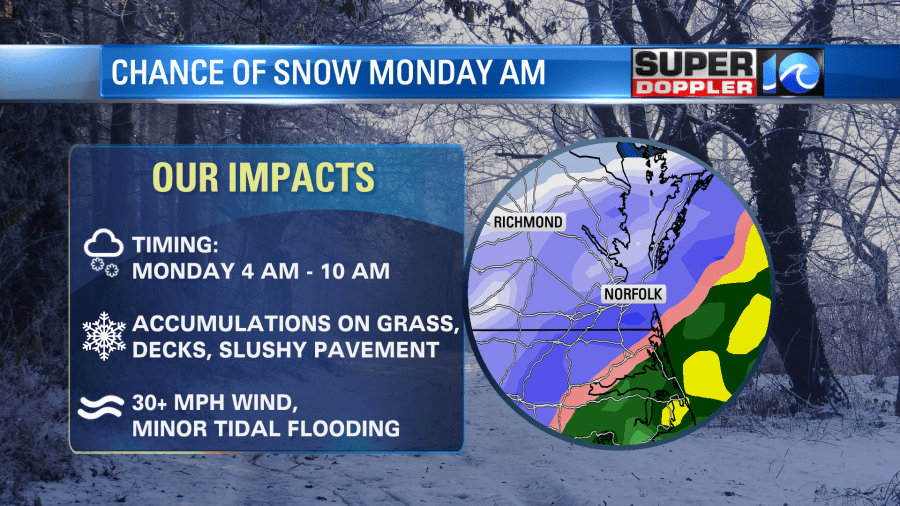
The impacts should be limited to natural ground. Since the models are still in heavy disagreement with each other, we will need to watch for changes. Meteorologist Steve Fundaro will be on Sunday morning with updates starting at 6 a.m.
Meteorologist Jeff Edmondson
