We are looking at a pretty nice Spring-like day again today. Even though temps will be a roller coaster over the next few days. Most of the time temps will be above or well-above average. Let’s take a look.
We have a weak area of low pressure and a cool front to our northwest with a cold front farther northwest.

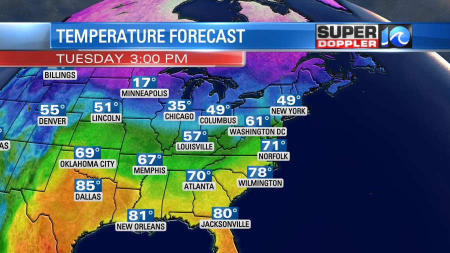
Both of the fronts are dropping down in our direction. They will merge later today as they move into our region. High pressure is centered pretty far offshore. We had some clouds and a few sprinkles/light showers early this morning. However, there was already some clearing inland by the time I started this blog. We’ll be partly cloudy for the bulk of the day. We’ll have a southwest breeze for a while. Then it will be out of the west and then northwest later today. High temps will rise to near 70 by the mid afternoon. This is going to be well above average.
Temps will fall late in the afternoon into the evening through the 60s. Overnight we’ll drop down to the 40s with partly cloudy skies. Tomorrow the front will stall out just to our south. We’ll have a variable breeze. High temps will be knocked down to the upper 50s to low 60s as the wind will be light and out of the northeast.

We’ll have increasing clouds with some isolated showers possible. There is some disagreement as to where the front will stall out tomorrow. However, there is little disagreement that the front will lift to our north as a warm front on Thursday. This will push our temperatures up into record territory.

The record is 79 degrees (1975). Based off of the latest forecast I think we will break that record. We’ll be partly cloudy through the day with breezy south/southwest winds. The humidity will also be up. So it is going to feel almost like early Summer out there….in late February…. Heading to the beach? Water temps are still only in the 40s and 50s.
A cold front will move through on Friday. For now it doesn’t look like there will be much rain with it. Temps will warm to the 60s. Then they will drop later in the day. Unfortunately, the temps will fall further into Saturday. Highs will only be in the 40s. Adding salt to the wound… there will be lots of clouds and some scattered rain showers.
While temps in the east and south will be super warm, it will also be well below average in the north/central and western U.S.
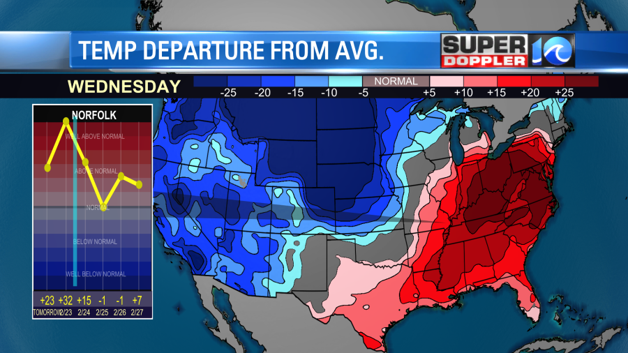
Record lows could be broken out west, but record highs are likely to be broken in several cities in the southeast.
The cold will lead to a large band of snow in the northern states. Some locations in the northern Plains and Midwest could see a foot to a foot-and-a-half of snowfall.
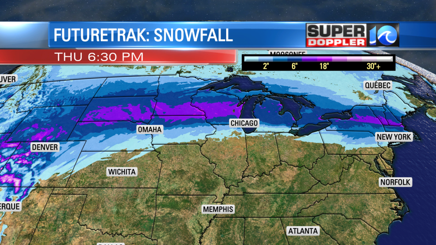
Sorry snow lovers. We won’t see anything like that around here. Not even close!
Meteorologist: Jeremy Wheeler