
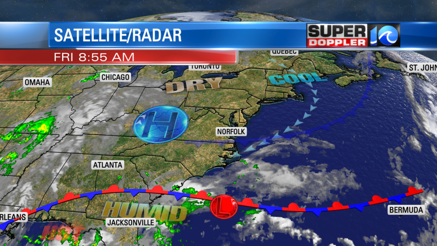
Overall, we are looking at some good weather for this Labor Day weekend. Why do I say overall? Well, there might be a few scattered showers on Monday for Labor Day, but we’ll see. For the bulk of the weekend we’ll have lots of sunshine. A cool front is dropping south but falling apart. High pressure is to our north. There is a stationary front to our south, but that won’t have any impact on our weather.
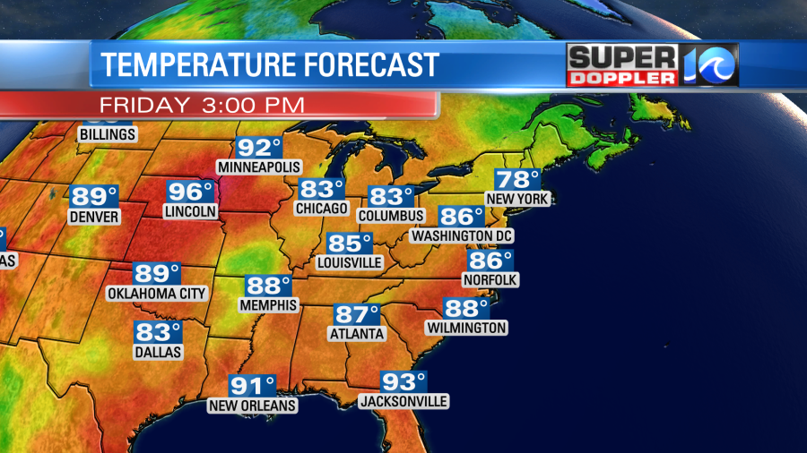
We’ll be mostly sunny through the day. Humidity will be moderate with dew points in the 60s. Even though the front is falling apart, it will still reinforce the mild/dry air that is in place. As I mentioned yesterday…It’s a late Summer dry…Not an early Fall dry. High temps will be in the mid-upper 80s. There will be a few 90s inland.
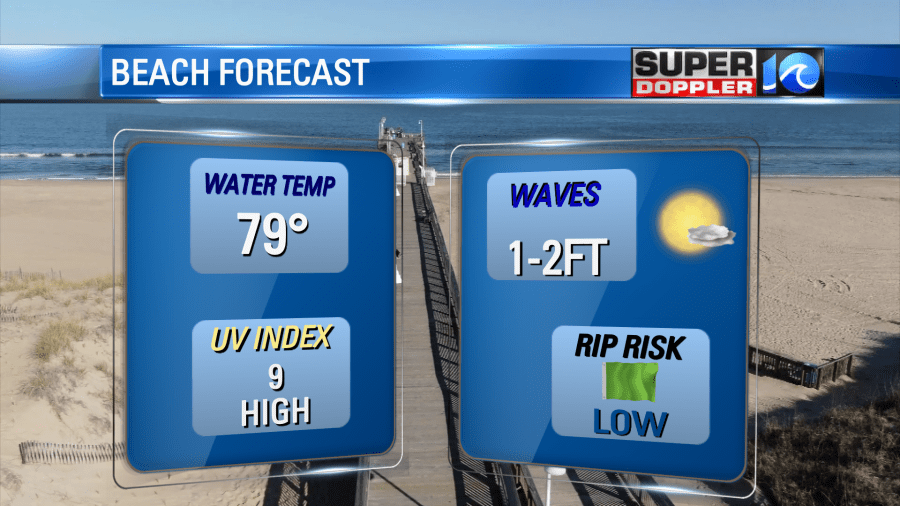
It should be some good beach weather for swimmers, but there’s not much surf.
As we look a little more inland, the weather will be great for tailgating at the ODU vs Virginia Tech game.
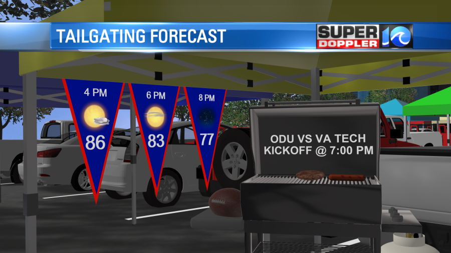
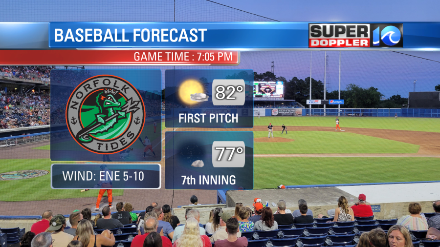
Weather should be good during game time. It will also be great for the Tides game tonight. Our very own Madison Pearman will be throwing out the first pitch.
The weather should be good tomorrow too for any other sports. It should be nice for Hampton VS Howard. I believe NSU plays out of town at Marshall. Good luck to all the local teams.
We’ll be mostly sunny tomorrow with high temps in the mid 80s. It will be about the same on Sunday. By Monday we’ll have increasing moisture and some more clouds. There may be a few showers ahead of a cool front. The front is forecast to stall out over the area Tuesday and Wednesday. That could bring us some decent rain showers. We really need it, but we don’t need for when the kids head back to school. Stay tuned for updates.
Speaking of updates… As I write this Danielle is transitioning from a strong tropical storm into a hurricane.
While it is over the north central Atlantic (which is not a tropical hot spot), the water temps there are above average. Plus, the upper level winds are very favorable for development. So the latest forecast calls for Danielle to become a category 2 system at one point.
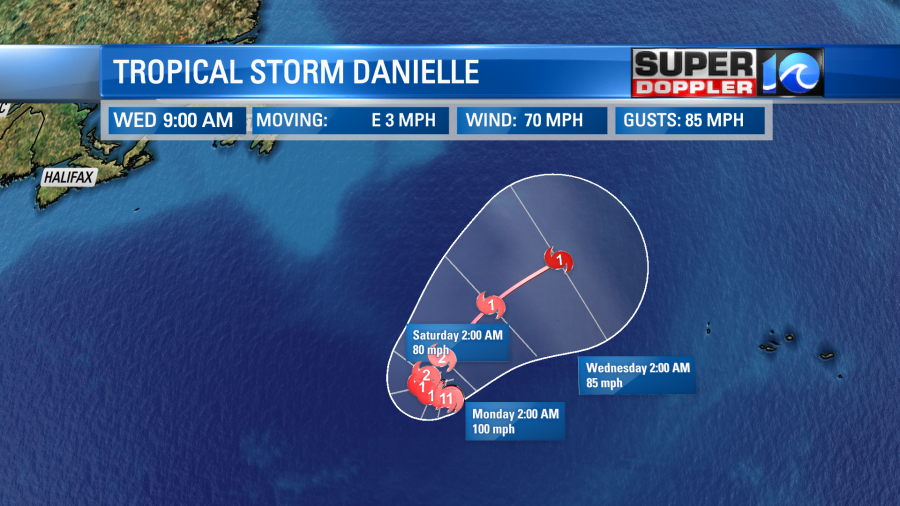
However, the system will stay out to sea, and it doesn’t even look like it will directly affect the Azores.
Meanwhile the formation potential for the tropical feature in the east Atlantic has dropped. This is due to some more of that dry Saharan air that came off of Africa.
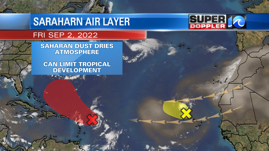
The tropical disturbance that is east of the Leeward Islands however, got away from its pocket of Saharan dry air. So it still has a moderate to high chance of formation. The models are a bit tricky. The bulk of the models still keep it offshore.
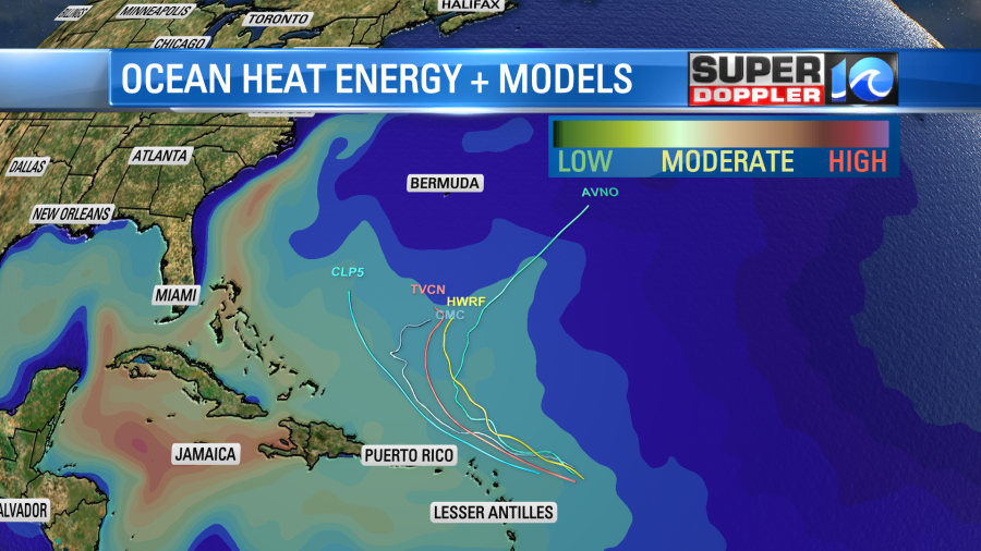
However, one big model (The European) still has it going more westward and keeps it weaker. It has been keeping up with that trend for the past couple of days. However, the GFS model has also been trending offshore and more east. It is much stronger.
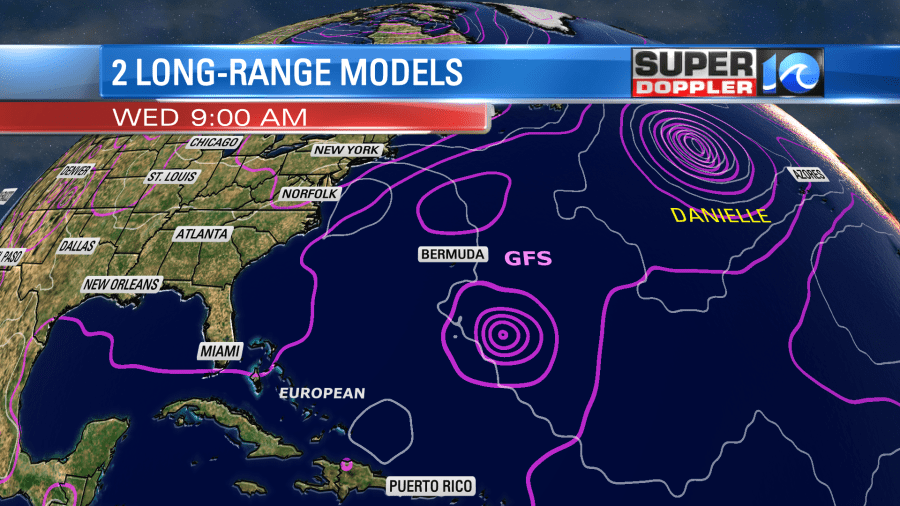
The strength and the upper level winds are different on both models. So I think that is why there is a big split. We’ll watch over the weekend to see which way the feature trends. The GFS solution could allow for some bigger ocean swells to move towards the coast. We’ll see.
Have a fun and safe weekend!
Meteorologist: Jeremy Wheeler


