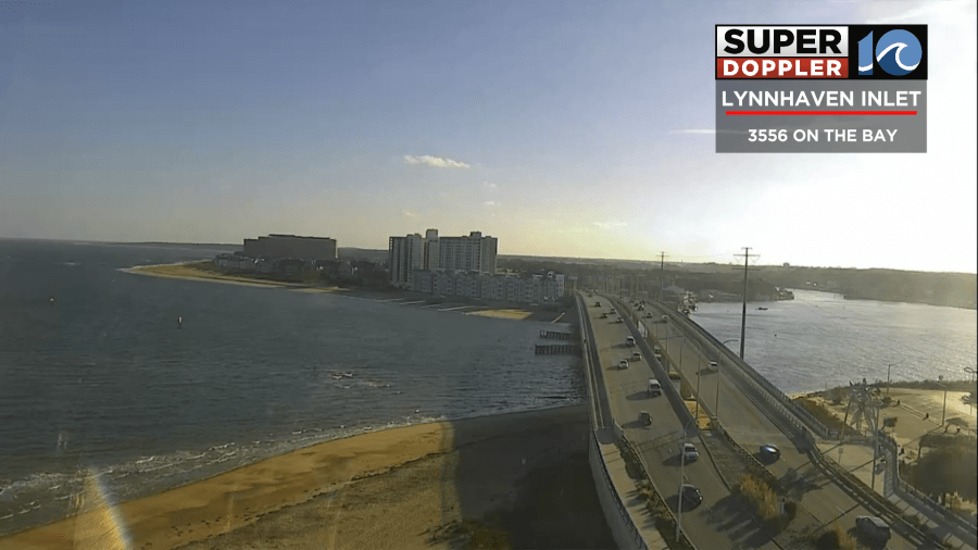
We are coming off of a dry and cool weekend. We started this morning with lots of sunshine, but there was some frost on the windshields.
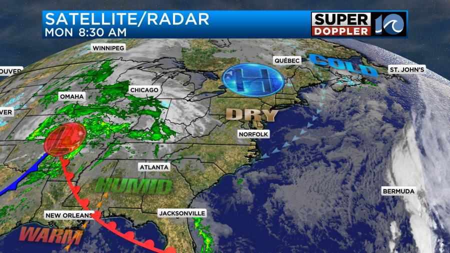
Today we have high pressure just to our north. There is a developing area of low pressure over the central U.S.
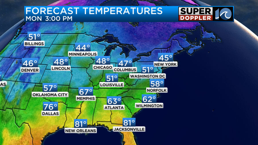
We’ll have lots of sunshine through the day with a little more clouds between the late afternoon and early evening. There will be a northeast wind. So high temps will only be in the upper 50s this afternoon with a few 60s inland/south.
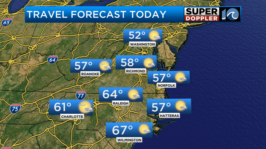
If you are traveling in the region the weather should be fine.
However, if you are traveling to the central U.S. or if you have a loved one coming from there, then you may have some slow downs.
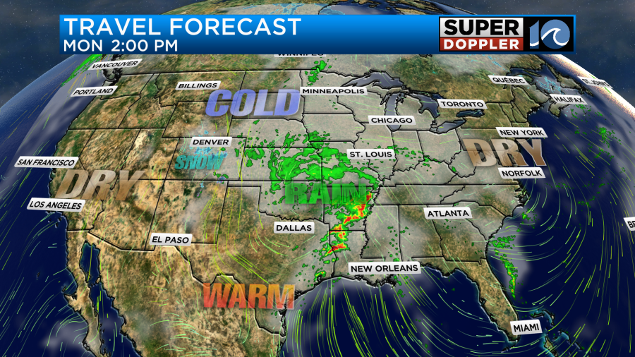
There will probably be a lot more travelers tomorrow and Wednesday. While our region will be getting some much-needed rainfall, it will be impacting travel.
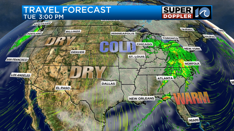
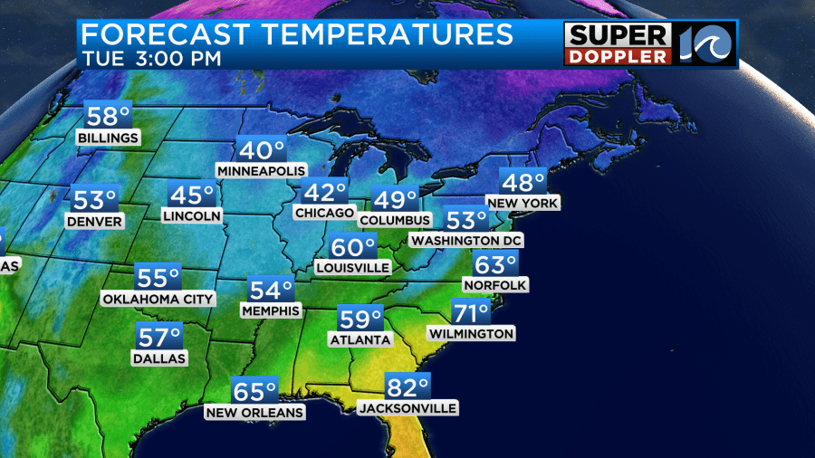
There will be a lot of rain in the eastern third of the country, but it will be pretty dry over the western 2/3rds. High temps in the region will warm to the 60s, but it will tough to get out and enjoy it as the rain moves in from the west.
The models disagree on the start and end times for the rain. So I’ll give you the latest update (as of this morning). Our Future Trak model already has a few showers in the region by 7-8AM tomorrow morning.
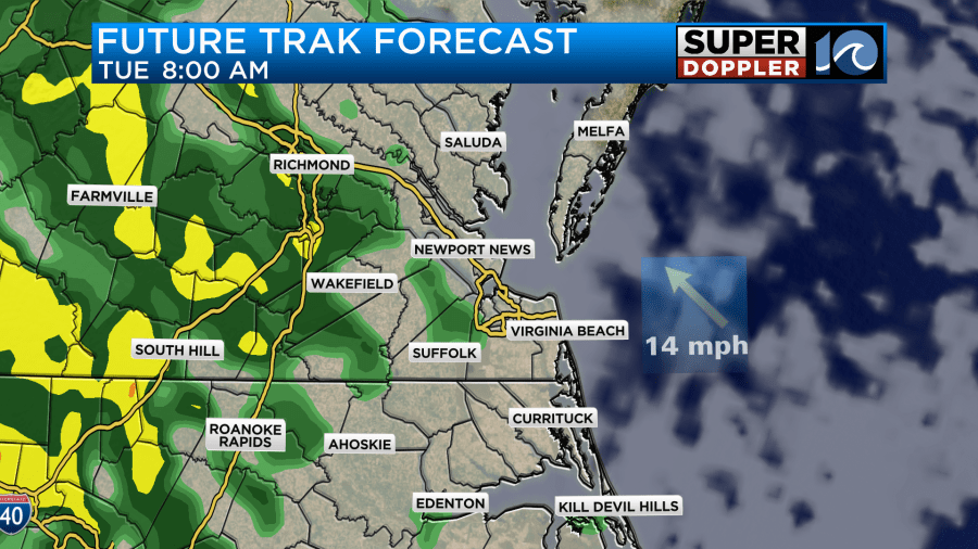
The GFS model has increasing showers during the afternoon, but it doesn’t have much in the morning. The Euro is pretty similar. However, the NAM model has hardly anything until the early evening. While an overunning pattern does favor an earlier start time, we do still have a lot of dry in the region. So I’m sticking with an increasing chance for rain tomorrow. Future Trak has a lot of rain (and some heavy rain) between the late afternoon and evening.
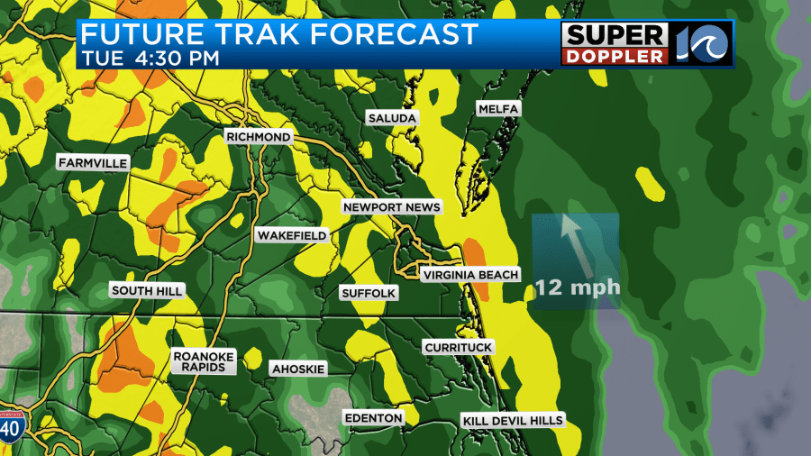
Despite the difference in timing, the theme is there. We’ll have an increasing chance for rain showers tomorrow through the day. There is pretty good agreement that the heaviest rain and highest chances will be tomorrow night.
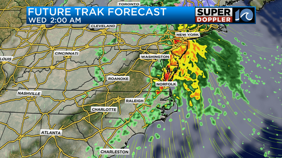
There may even be some isolated thunderstorms tomorrow night for a time. The models have the rain continuing into Wednesday morning.
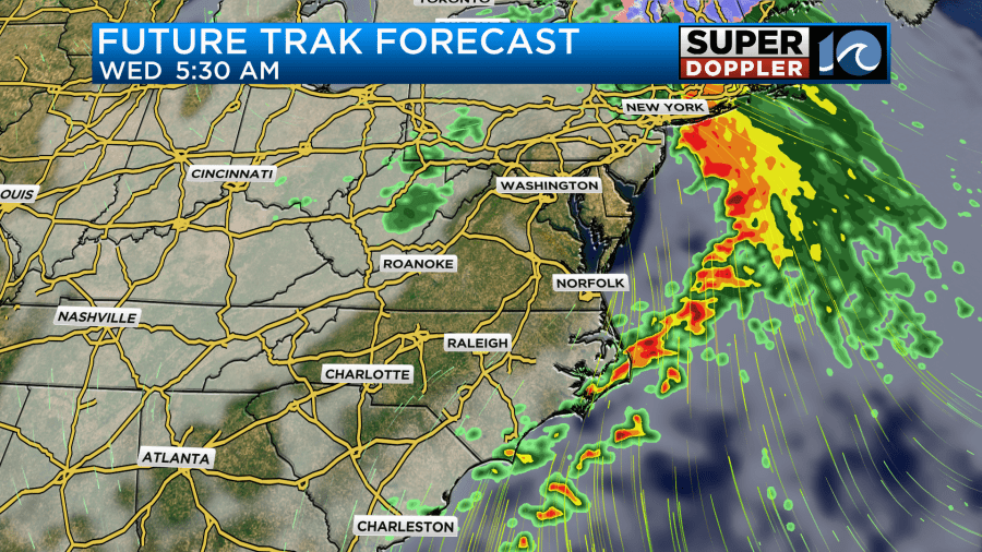
Our Future trak model has the rain moving out by mid-morning Wednesday. It then has a small pocket of showers returning in the afternoon.
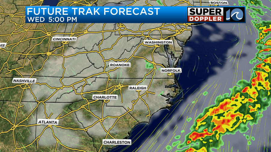
The GFS model has the bigger area of rain stretching out and extending into the afternoon.
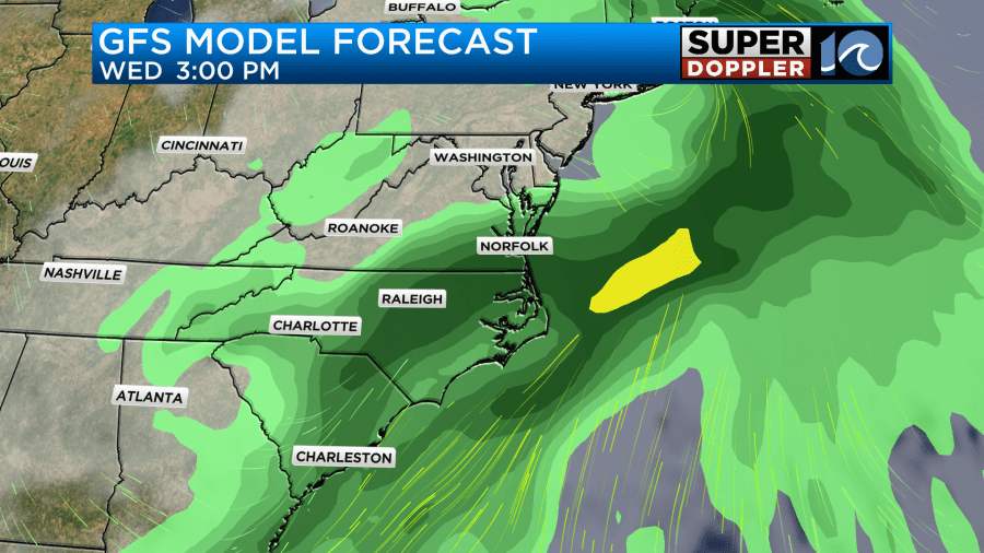
A couple of those models even suggest that a couple of isolated showers could linger until before sunrise on Thursday. Then they have us dry for the holiday itself. For some reason the overnight version (06Z) of the NAM decided to create a Mega curve ball on Thursday. It has a strong upper level trough (dip in the jetstream) swinging overhead which creates a big area of rain during the day. The previous versions did not have this. All the other models are dry Thursday as it has that feature already swinging to our east. So I’m going with a dry forecast for now (save the isolated showers before sunrise). Either way it will be chilly and breezy. High temps will be in the mid 50s. We’ll stay dry and chilly for Black Friday.
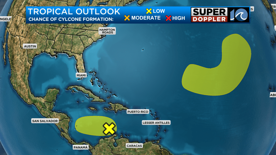
There are 2 tropical disturbances in the Atlantic Basin. However, they both have a low chance of formation, and they should also both not affect the United States.
Feel free to check back for updates on all of this active weather.
Meteorologist: Jeremy Wheeler


